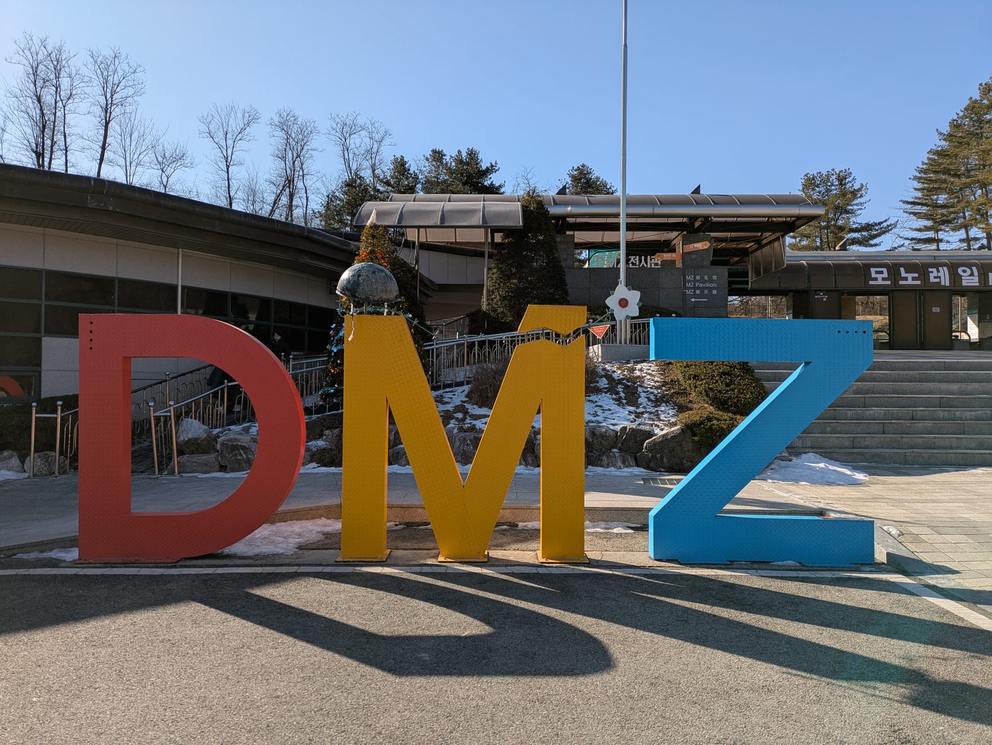
DMZ of the Korean Peninsula
On the last day of 2024 we joined a tour of the DMZ between south and north Korea. We were part of a large group on a bus that could fit up to 50 people, and because of the military schedules, we had to leave Seoul at 6:40 AM. Our tour guide was Lina, she was an excellent guide, a local who could provide not only the history of the demilitarized zone but share her own experiences with it. Our tour included five main stops, these were: the red suspension bridge, the peace park, the third tunnel, the Dora Observatory, and finally a stop at a market/buffet restaurant where we ate a late lunch.
The Red Suspension Bridge
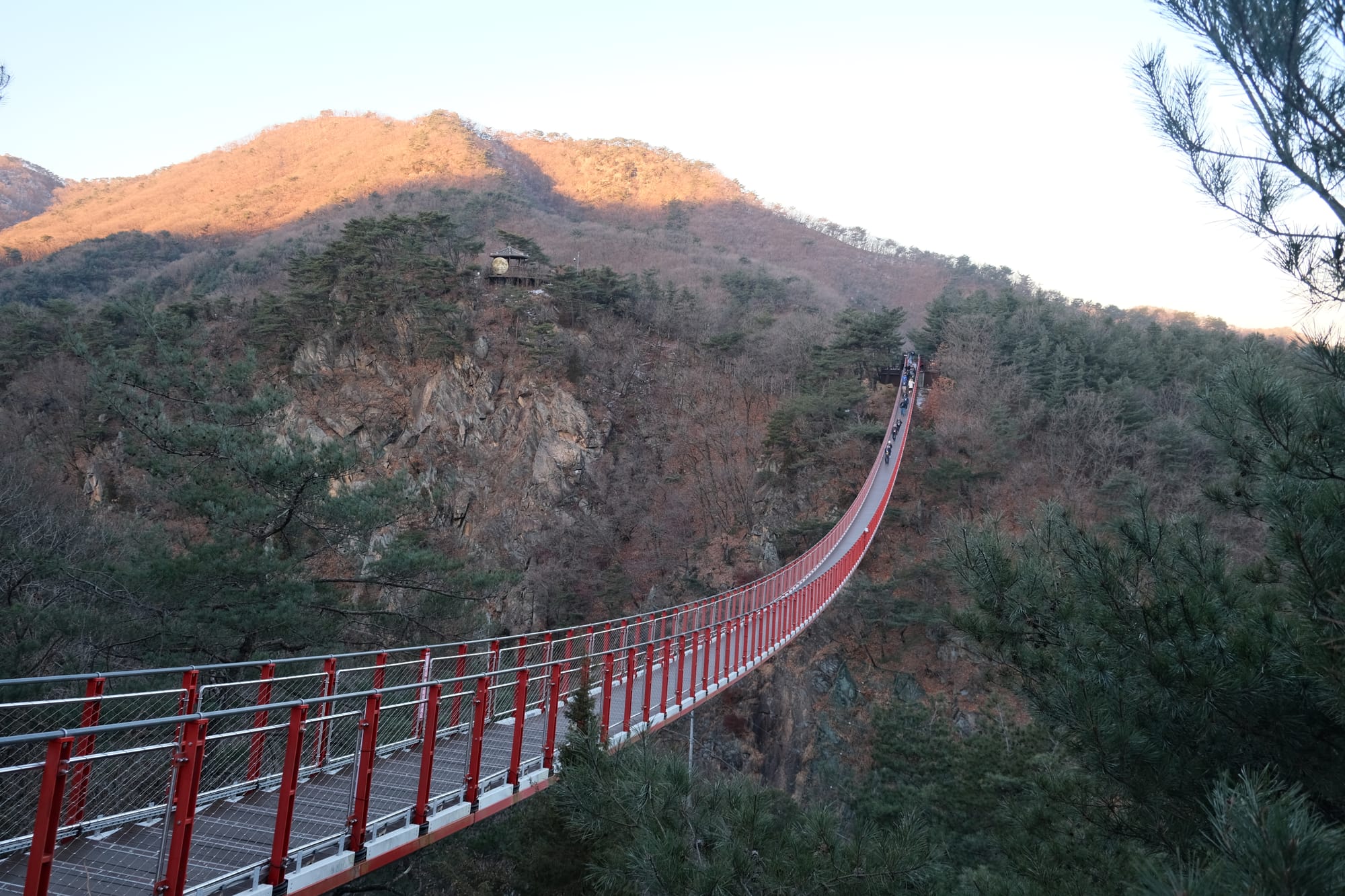
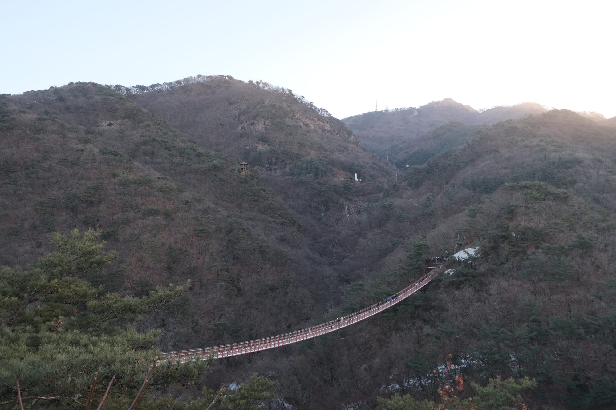
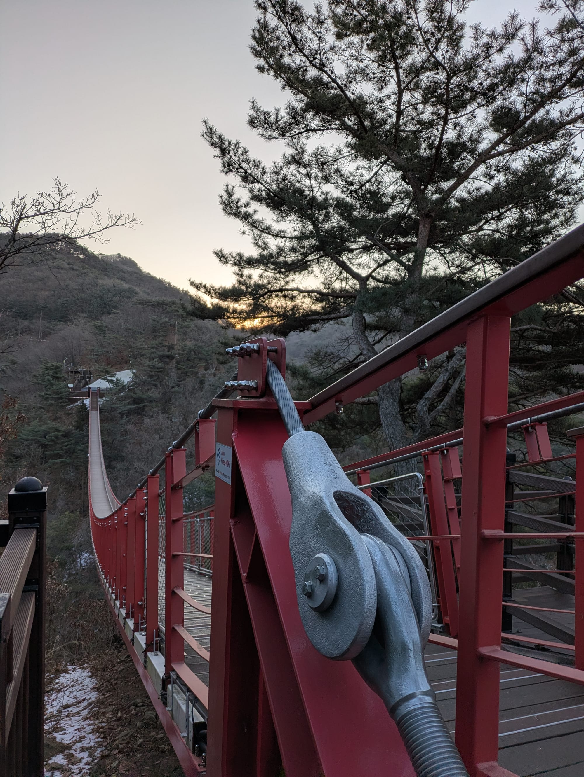
Pictures of the red suspension bridge.
This bridge is located in the mountains close to the DMZ but before all the military checkpoints. During the Korean war this area was a battle-zone, we saw some old military bunkers on the short hike to the suspension bridge.
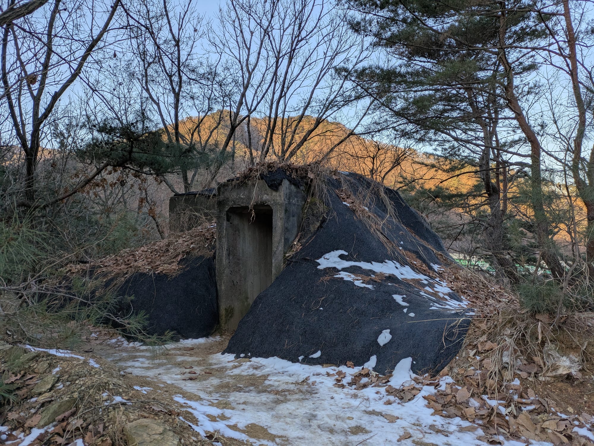
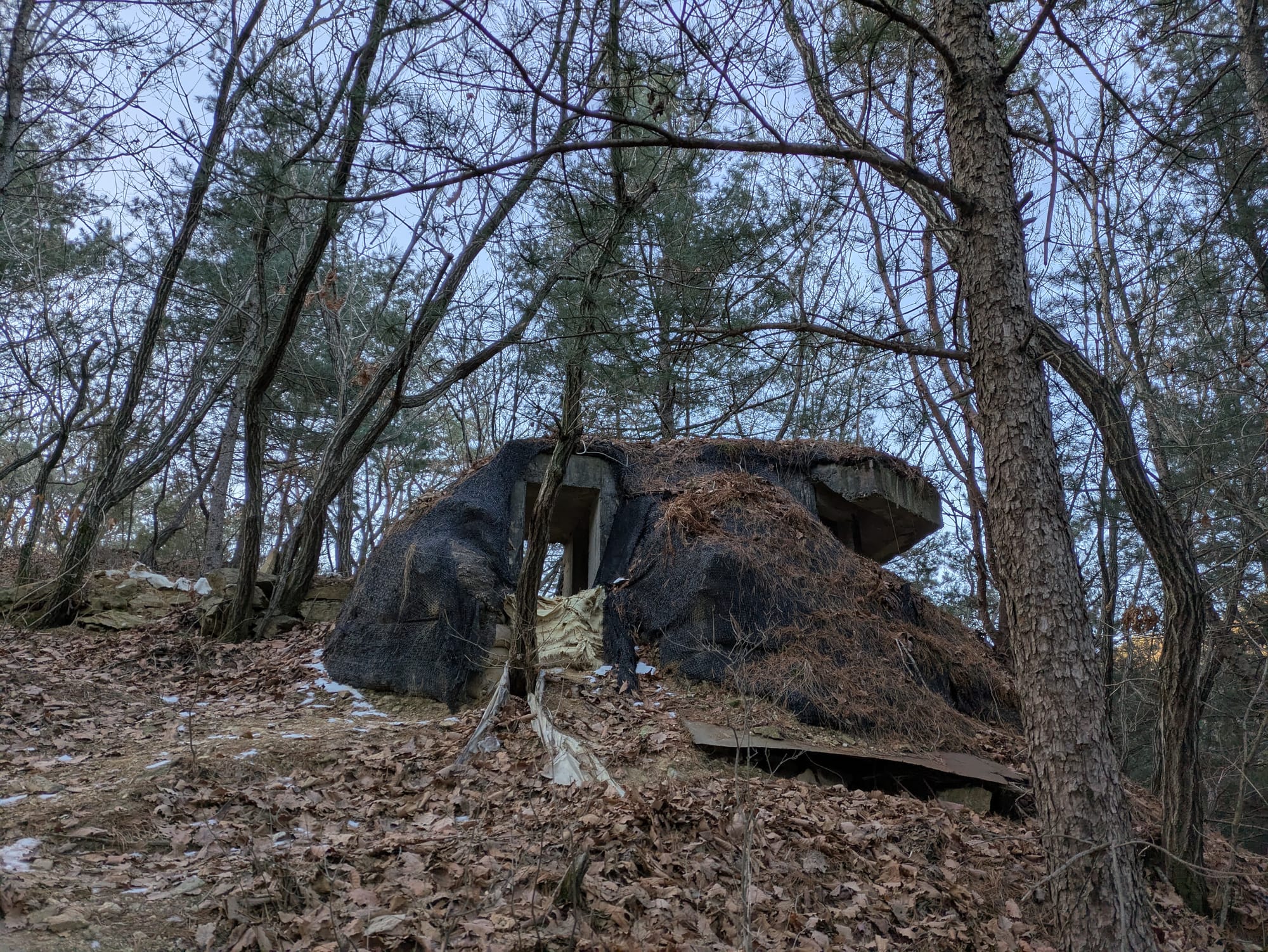
A couple of the concrete bunkers situated along the hiking trail.
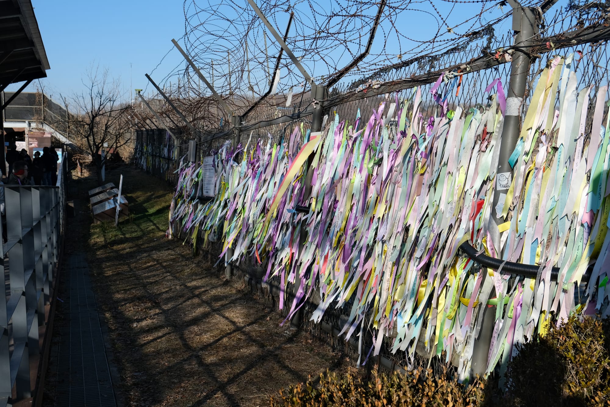
Imjingak Peace Park
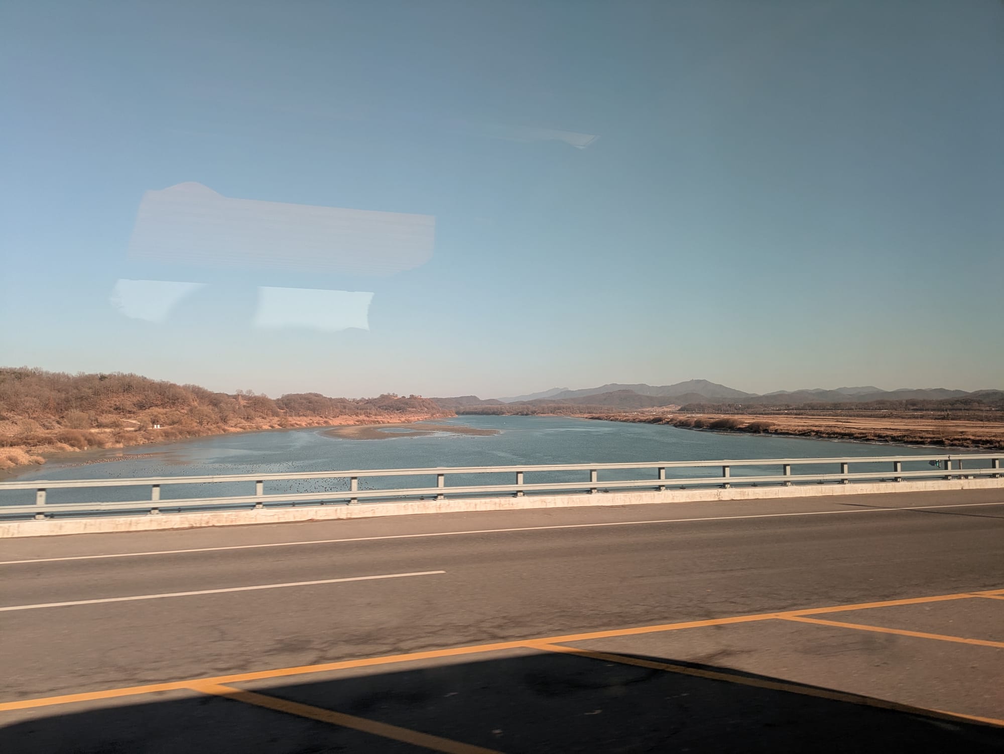
This park was sort of a mix between a war memorial, museum, and amusement park. The park is located along the river just before the DMZ proper. I believe it is the closest civilians can get to North Korea without crossing the Civilian Control Line (CCL) and entering the area run by the military, where special permission is required. When we would later cross the bridge and this line, a military personnel boarded the bus and checked everyone's identification.
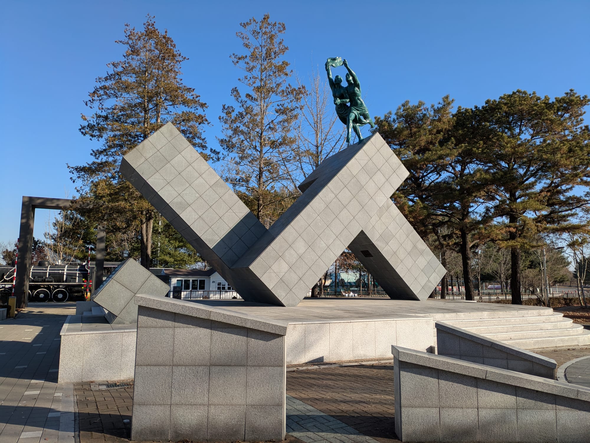
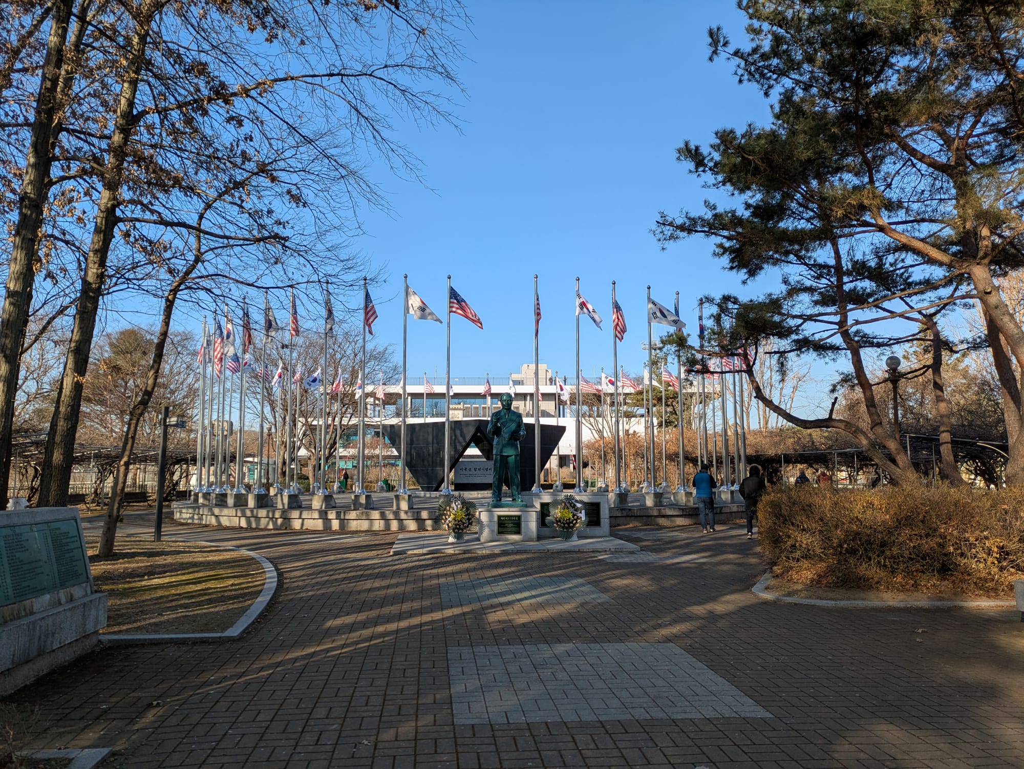
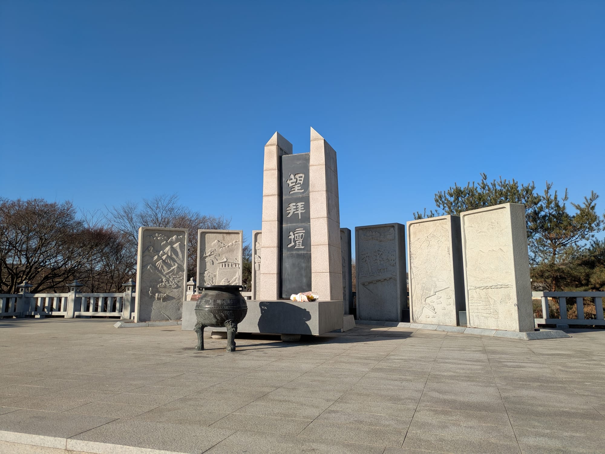
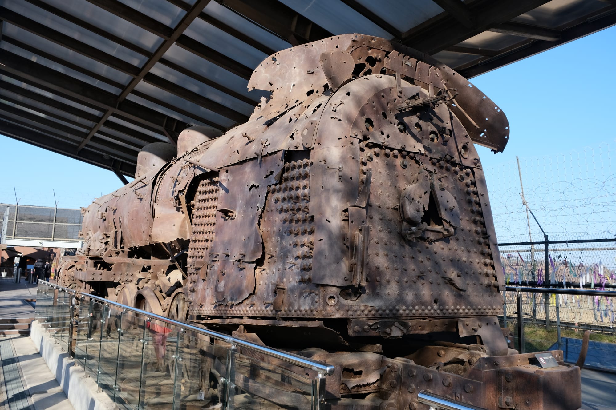
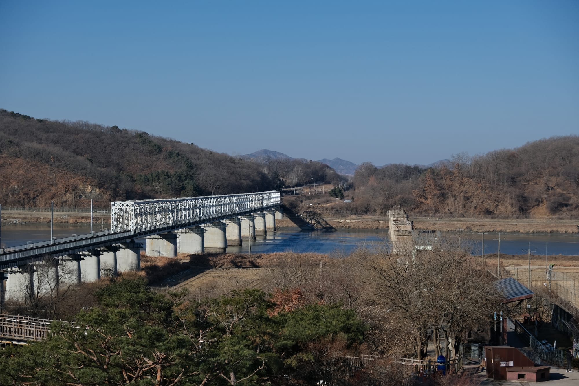
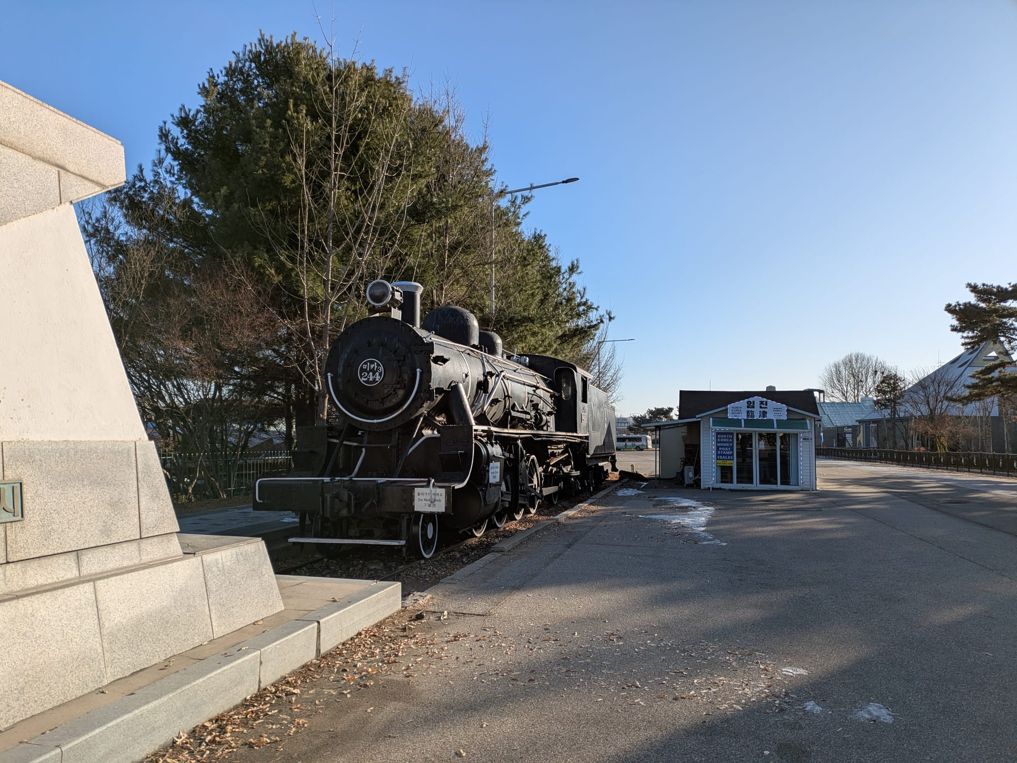
The Imjingak Peace Park park was created as a symbol for unity, as a place for South Koreans to connect with their lost homes and loved ones in the north. There is a bridge here (that was destroyed then later re-built) that was used for the South Korean prisoners of war to return back to the South from the North. There is an old steam locomotive that was preserved from the Korean war, all shot up with bullet holes. There is also some monuments/memorials built to the Korean war, including something like an altar where South Koreans can pay respect to ancestors who's graves they can no longer access. Our guide, Lina, told us how she used to come here as a child with her family to connect with her lost family members in the North. The amusement park nearby was set up as a place for all the kids to have some fun. Koreans still visit the park and pray for peace and re-unification, although our guide told us that there were fewer visitors now. The new generation of South Koreans do not have the same connections with the north as those that lived through the war.
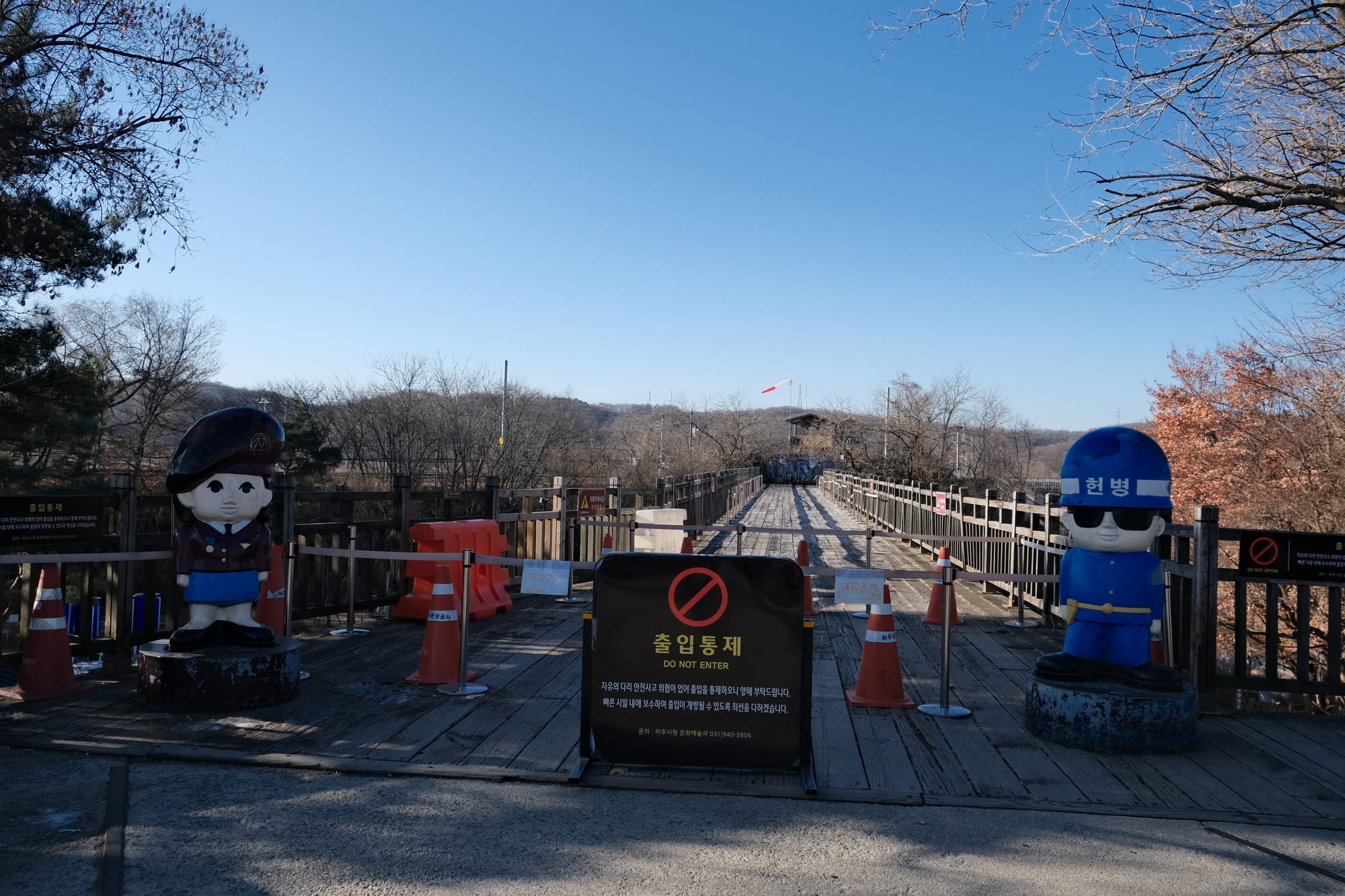
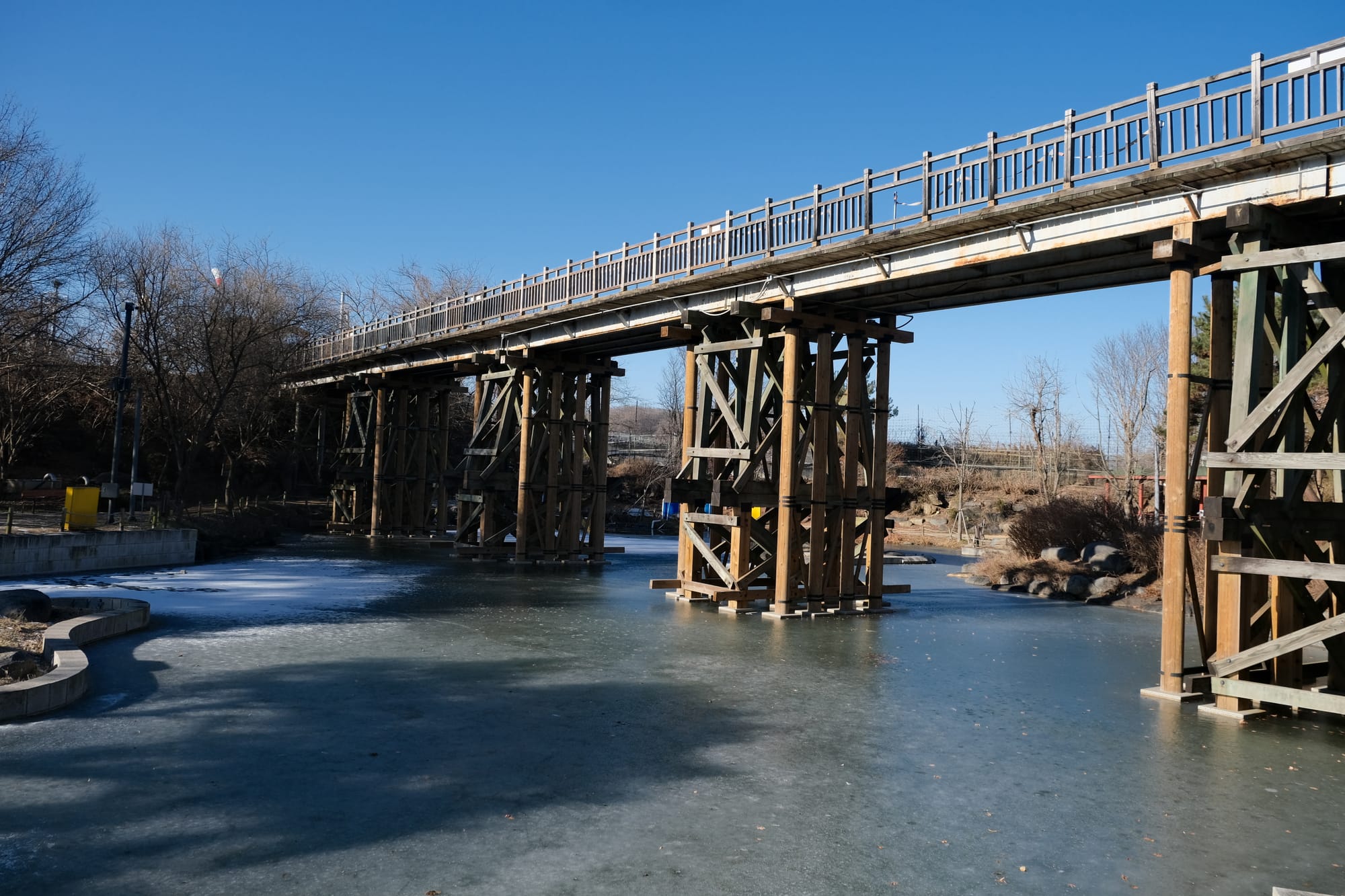
Freedom Bridge. This was the bridge used by POWs after the war to cross the DMZ and return to the South.
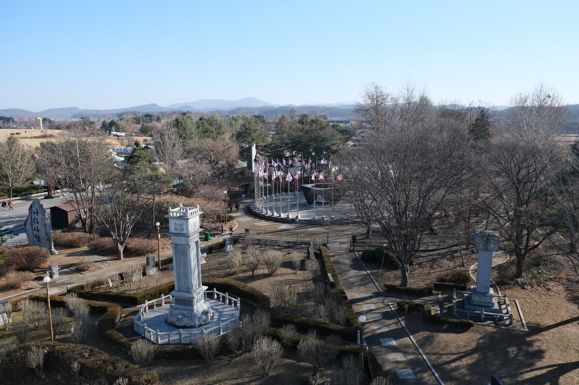
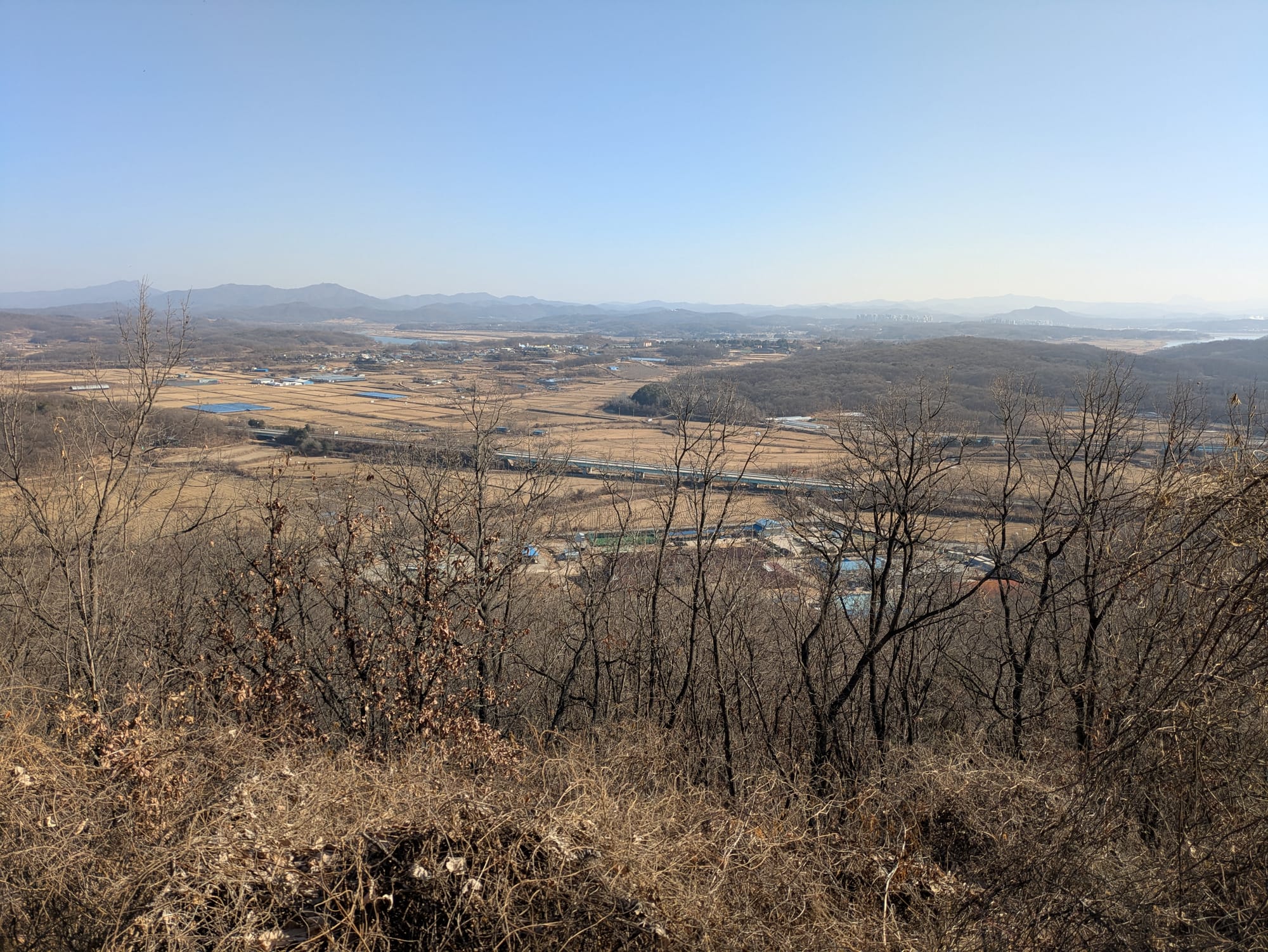
These views are from the same observation deck looking out towards the river that marks the border of the DMZ, some of those mountains in the distance would be part of North Korea.
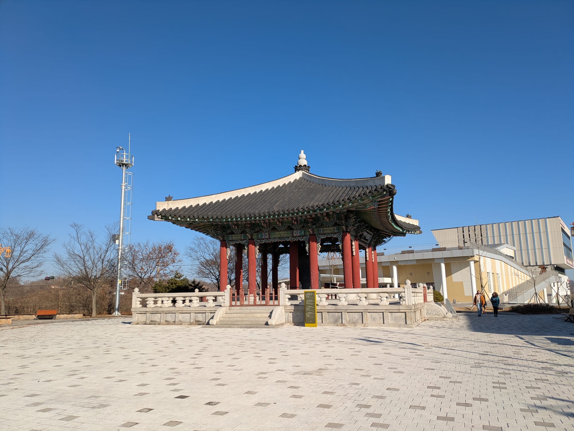
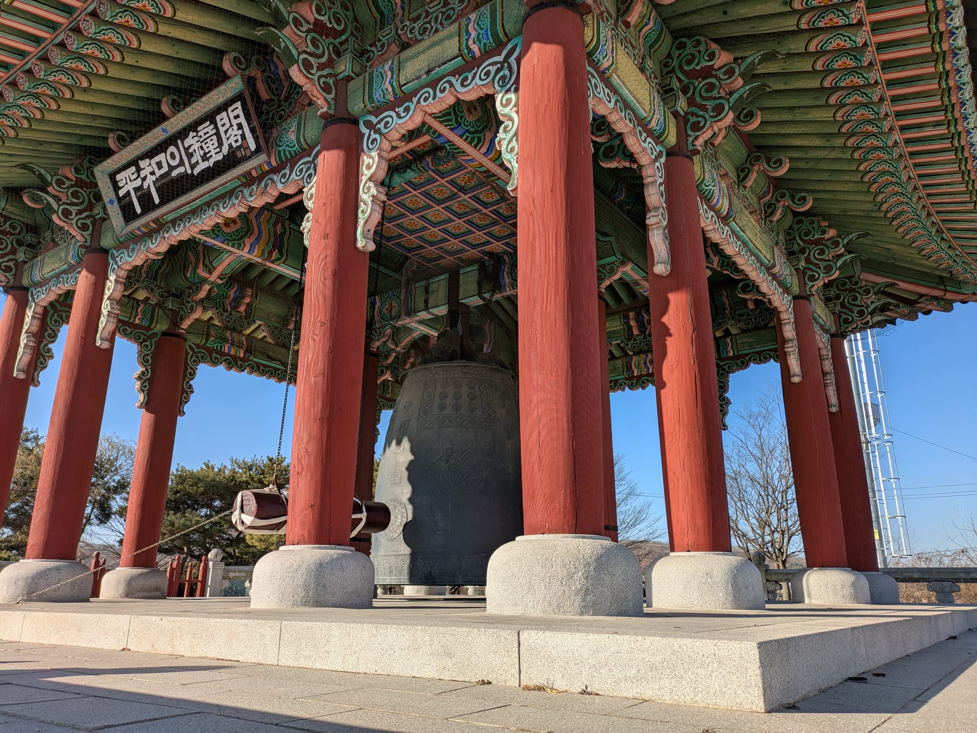
The Peace Bell, it symbolizes the hope of reunification and peace for all humanity.
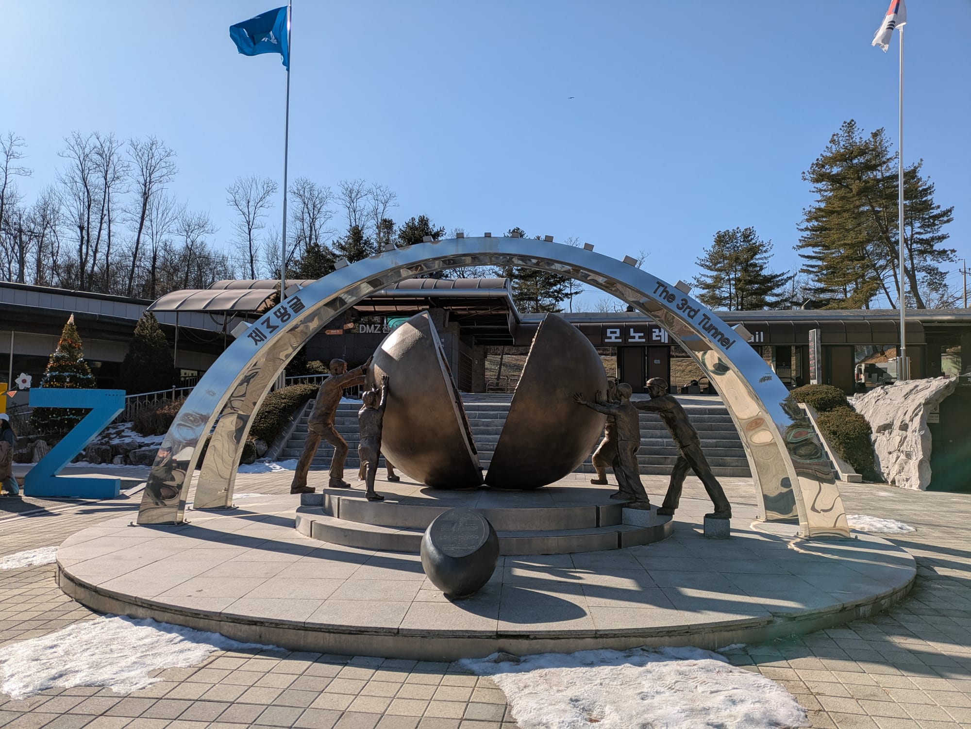
The Third Tunnel
This is the third of four known tunnels dug under the demarcation line between North and South Korea. It was discovered in 1978 by the South Koreans who describe it as an infiltration tunnel made by the North in an act of aggression against the South. Upon discovery the South Koreans dug an interception tunnel to stop the North Korean advancement and then secured the tunnel with barricades at the Demarcation Line.
Now this tunnel has become a tourist attraction. The original interception tunnel descends at an extremely steep angle so, to accommodate tourists, a second larger tunnel was dug down to the infiltration tunnel at a gentler (but still steep) angle that tourists could walk down. No phones, cameras, bags, or technology of any kind was allowed into the tunnel. We had to leave our stuff in a locker in the lobby and take nothing down with us, the only item we were allowed to take is a clear water bottle. At the entrance to the tunnel we were given a helmet to wear during our visit.
The descending tunnel was wide with plenty of room to pass by other people, and where this tunnel joins the infiltration tunnel we could also see the first interception tunnel. I believe this interception tunnel now has a train that can bring some tourists down, but it wasn't running when we visited. The infiltration tunnel though, dug by the North Koreans, was much smaller. Not quite tall enough for me to stand up straight, it was wide enough only for two people, meaning we walked single file in each direction. The walls were natural granite and sections were wet, dripping with water. We walked single file down this tunnel 150 meters or so to the third barricade. There I was only 100 meters or so from the border between North and South Korea.

At the barricade there is a red digital number display that shows the number of days since the signing of the Korean Armistice on the 27th of July 1953. On the day we visited the count was up to 26090.
The following paragraph I wrote on my phone the moment I left the the tunnel, while the image of the barricade and tunnel was still fresh in my mind.
The board with the number crossed the tunnel, we could go no further. Right behind the board was a big roll of barbed wire, about waist high. Beyond that, about 2-3 meters from where I was standing was a concrete wall. Through a window on the left I could see some small green plants growing, I think one of them was a fern. I also saw some moss growing in the wall near where I was standing. On the left, a little behind, was a light and CCTV camera. On the way back I noticed a number of the yellow circles that still showed where they dug the hole to place the dynamite.
New Dora Observatory
The New Dora Observatory is built near the old one, both situated on Mount Dora. The observatory has an indoor amphitheater with a huge glass wall facing north providing extensive views of the DMZ and North Korea beyond it. There was also a cafe and souvenir shop within the building.
Photography of the northern view of the DMZ was strictly forbidden. We were warned multiple times by our tour guide not to take pictures and, to be safe, I didn't take any pictures while in the observatory or of the building itself. The above image is about all that I took from Mount Dora. While in the observatory I studied the view with my own eyes. Our guide provided an overview of some of the key features to look out for and there was a model that provided details as well. While a poor substitute for a picture, I will try to, from memory, provide you an overview of what I saw.
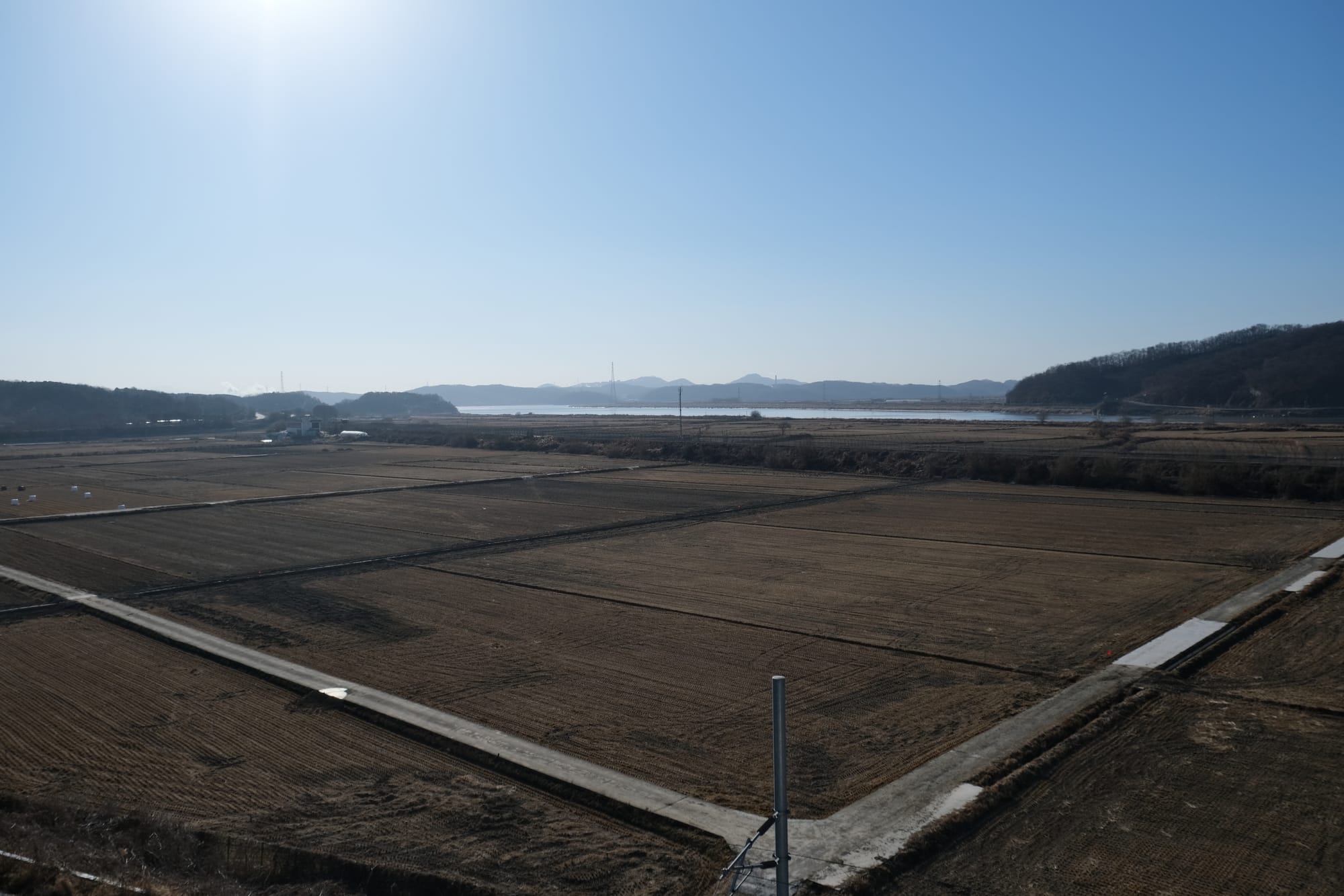
From the observation room I could see a valley stretching out before me, with some low mountains in the distance. Near these mountains, and beyond them, I saw an industrial park and parts of Kaesong, the closest North Korean city to this part of the DMZ. Within the part of the valley on the South Korean side, I saw a village and farms that are still occupied by South Korean citizens today; on the Northern side there was a fake village set up as a propaganda stunt by the North Koreans, but no people live there permanently. Both sides had set up a large flag pole with their countries flag; the South Korean's started, then the North built a taller flag pole, and each side kept making their flag pole taller until eventually the South gave up. With careful observation I could also make out some of the military infrastructure, mostly some of the watch towers on the South Korean side. The nature and vegetation looked much like what I had already seen throughout Korea, shades of brown for the winter. The scene before me might have been normal, if not for all the little details I have already mentioned, and I found it so fascinating: due to an arbitrary line I could not see, this stretch of land was realistically inaccessible to an ordinary person, a place that could only be seen but not visited.
Buffet at Tongilchon Village
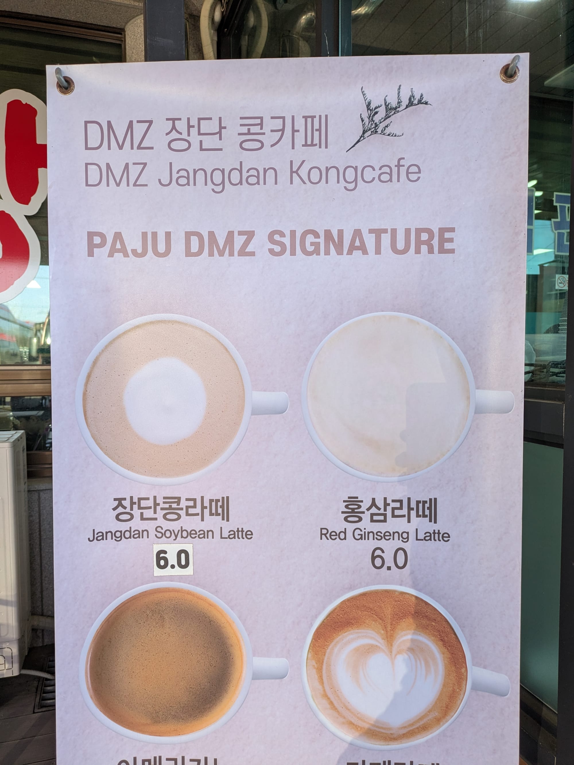
We had a late lunch at this village located near the DMZ and still within the the Civilian Control Line (CCL). This village was evacuated during the war, became a residence for military personnel, and after the war new residents were brought in to establish a model farming community. The villagers grow specialty crops on the fertile land such as rice, Jangdan soybeans, and ginseng. They sell these products to the many tourists who stop by when on a DMZ tour.
There was this large building with a buffet restaurant and a souvenir/produce store. There wasn't any time to explore the village (and I suspect we would not have been allowed). I had a look through the shop where I bought some local soybean chocolate shaped like a grenade. All the products were branded with the DMZ and marketed to tourists. I then went to the buffet and ate a little rice, I was still feeling a bit unwell so didn't eat much. Outside the building there was a little cafe store selling a Jangdan soybean latte, it was perhaps the best soy latte I have ever tried.
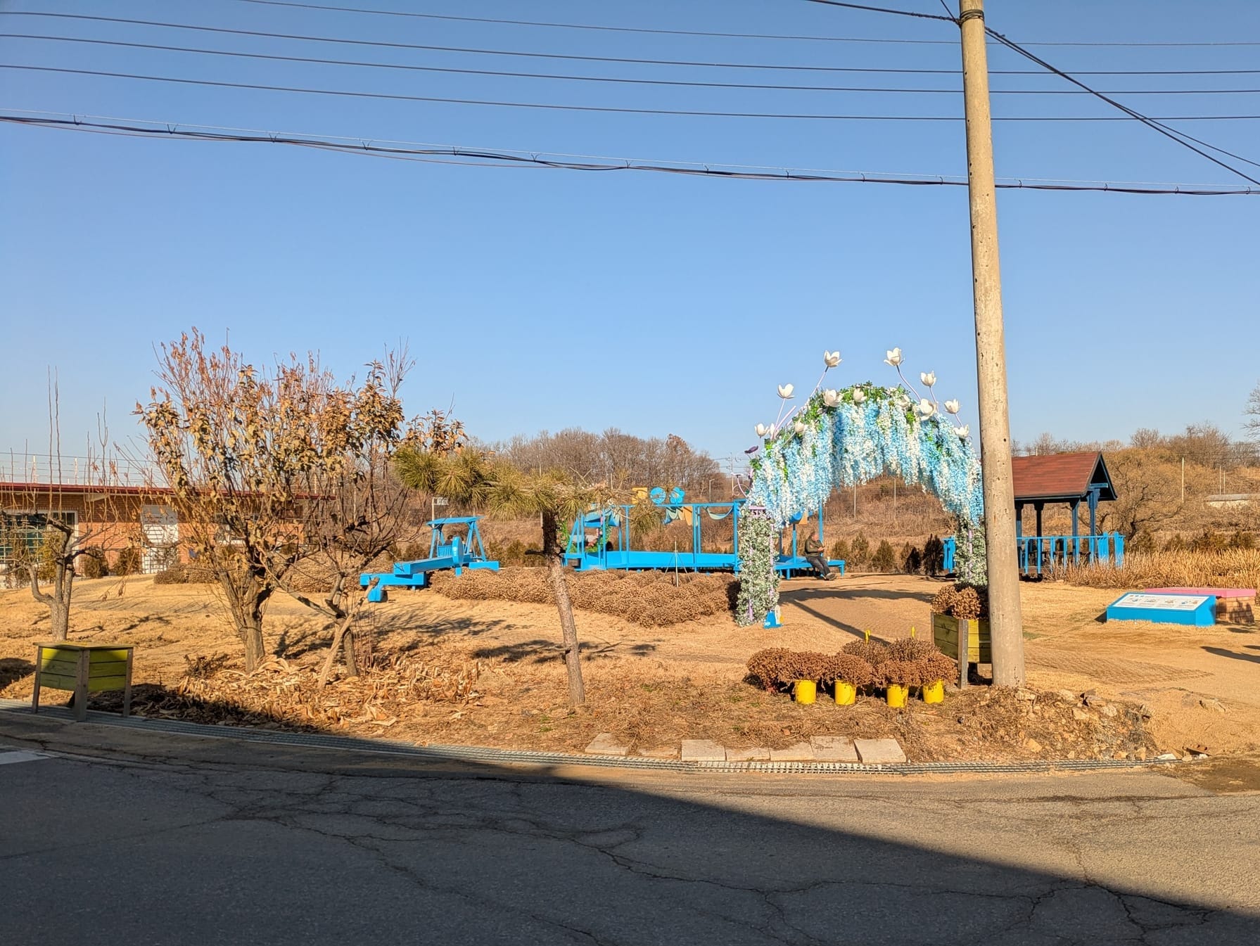
This little park was located just opposite the buffet restaurant. The second image shows the advertising banner for the cafe stall.
In much of South Korea I saw evidence of a divided country, but here I saw the physical manifestation of that division. I heard stories of how families were split apart, and how this war from the 50s is still impacting the people of Korea today. I saw evidence for a desire for reunification but I wonder if this could ever actually happen. Other countries that reunified (like Germany) did so within the lifespan of an individual. But now it has been over 70 years since the Korean war and generations have passed. I wonder if there is a point where the two halves of a country separated for so long that merging together again becomes no longer feasible. I certainly hope that is not true, and I hope that this beautiful country can be reunited and free without further bloodshed.
Going on the DMZ tour was really interesting even if a little scary at times. I was glad to experience it and to see, in person, the real impact of wars and politics that I so often hear about on the news.
Thanks for reading – Edward
Finally written on 17th of October 2025