Kościelec

We came to Zakopane to meet an old friend of my Mum's, and to climb the Koscielec mountain peak.
Zakopane is a mountain town in the south of Poland, almost next to the border with Slovakia, nestled in the foothills of the Tatra Mountains. I love this area of Poland, the mountain scenery is so beautiful, and I still remember this place as being one of my highlights from my last trip to Poland in 2018. I hope the pictures in this post can convey some of the majesty of these mountains.
The Cable Car
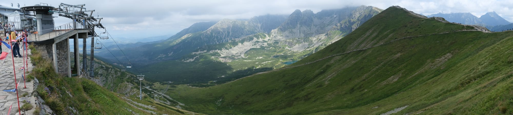
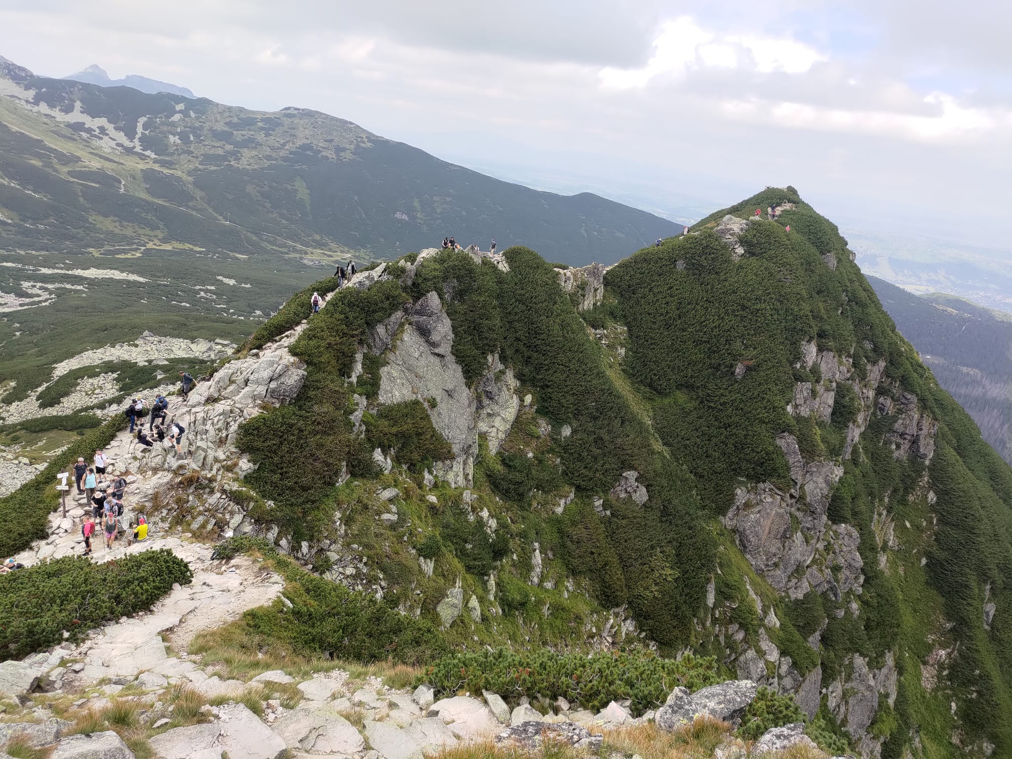
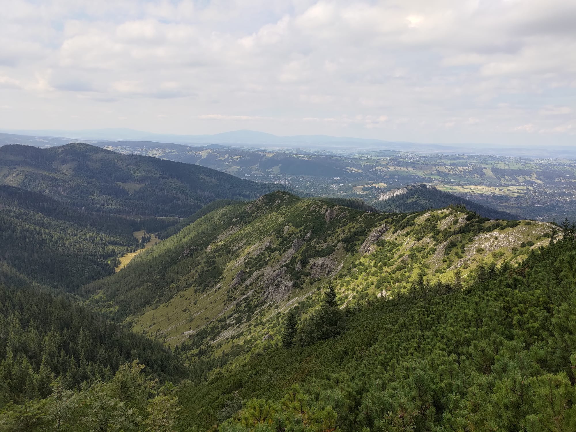
We had two days in Zakopane, with the big hike scheduled for the second day. So our first day was free to explore the town and the surrounding area. In walking around we noticed signs for a cable car. I quickly did some research on my phone and found a website that suggested it was better to book tickets in advance. The online booking portal still had two spots available for that afternoon so I quickly booked them, and I was so glad I did. The cable car goes to a peak on the mountain ridge called Kasprowy Wierch, and that is right on the border with Slovakia. The top cable car station was at an elevation of 1987 meters and from there we could walk to the border and along the ridge line. We followed the ridge for a kilometre or so to another peak, walking on the border. All along that path there were fantastic views of both the Tatra mountains, and into Slovakia.
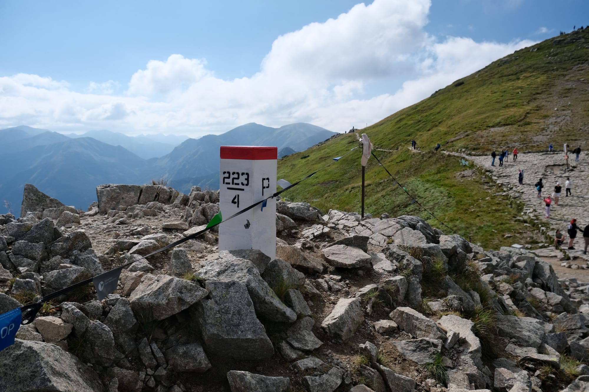
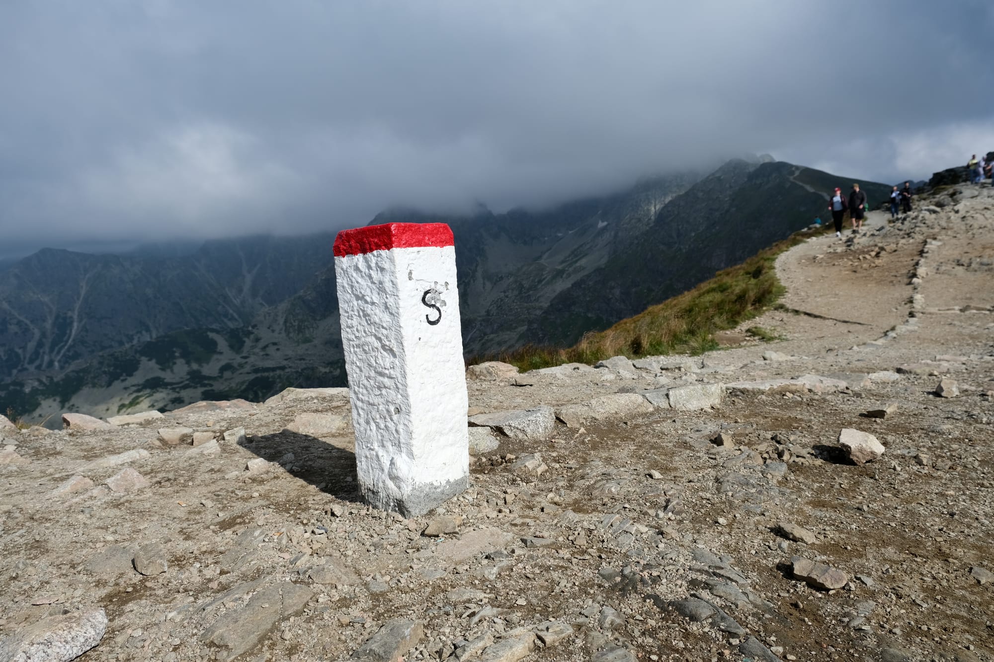
The border markings between Poland and Slovakia; on the Polish side there is a P, on the Slovakian side there is an S.
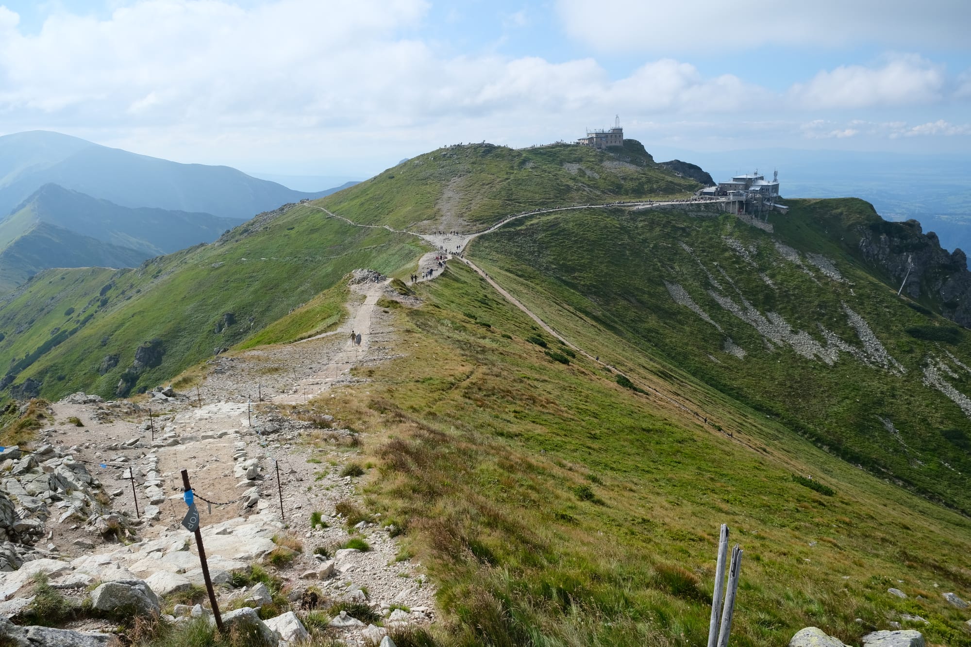
The view looking to the Slovakian side of the mountains.
I absolutely loved how the slightly cloudy day made wonderful patterns on the scenery of bright and light patches. It made the entire scene seem to come alive and highlight the beauty more than an all cloudy or all sunny day ever could have.
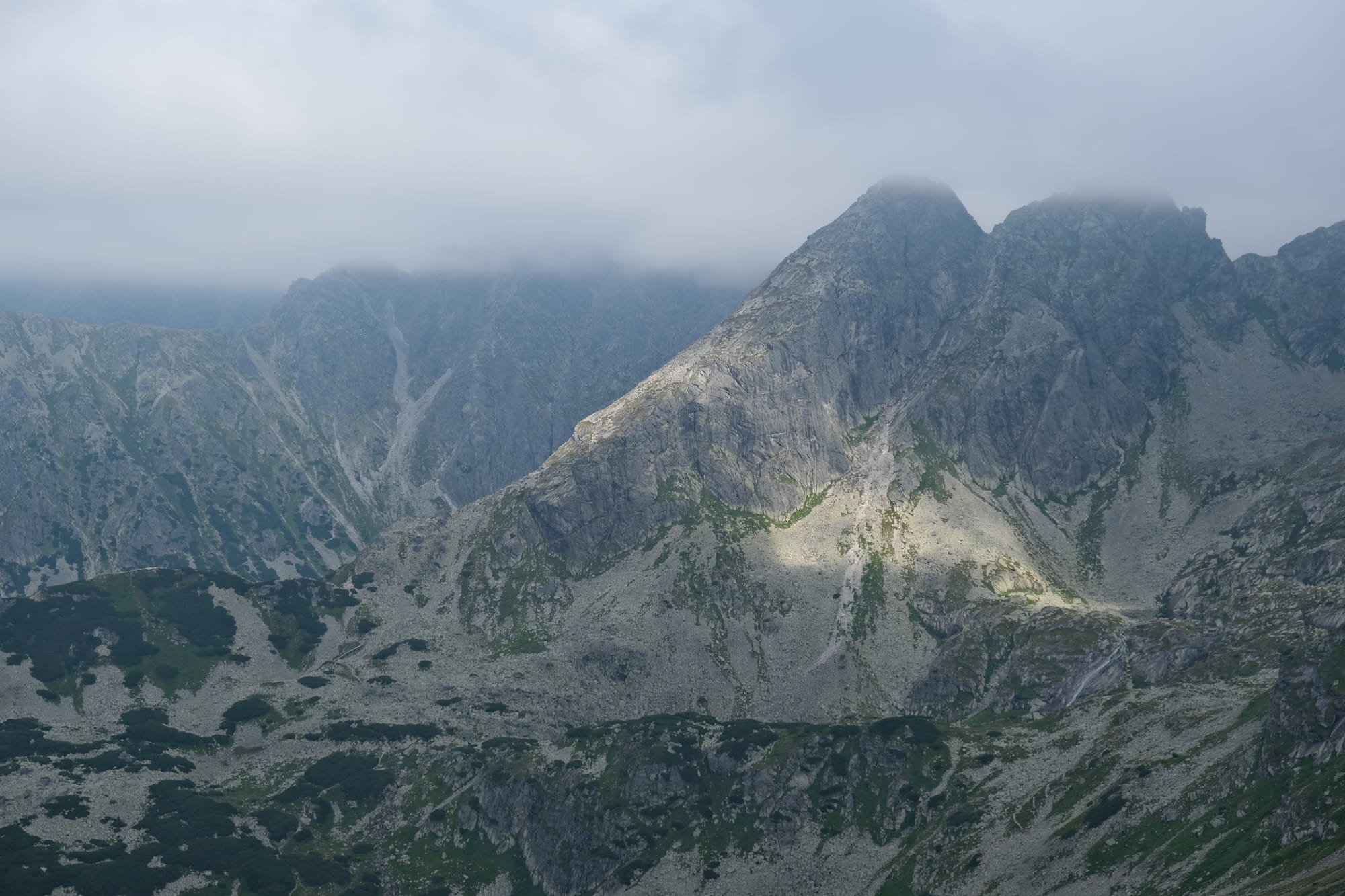
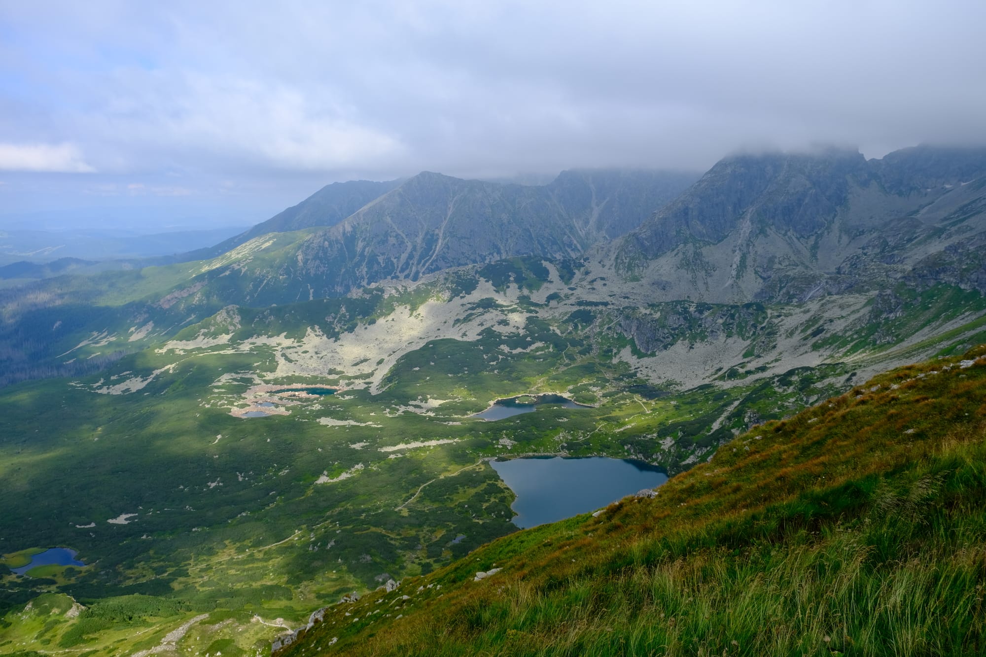
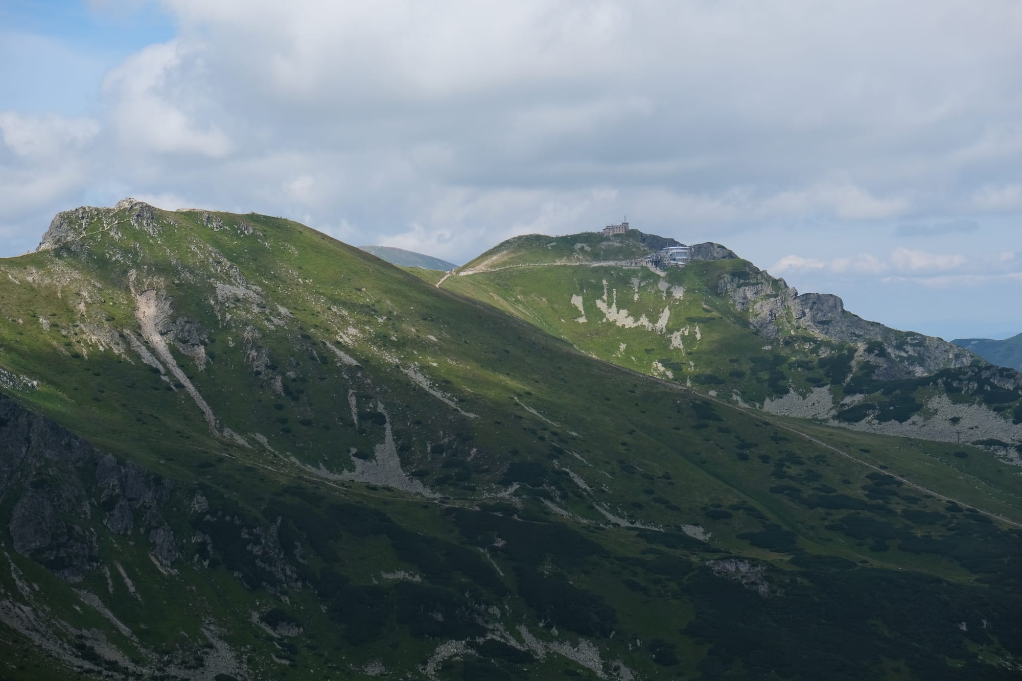
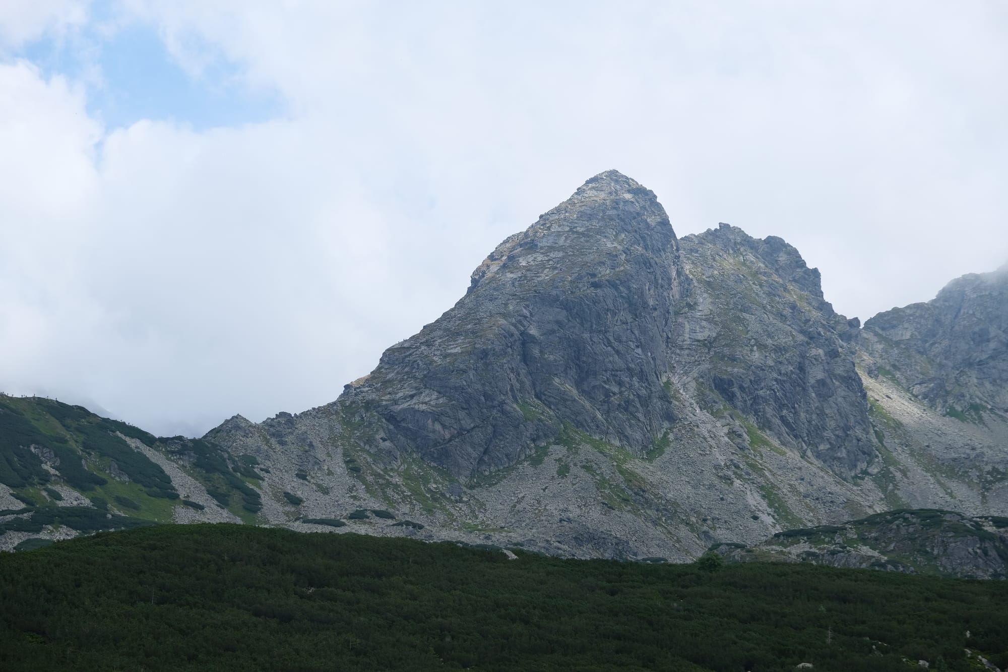
A view of Kościelec, a peak situated on a spur of the taller mountain Świnica which here is partially hidden by the clouds.
Both these pictures were taken from the mountain behind the cable car focusing on the border ridge; the left photo looks towards the east and the right looks towards the west.
Hike to Kościelec
We hiked to Kościelec all the way from our friends place in Zakopane. The first part of the hike was walking through Zakopane back to the lower terminal of the cable car. From there we entered the National Park and embarked on our first major ascent.
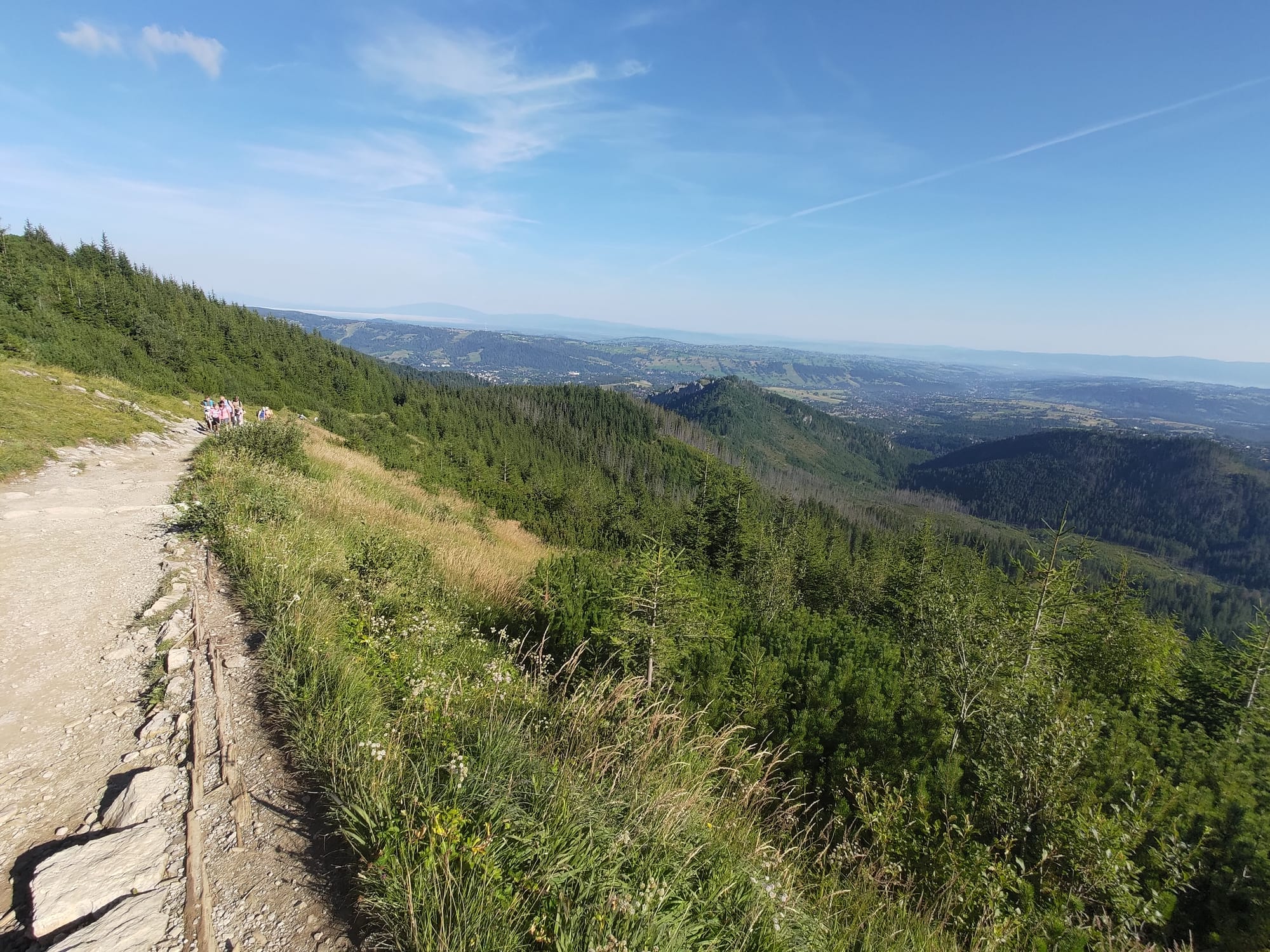

The view looking back towards Zakopane on the path up the mountain.
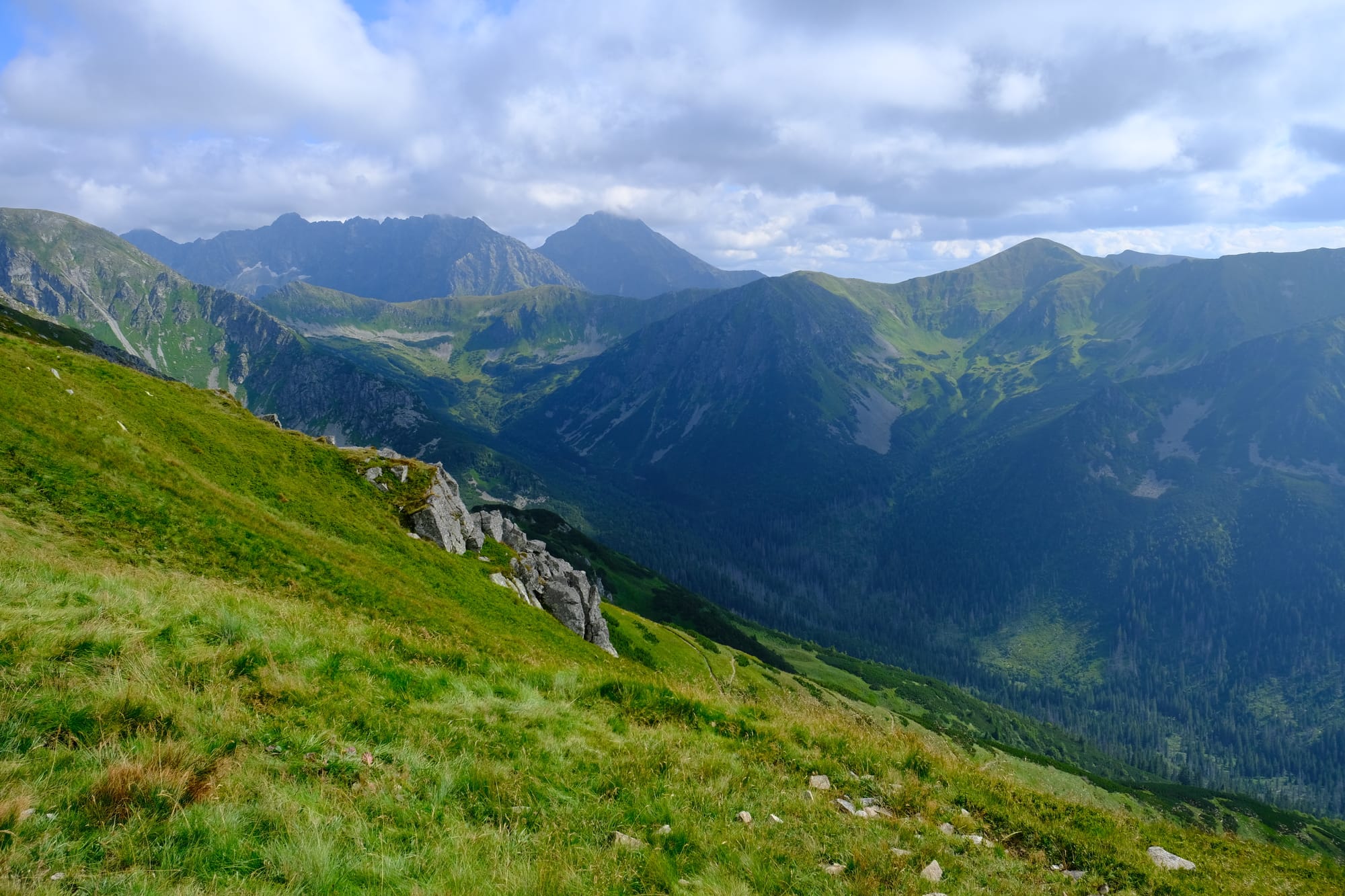
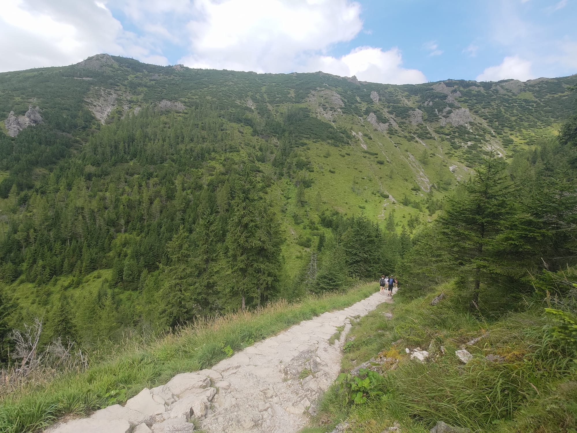
Our first ascent started steep but then became a more gentler upward climb once we reached a ridge. We followed that ridge up into the higher valleys of the mountains. At this point we were focused on moving forward so I was only using my phone to take pictures.
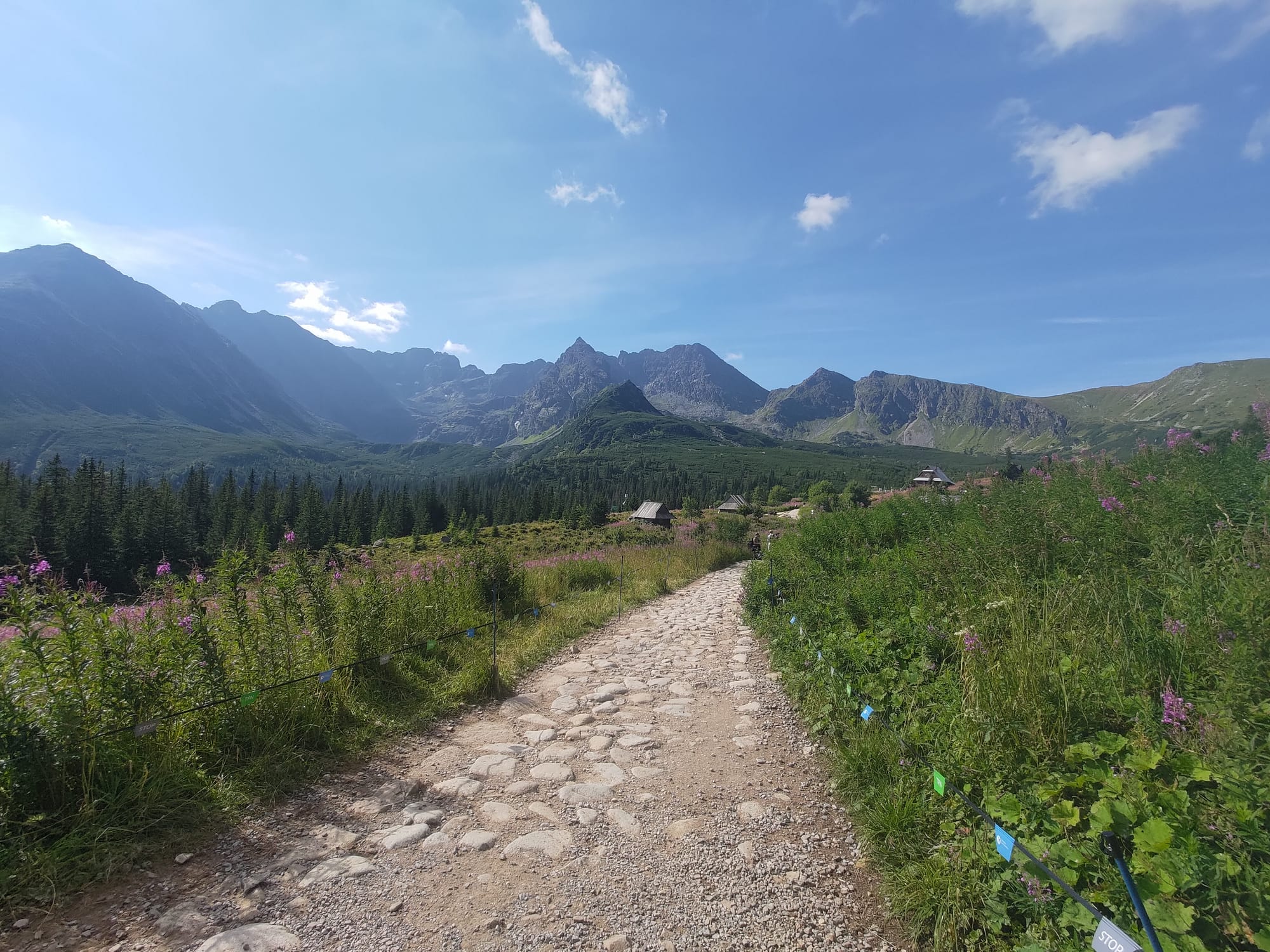
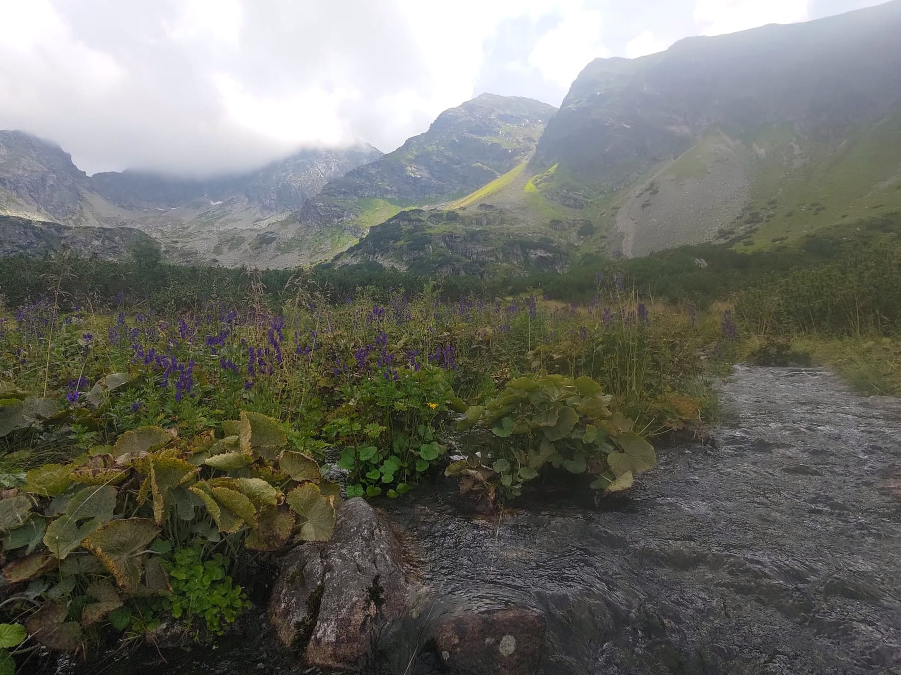
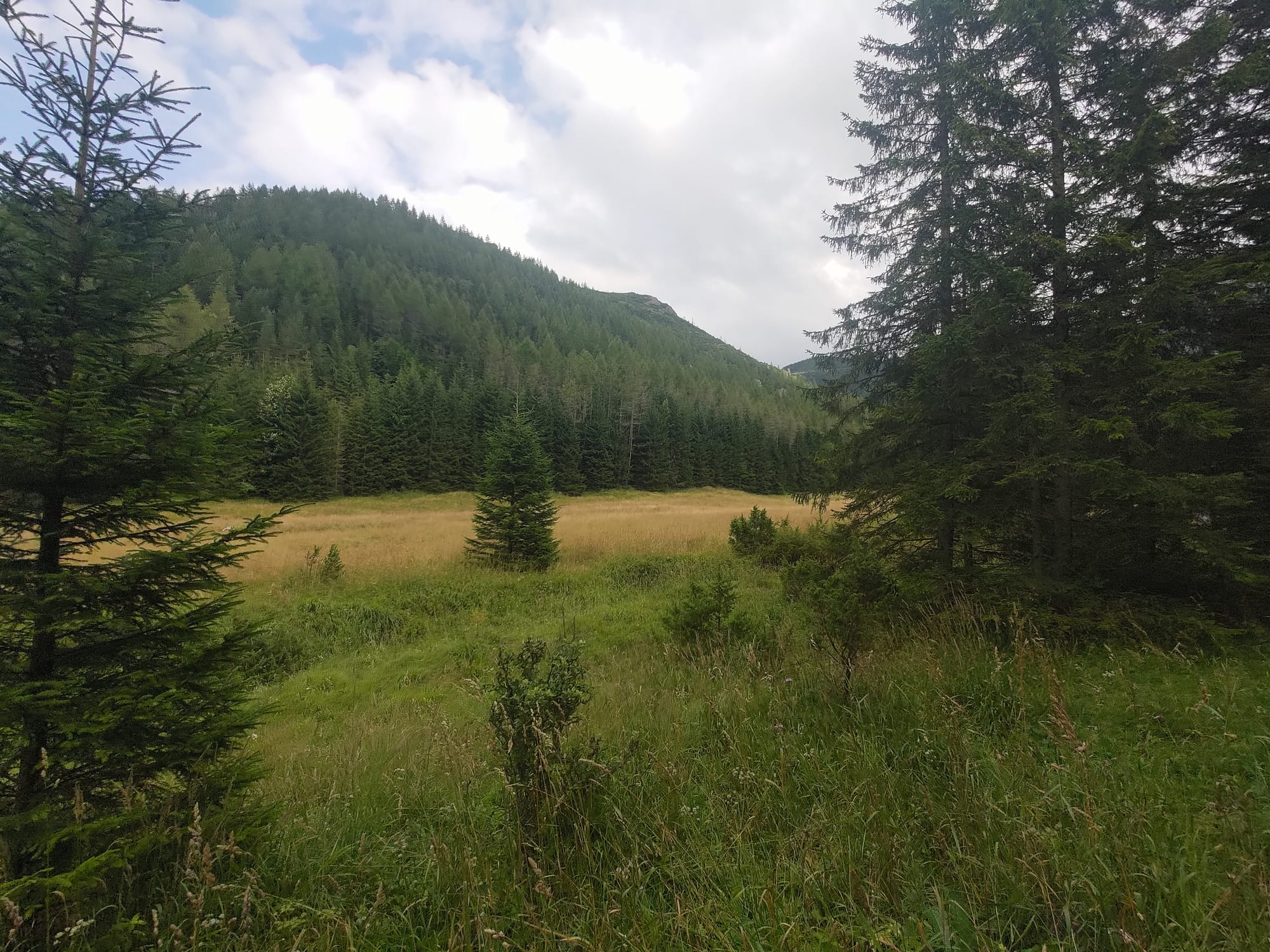
The alpine valley before the Black Lake with a few huts and filled with purple flowers.
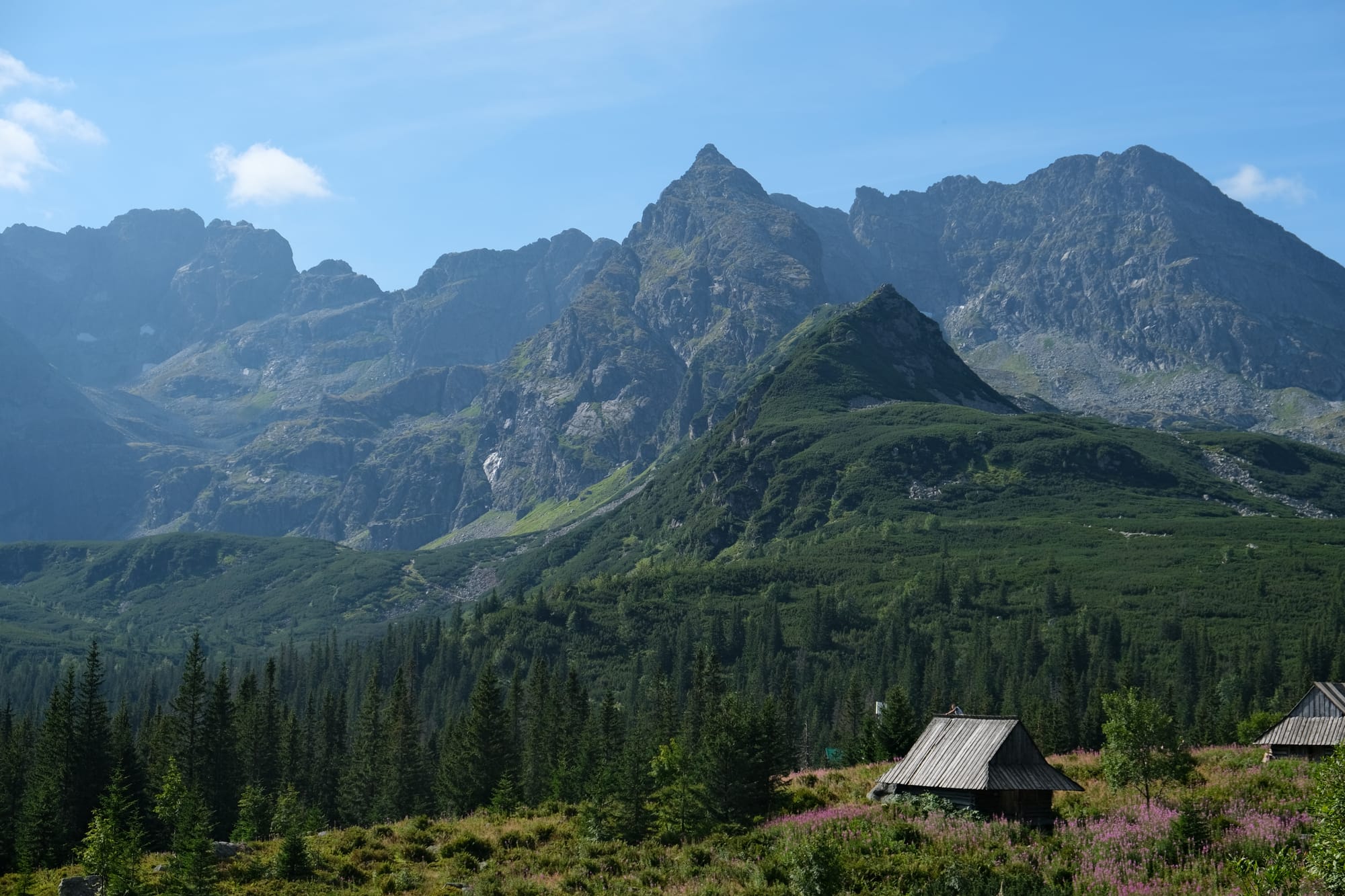
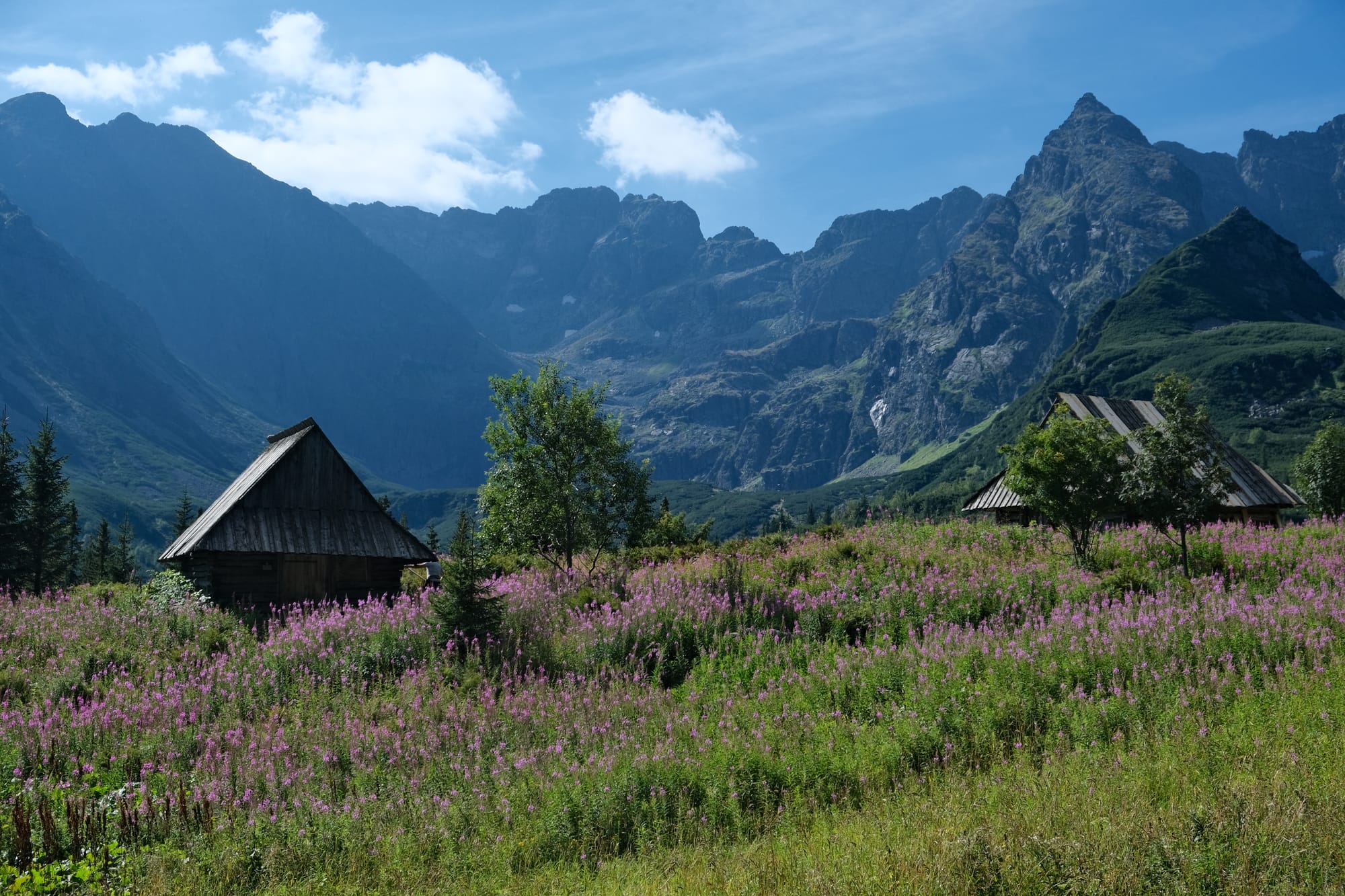
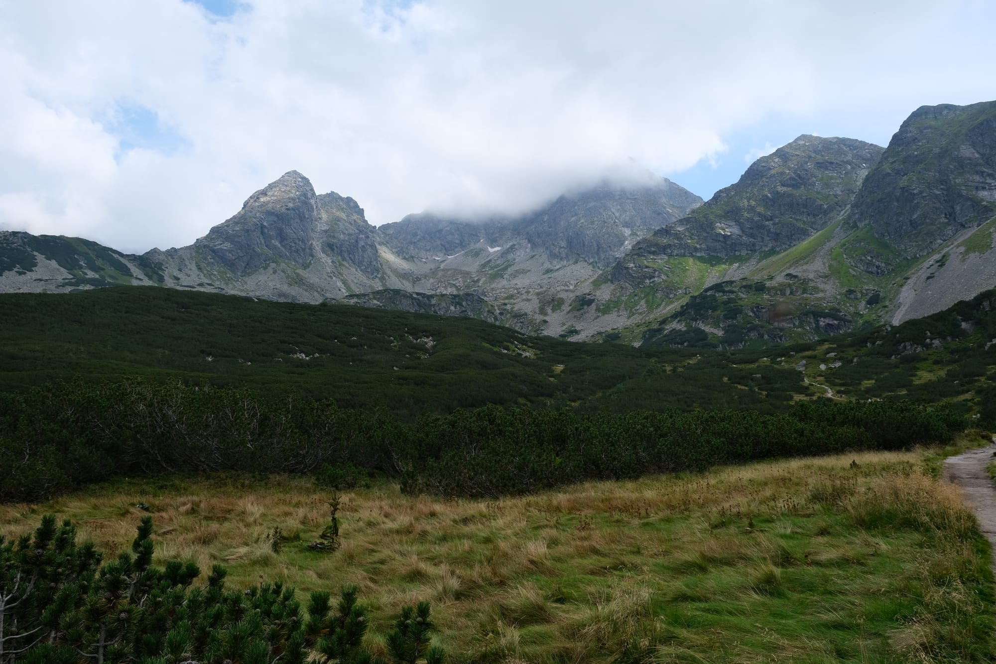
After the first ascent we entered a beautiful valley. There were small mountain huts and the grassy glades were full of purple flowers. As we descended into this valley we had our first glimpse of Koscielec, our destination.
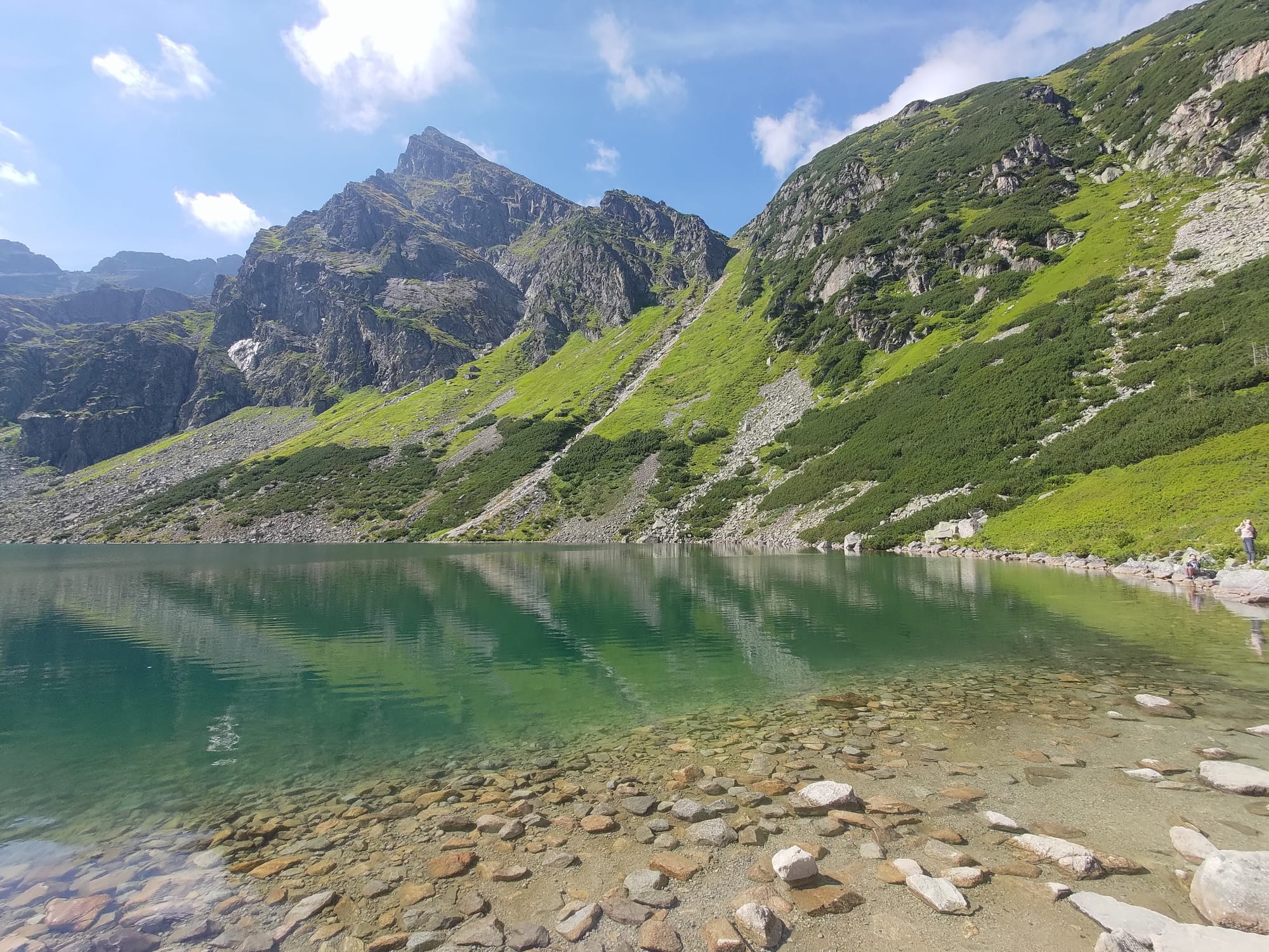
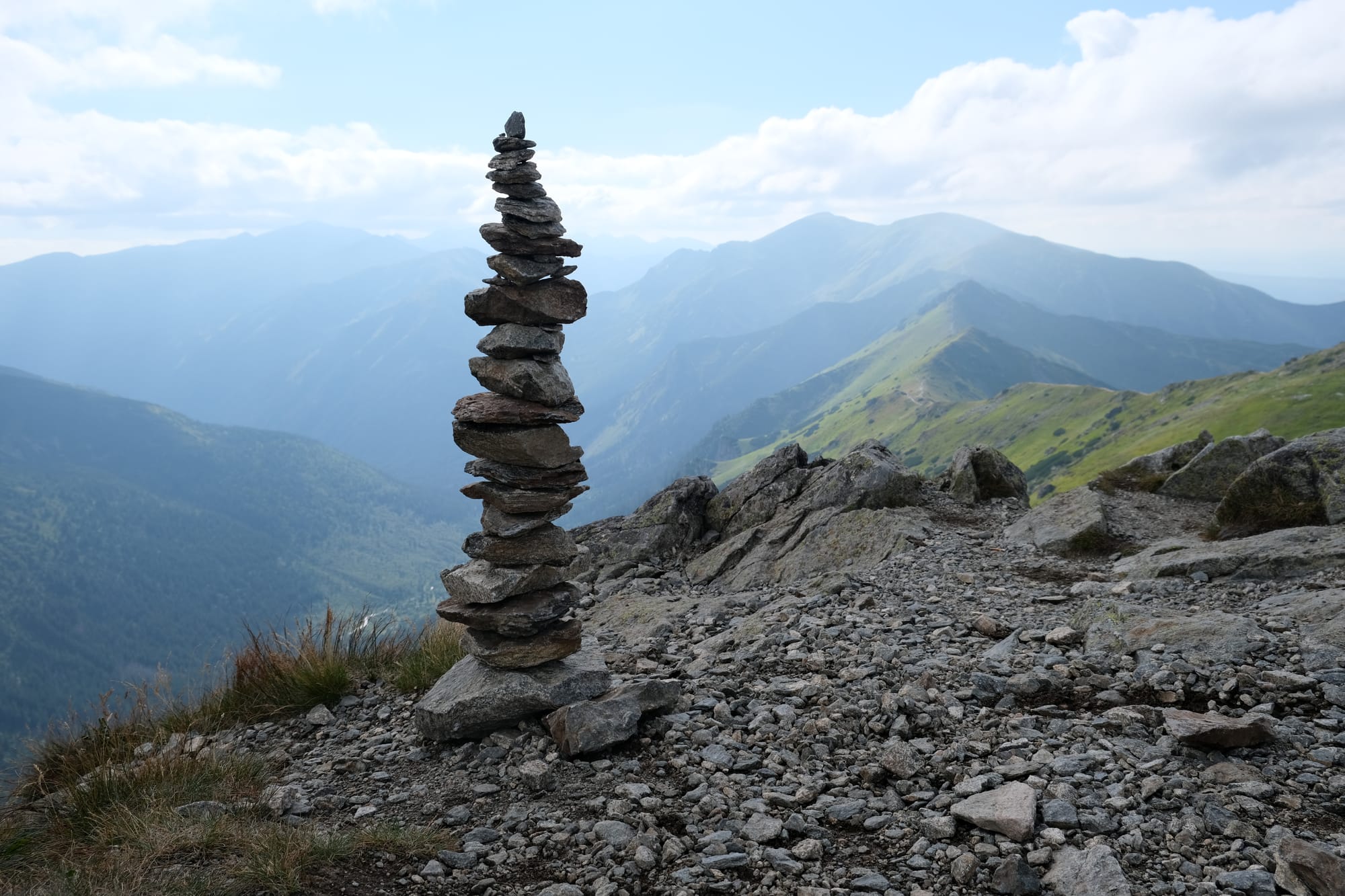
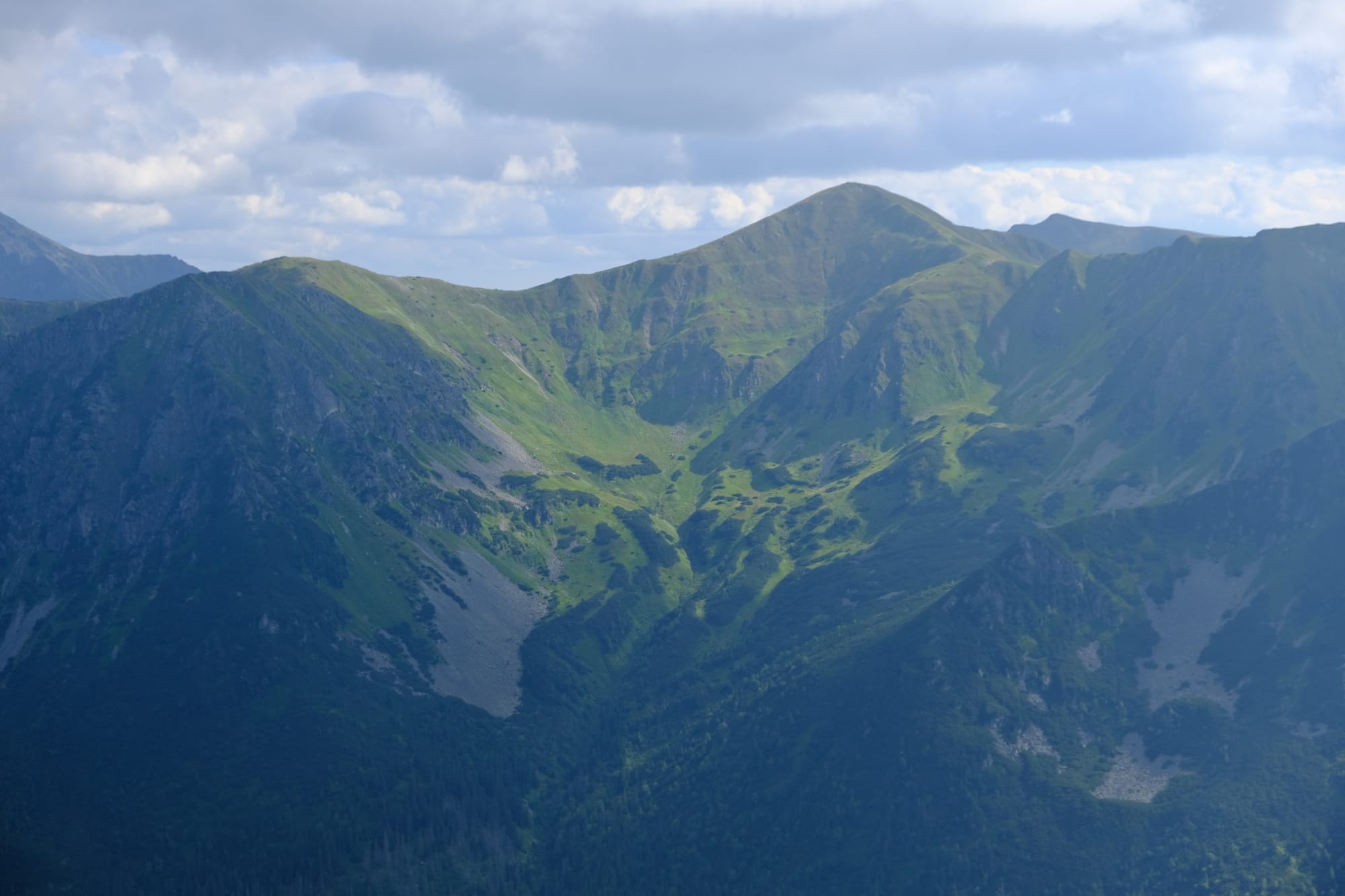
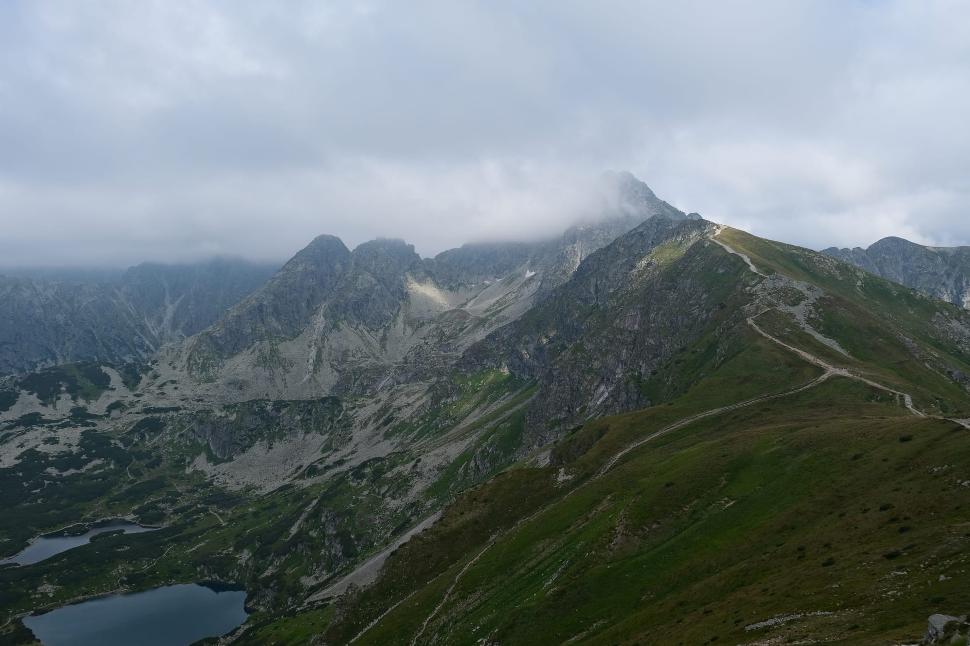
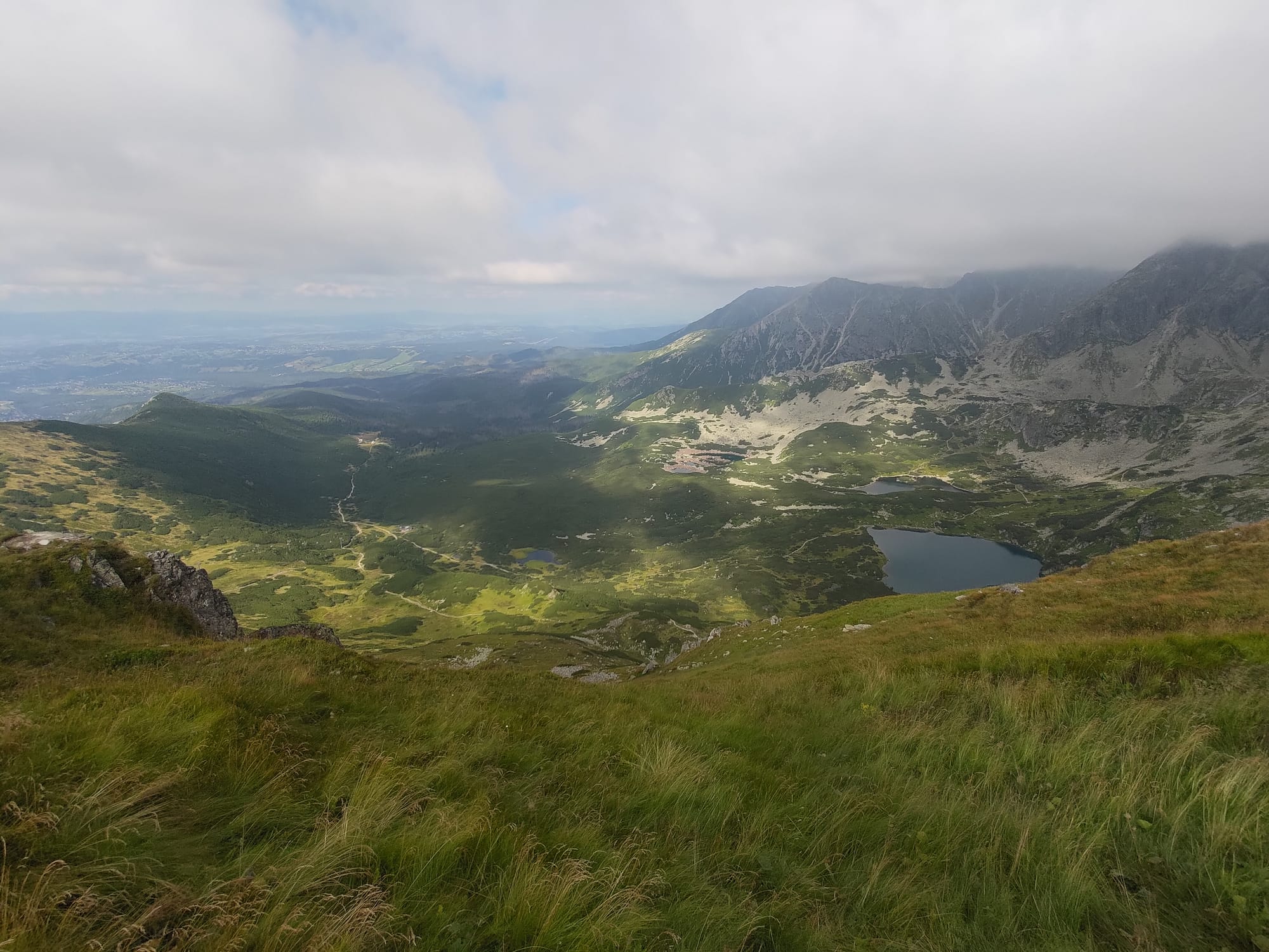
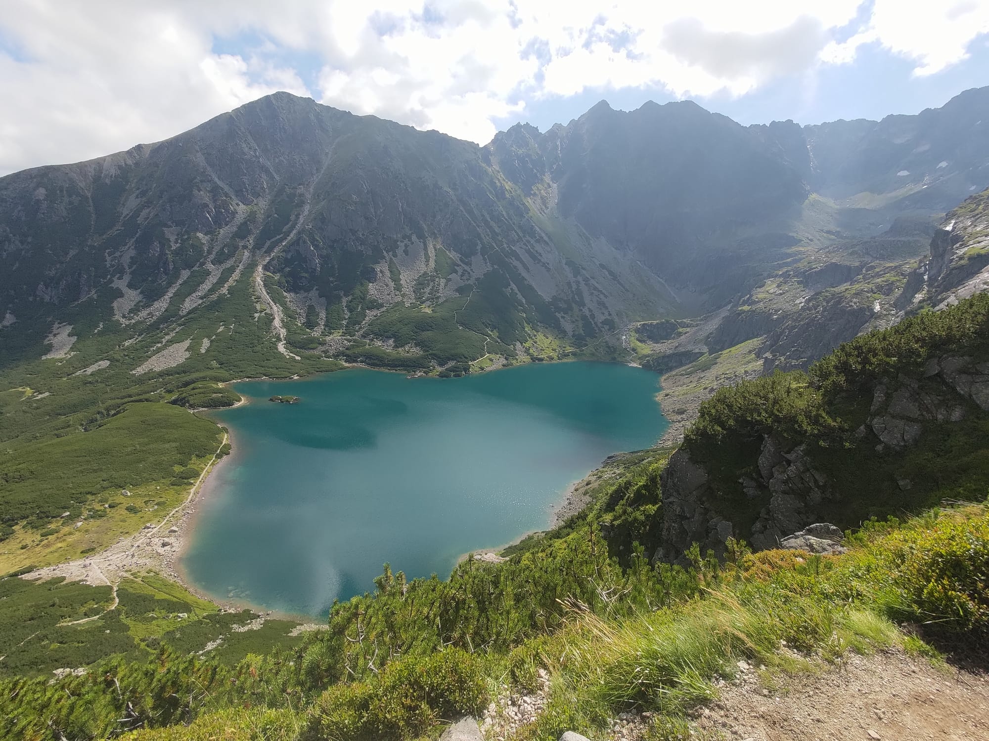
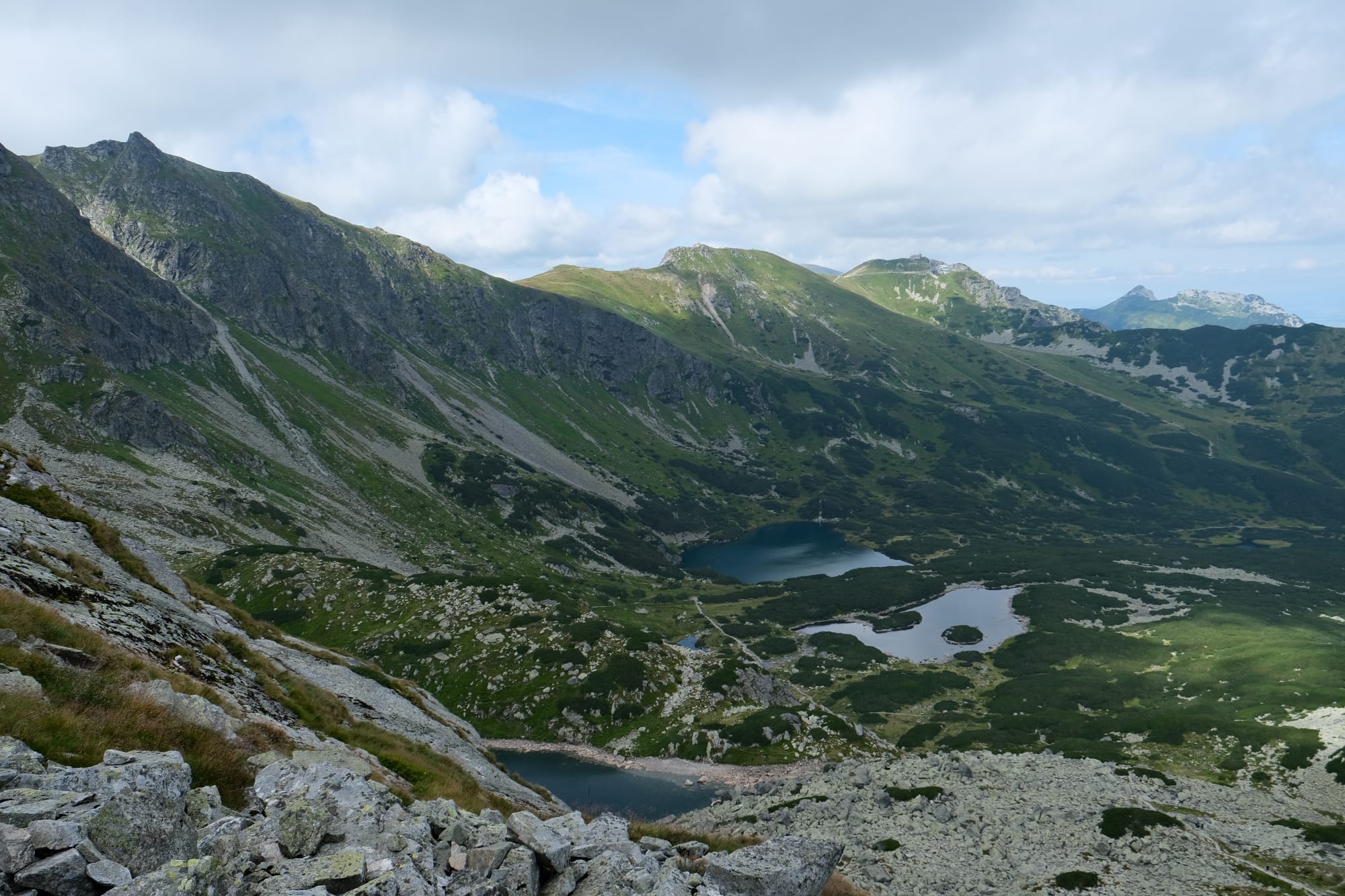
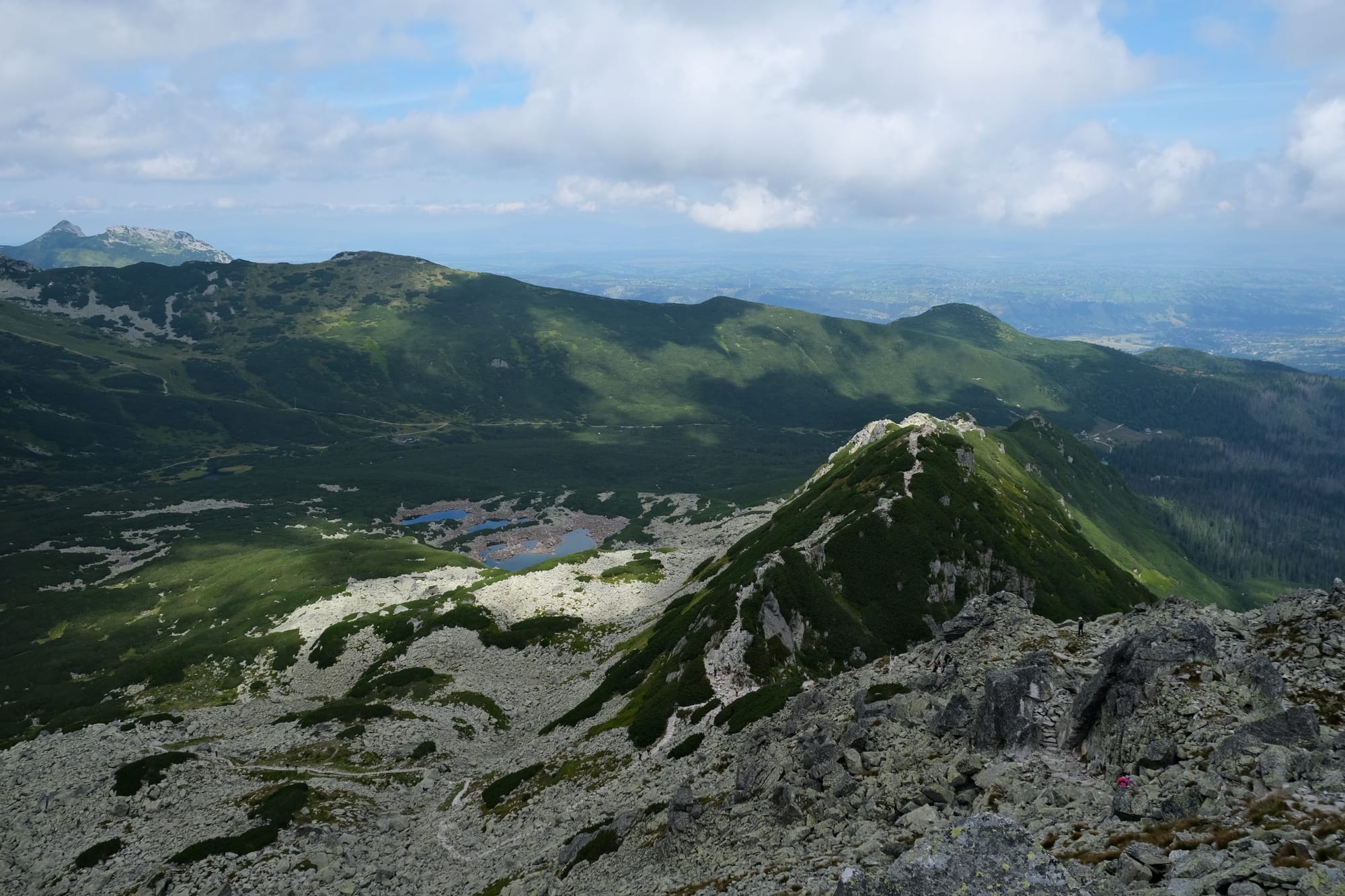
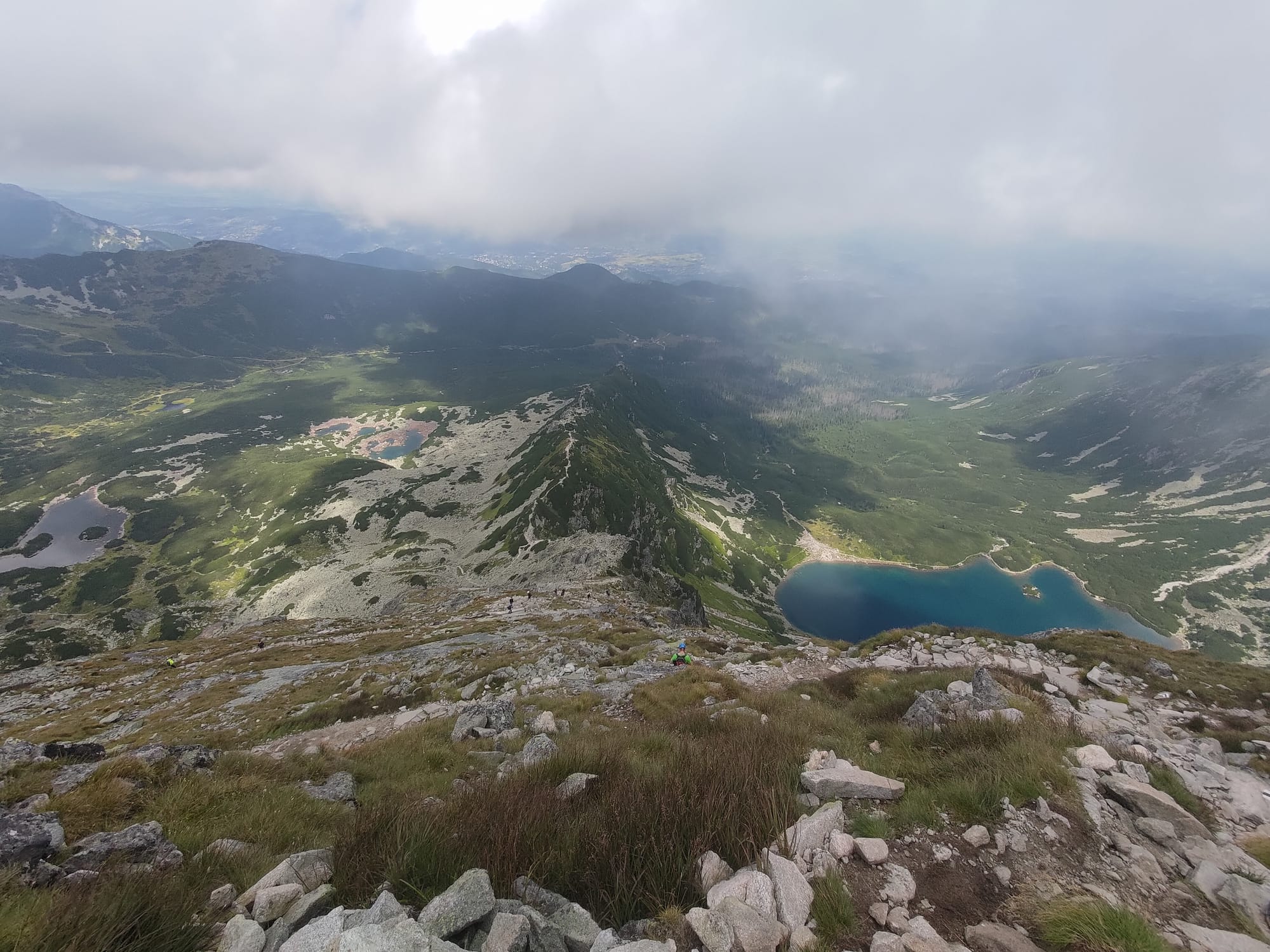
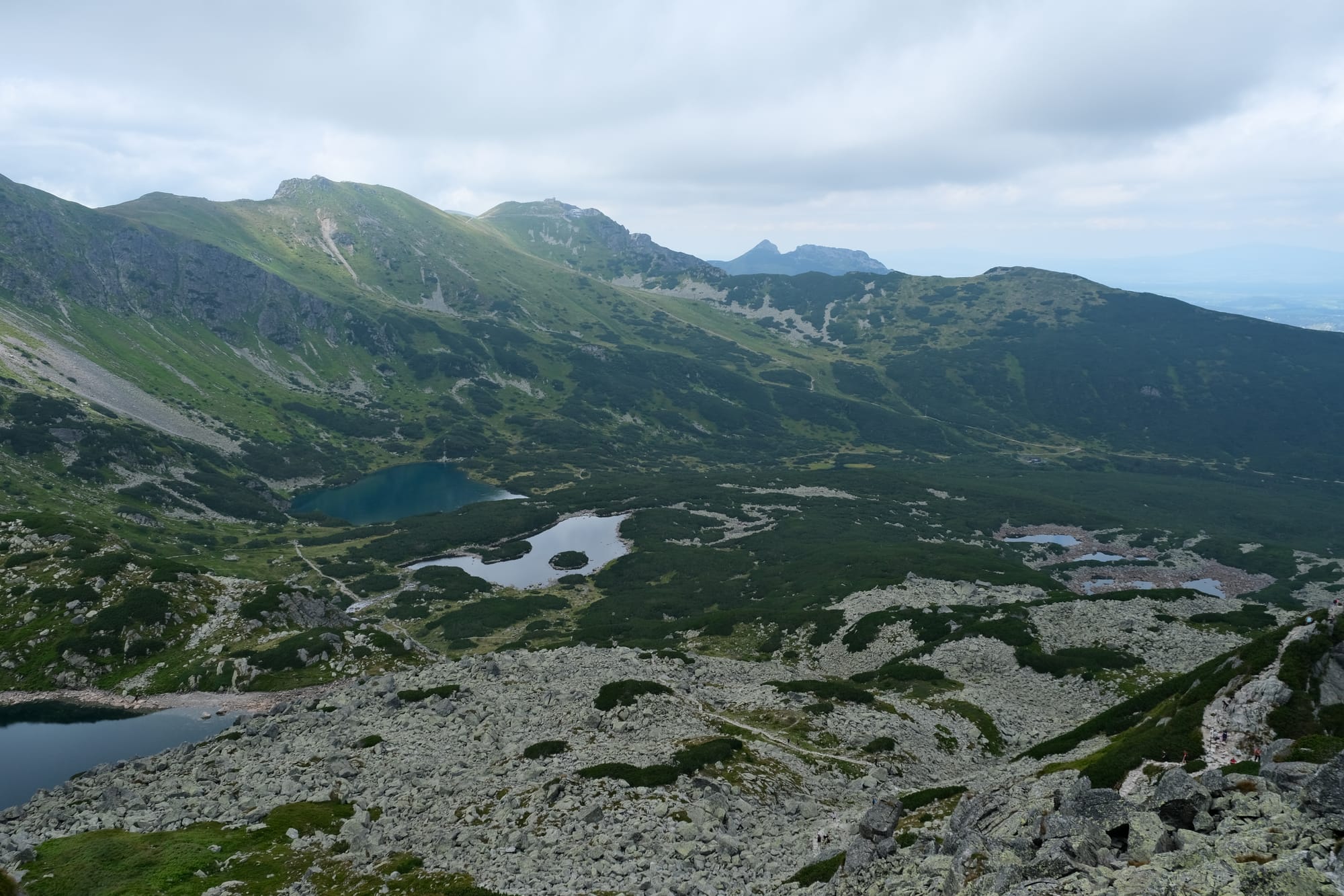
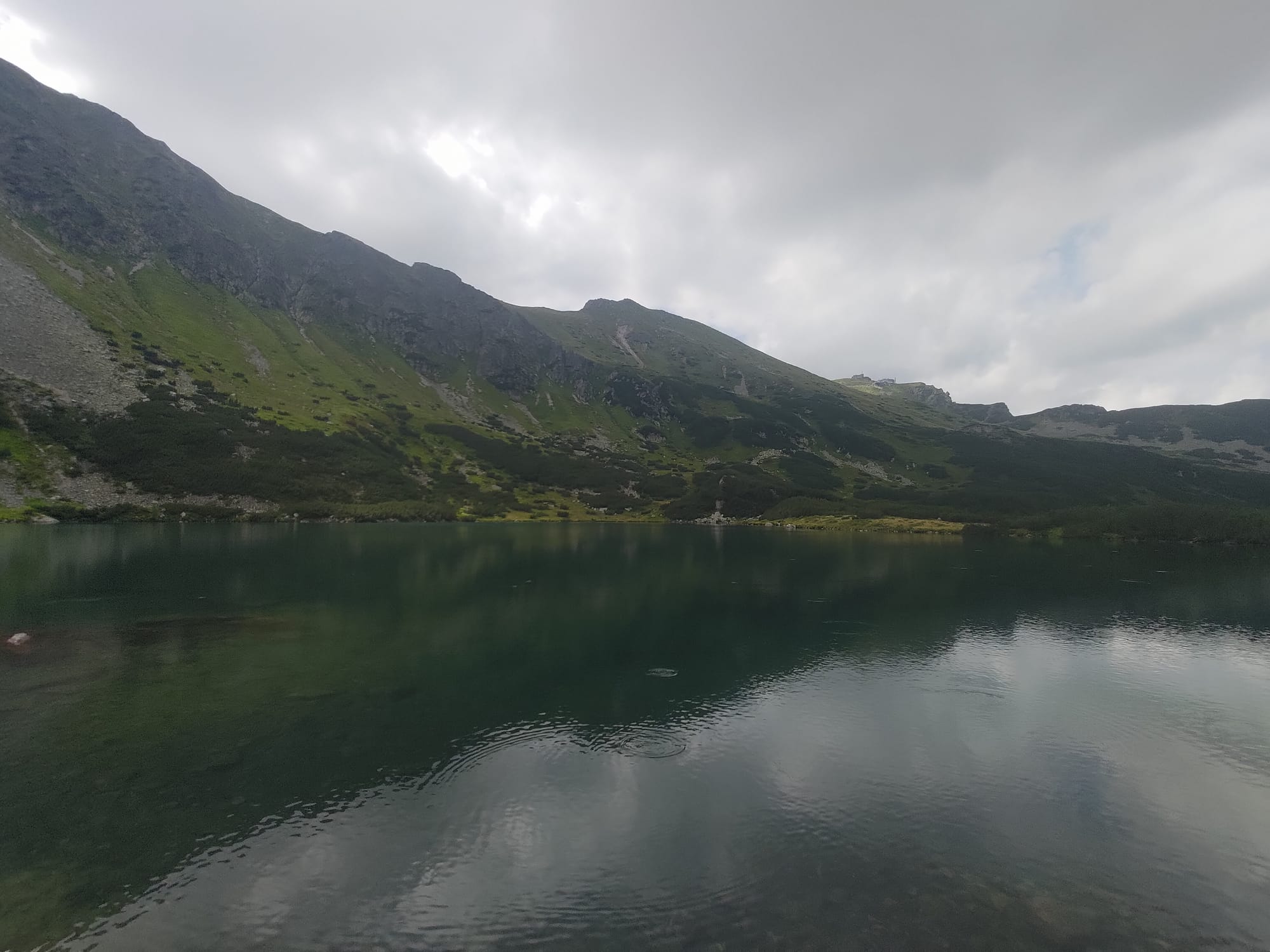
From that valley we continued climbing higher until we reached the Black Lake. We stopped here for a quick break and a snack. This lake was the last section of the normal uphill part of the hike, the next stage would involve the steepest climb of the journey. From here we would hike right up to the top of that ridge visible on the right of the picture above.
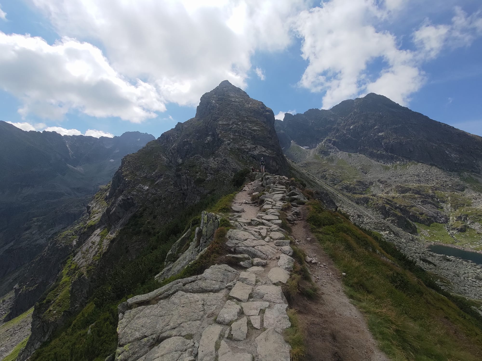
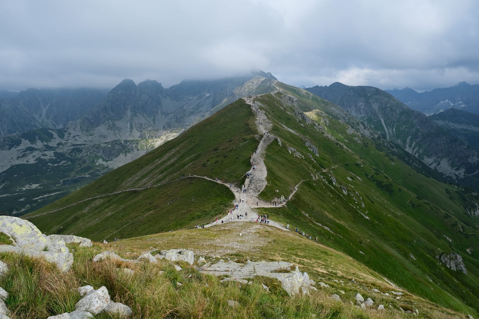
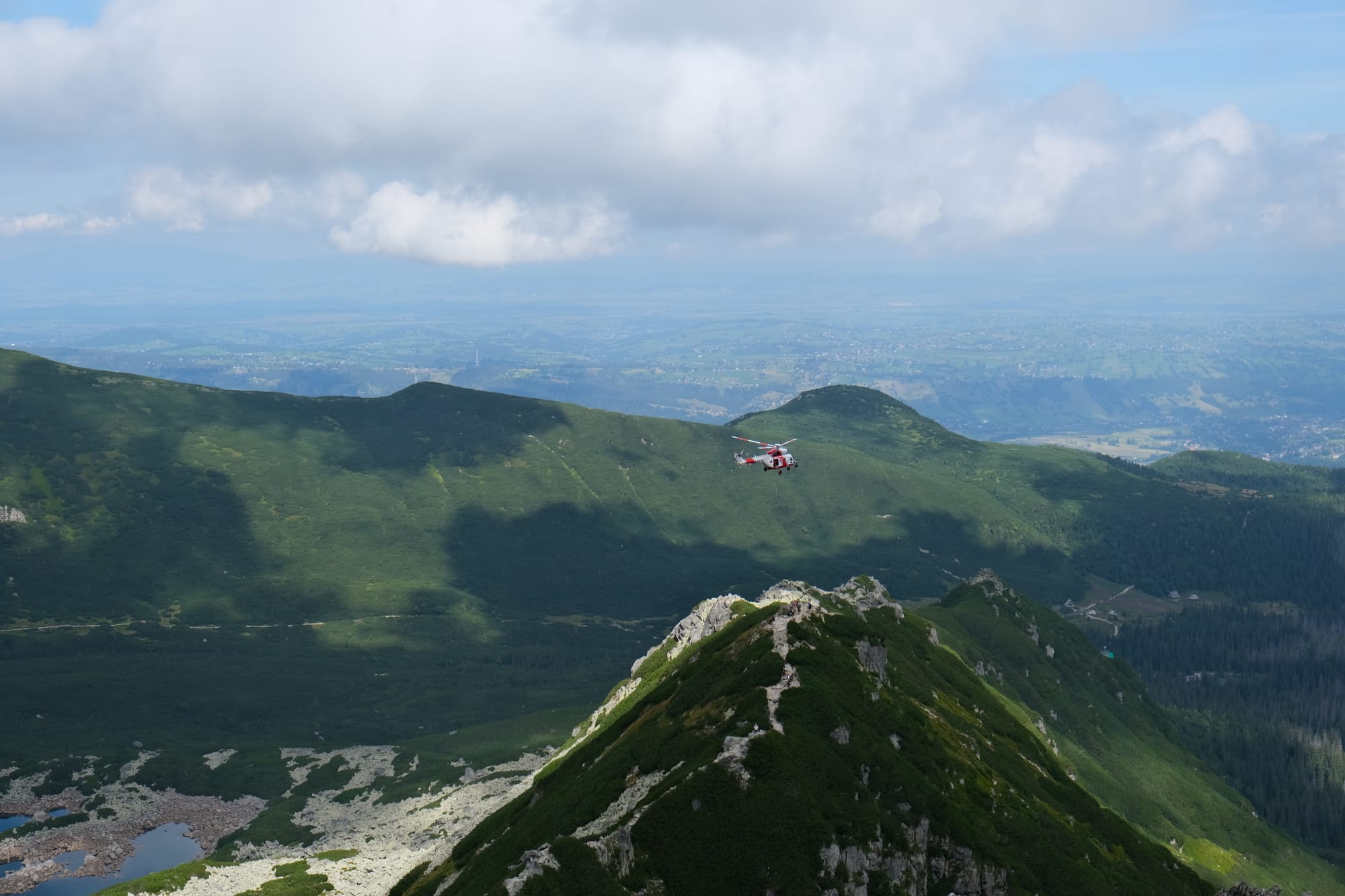
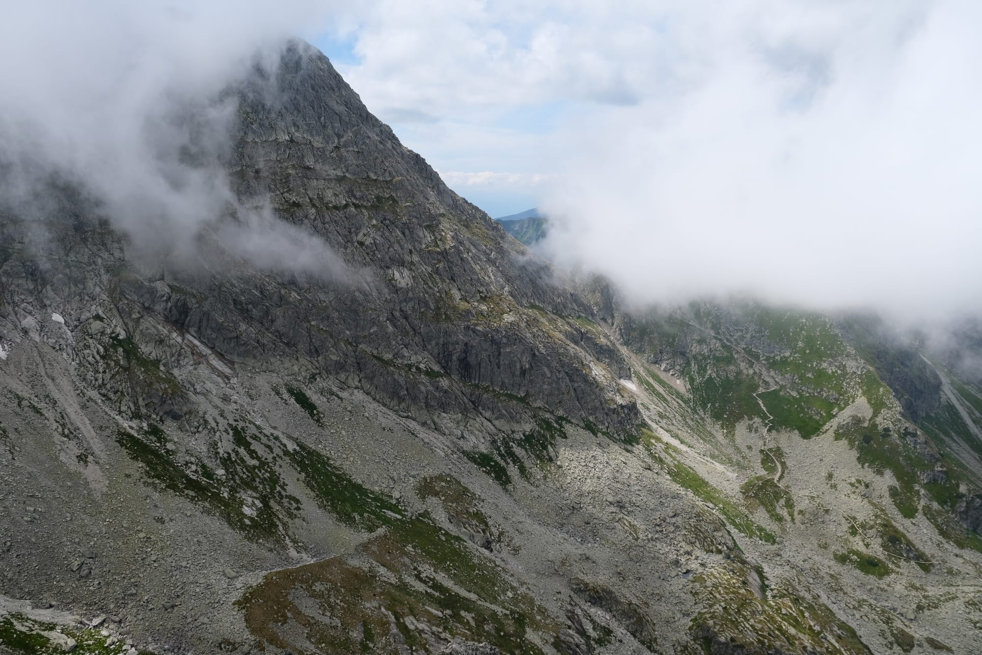
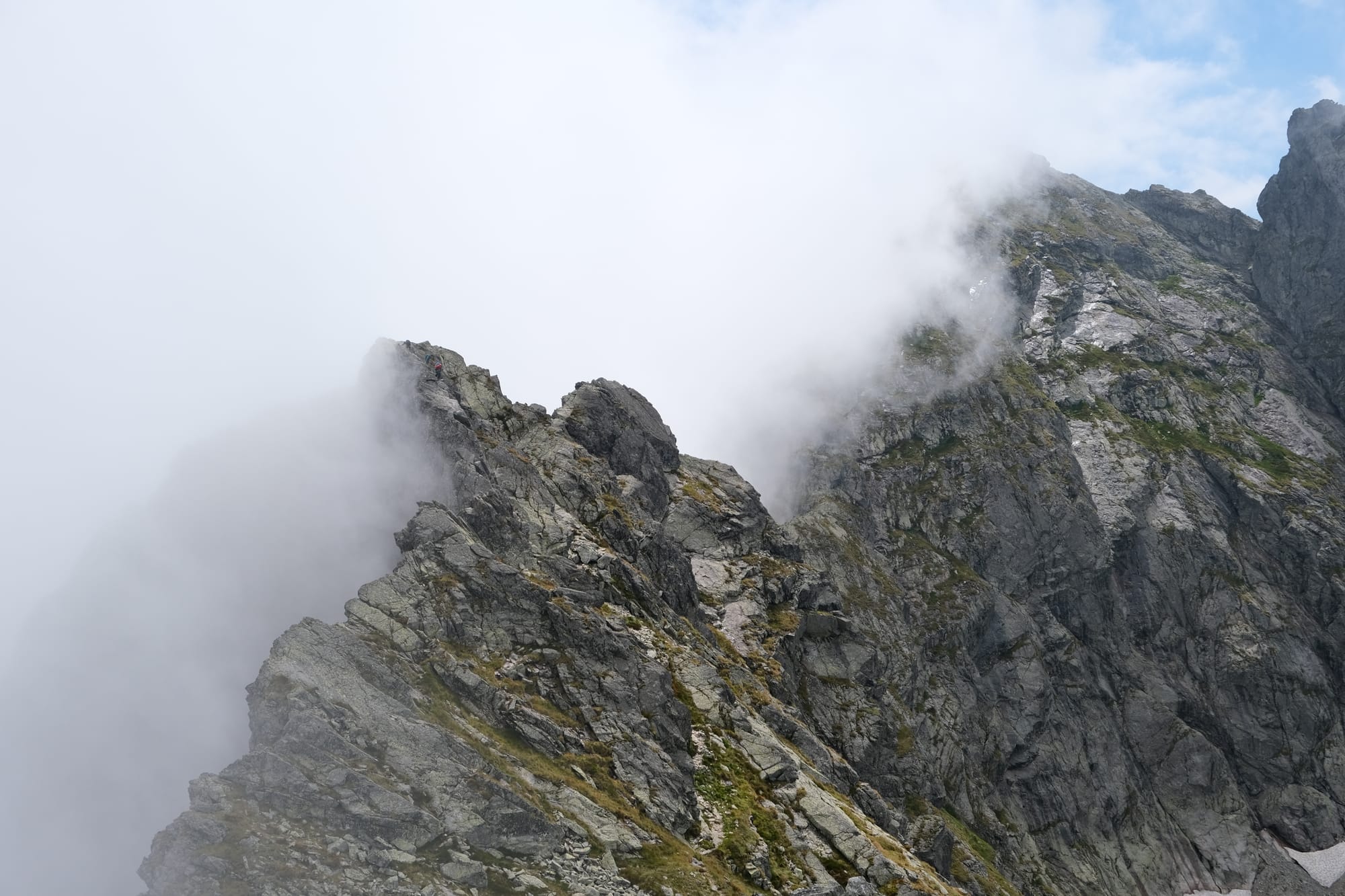
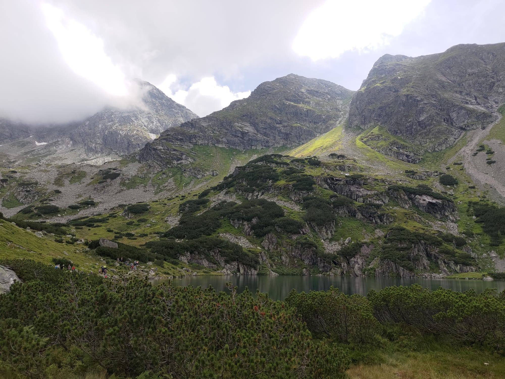
Once we reached this ridge we could see into the valley on the other side of Kościelec. We walked along this ridge toward the dominating mountain peak. This was a fantastic part of the walk as we had views on either side. As we walked, a helicopter flew in the valley to the right and seemed to be helping some hikers in the distance.
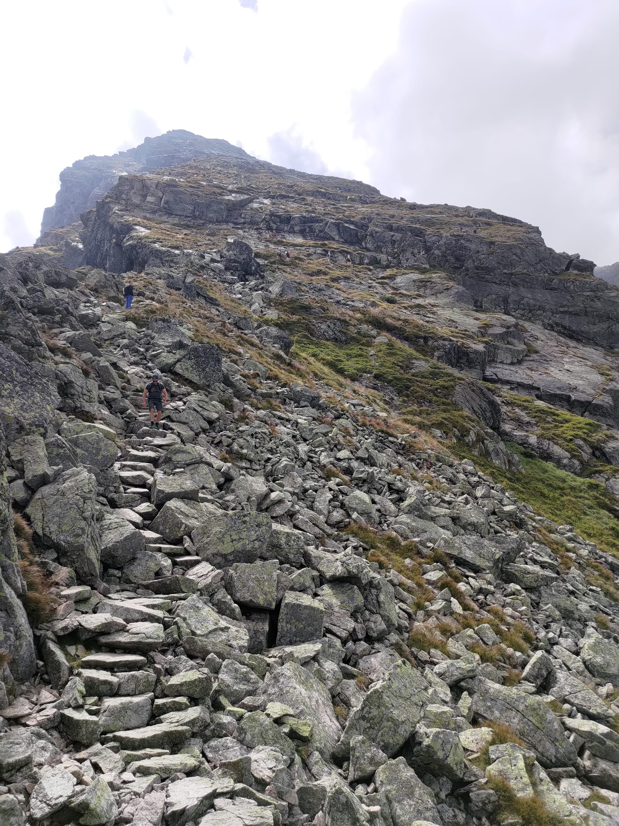
The final ascent to the peak was the toughest part of the walk. There were steep steps almost the entire time, and where there weren't steps, we were scrambling over rocks.
Some photos taken halfway up the steep side of Kościelec.
While the climb up Kościelec was hard, every step was worth it as the views kept getting better and better. I frequently was stopping to look back at the valley below, that now seemed to be getting smaller and smaller the higher I climbed. Unfortunately, during this time the clouds arrived shrouding the peak and I worried we wouldn't have a complete view at the top.

We made it to the top of Kościelec. The area of the peak is very small with steep cliffs on all sides, there was even a final rock climbing scramble just before the top. When I arrived one side of the mountain was covered in fog, completely obscuring the view of the Black Lake. On the other side we could see some of the scenery but it would occasionally be hidden by the clouds as they ebbed and flowed around the mountain. We had lunch here and rested for a time. Even though there were clouds blocking much of the view, I still tried to take some good photos, and in some ways, I think I captured some really nice ones that were enhanced by the presence of the constantly flowing clouds.
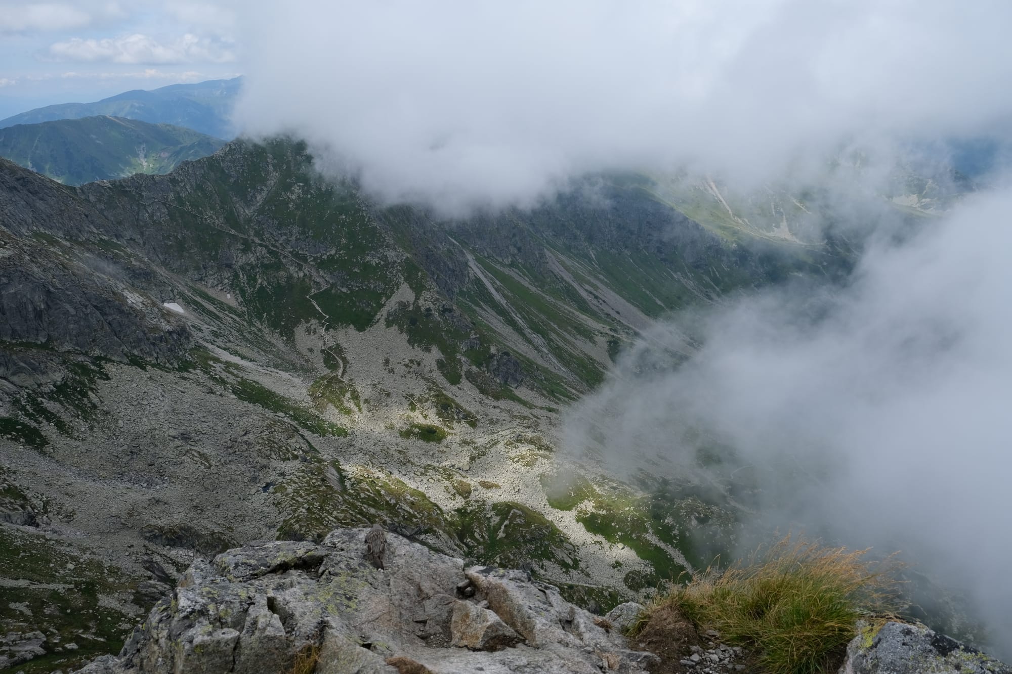
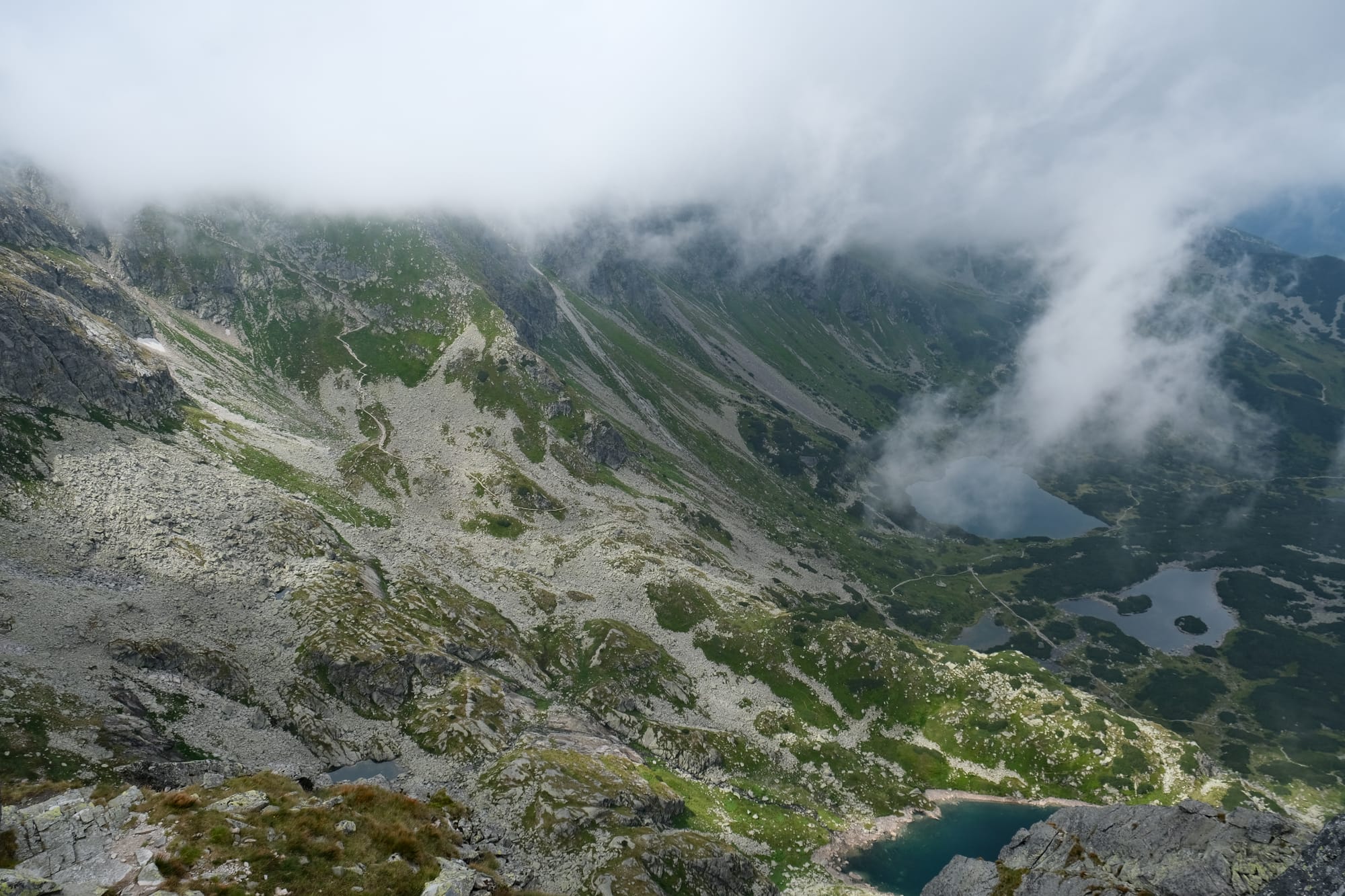
Photos captured from the peak of Kościelec.
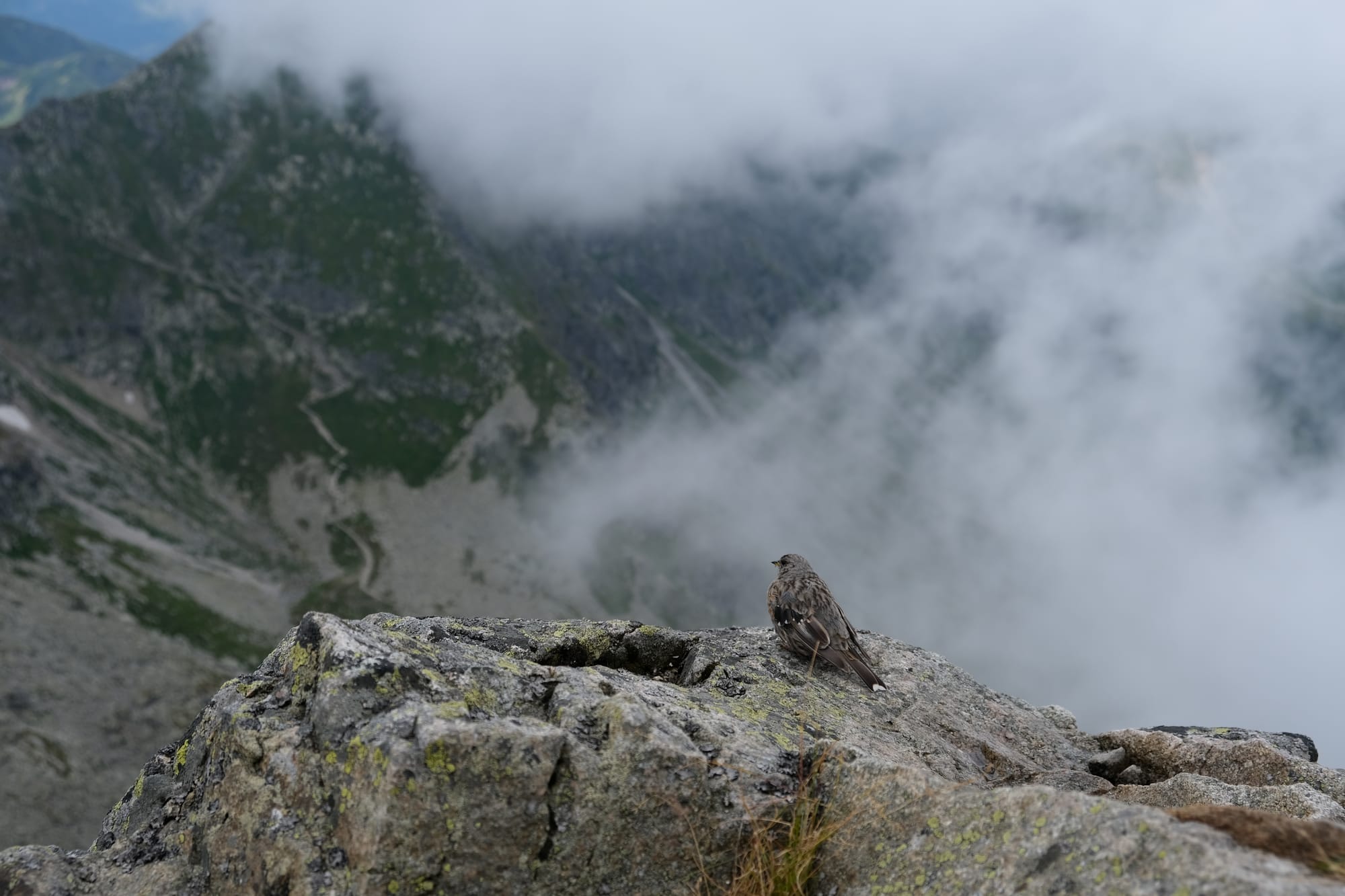
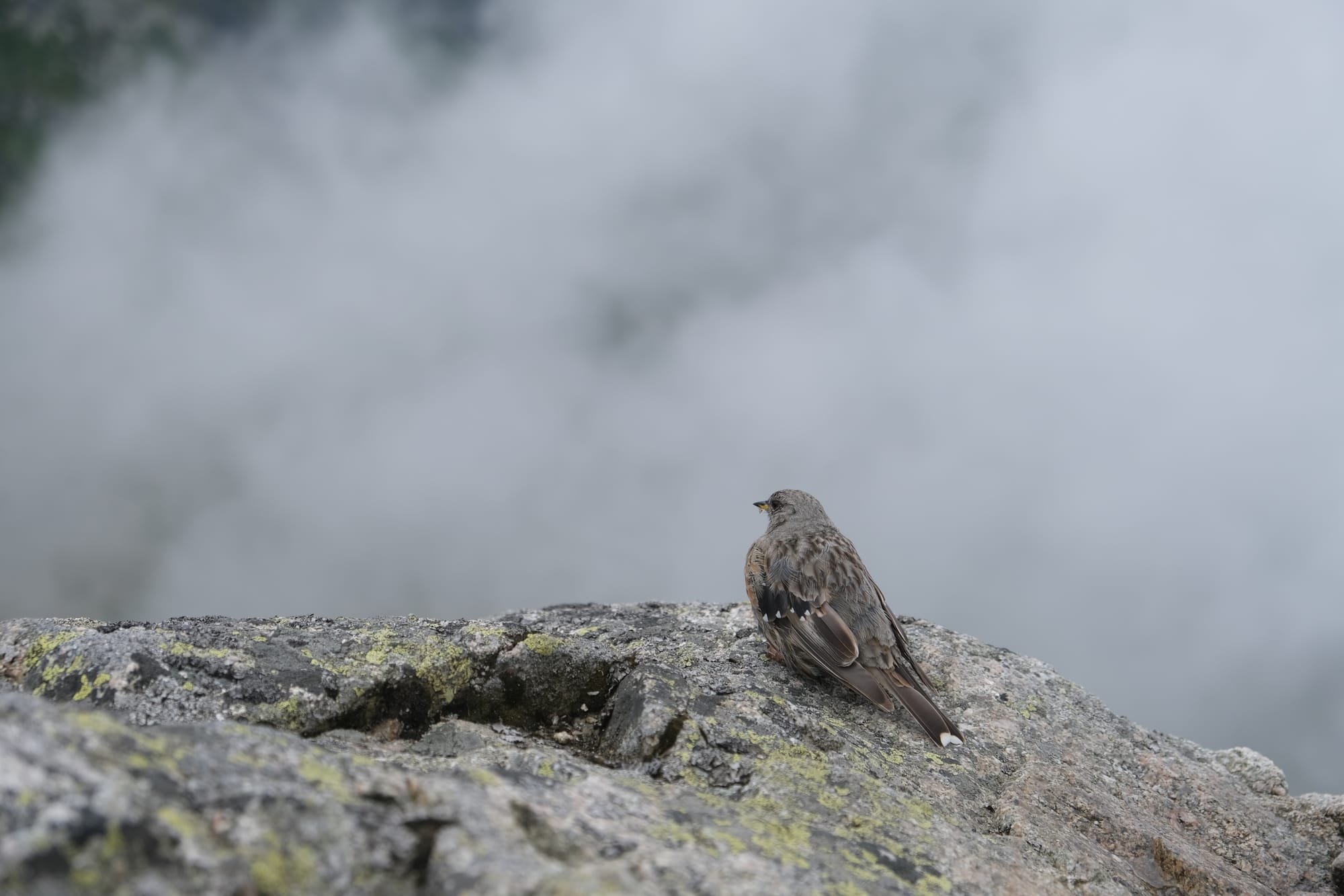
A small bird on Kościelec enjoying the view.
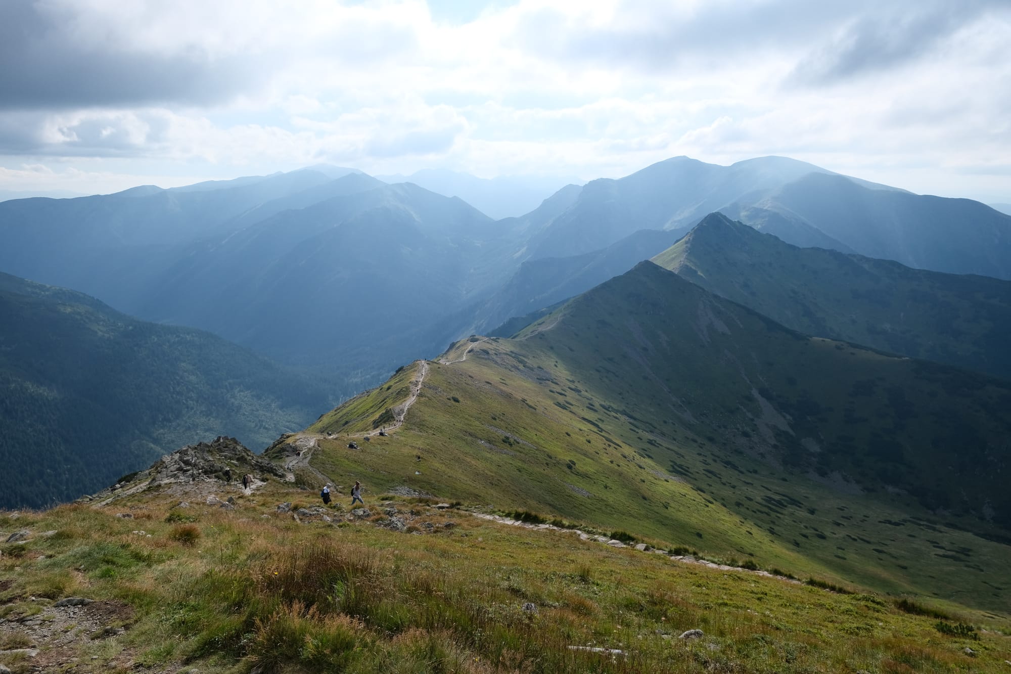
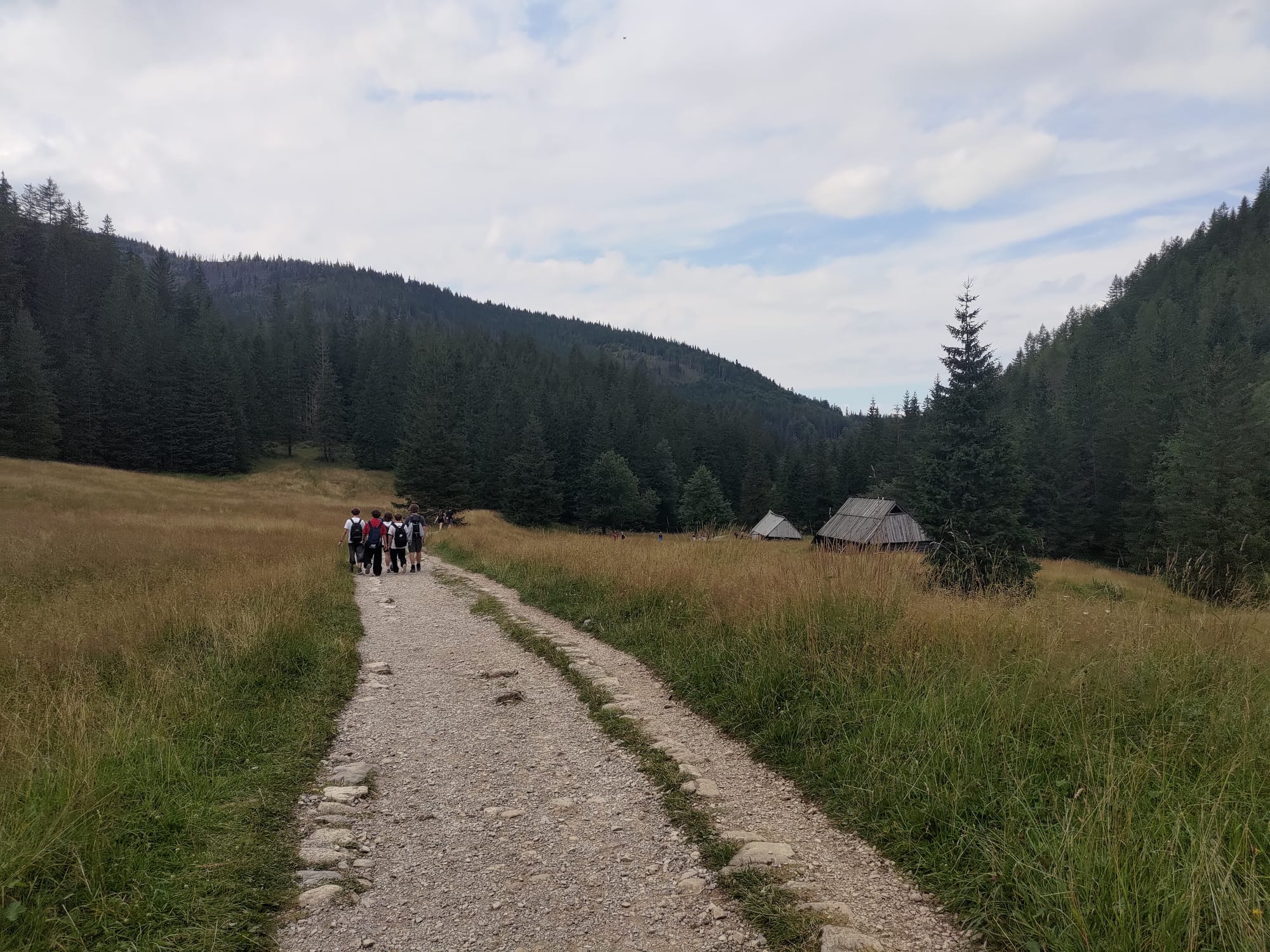
We spent about 45 minutes at the top having arrived at about quarter to noon. I enjoyed every minute of it, and while the trail up was hard, it was definitely worth it. For our return journey we descended into the valley on the western side of Kościelec (the one opposite where the Black Lake is). We made a loop back to the central valley with the purple flowers. From there we continued back down the final descent, again, by a different path; walking along the valley floor rather than a ridge line.
Kościelec peak as seen when looking back on the return journey.
A couple of the lakes we walked passed on the return journey.
The valley we walked down for our final descent out of the national park.
Photos taken as we walked along the valley floor.
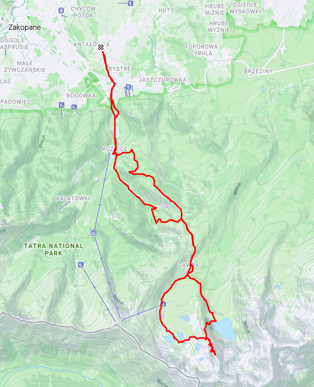
I didn't take as many photos on the return journey as we were wanting to get back as early as possible. After we exited the national park we had a final couple of kilometers to walk through the outskirts of Zakopane to reach our friend's place. Overall we walked 24 kilometers and ascended over 1400 meters, completing the hike in 6 hours. It was a long hike but a wonderful experience to spend some time out in nature and in the mountains that I so enjoy. I did also want to give a special thanks to my Mum's friend who was so kind in hosting us for the couple days we spent in Zakopane.
I hope you enjoyed all the pictures. Thanks for reading – Edward
Written 13th of August 2024