Lespezi Mountain
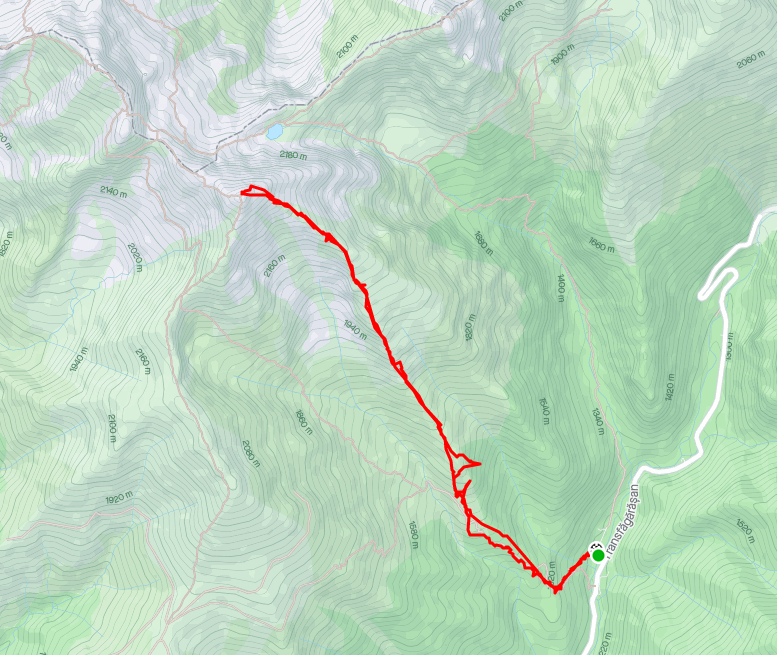
While staying at Brasov, I had the opportunity to summit Lespezi mountain, a peak above 2500 meters. It is the fifth highest mountain in Romania. I was able to join a tour group organised by a guide I had previously hiked with. The winter route to the summit is a beginner level mountaineering course that did involve one technical scramble down a rocky outcrop. While the actual distance from the car park to the summit wasn't too far, about five kilometers, the elevation gain was over 1300 meters.
We spent the previous night at a hotel about a 45 minute drive from the hike. The starting point is on the south side of the Făgăraș mountain range. This is the longest single ridge in Europe, and so to get there we had to take the long way round, traveling for four hours from Brașov. At the hotel the guide gave us our mountaineering equipment, including a harness, helmet, crampons, walking poles, and an ice axe. The day of the hike was bright and sunny, with not a cloud to be seen. While the risk of avalanches was high, our route would take us along the mountain spur up to the summit, which is a safe route from avalanches.
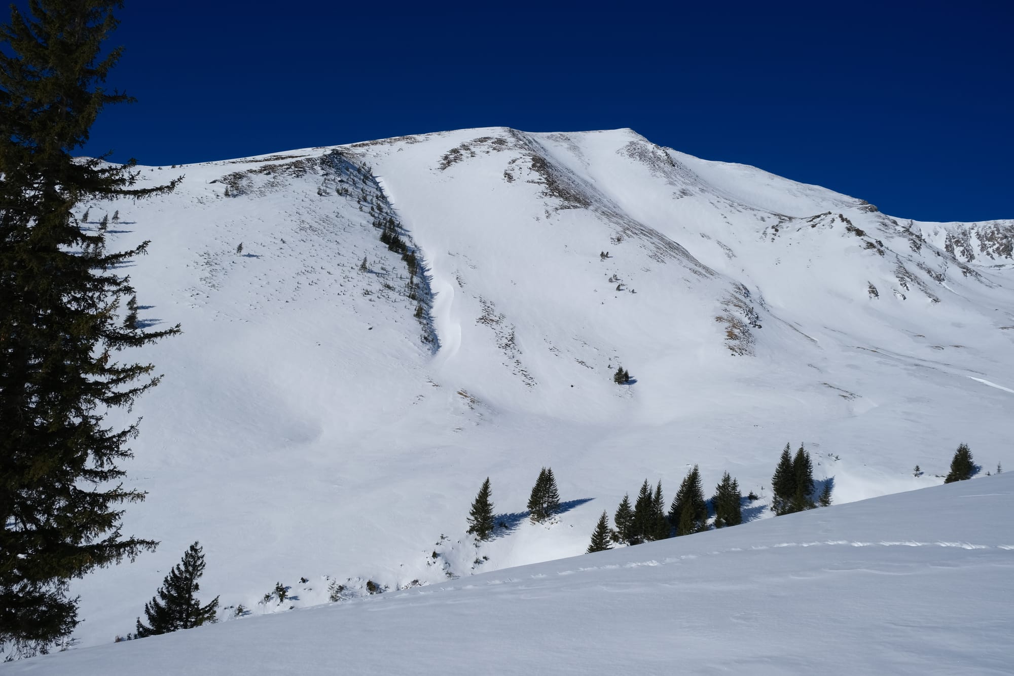
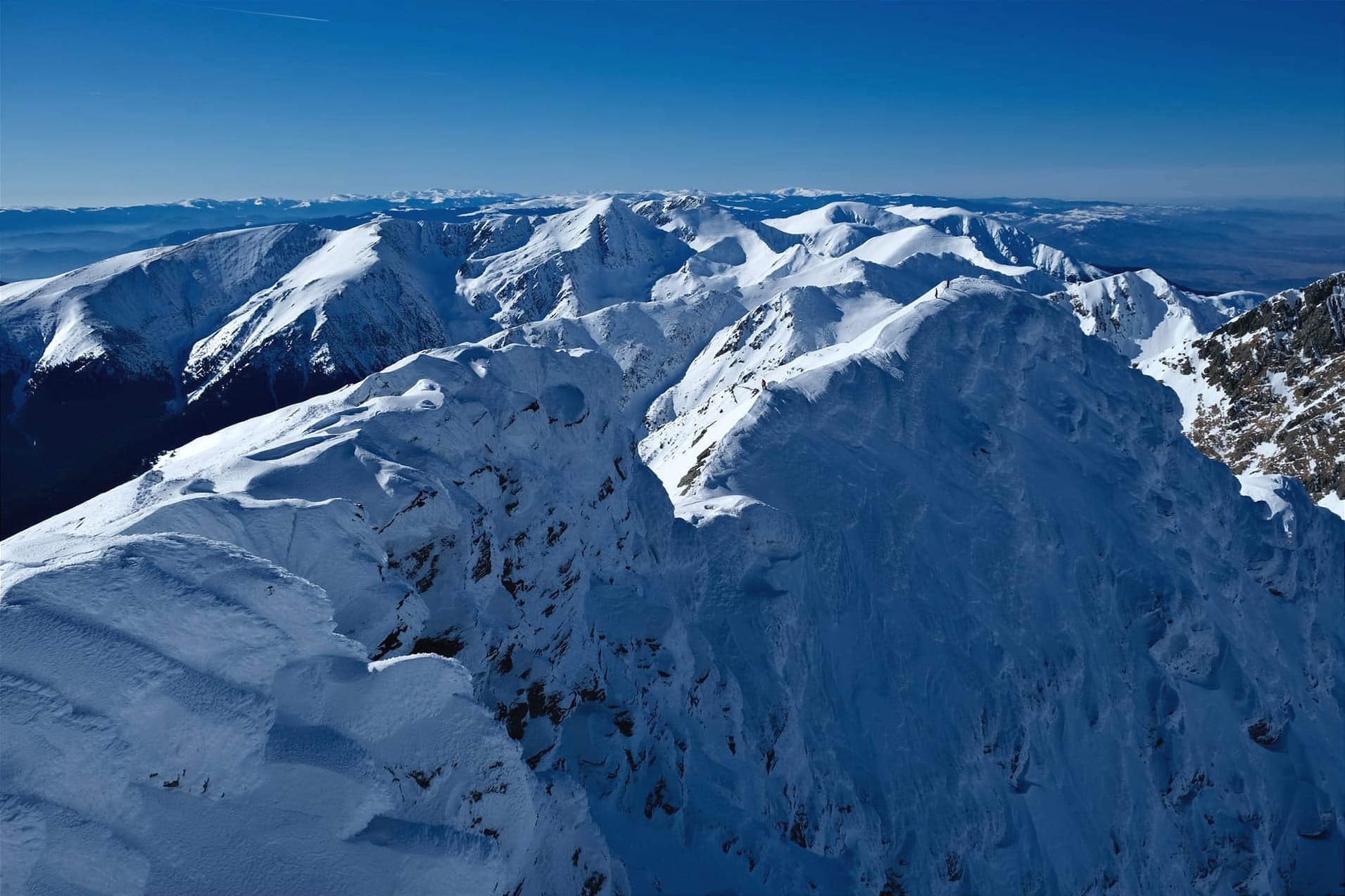
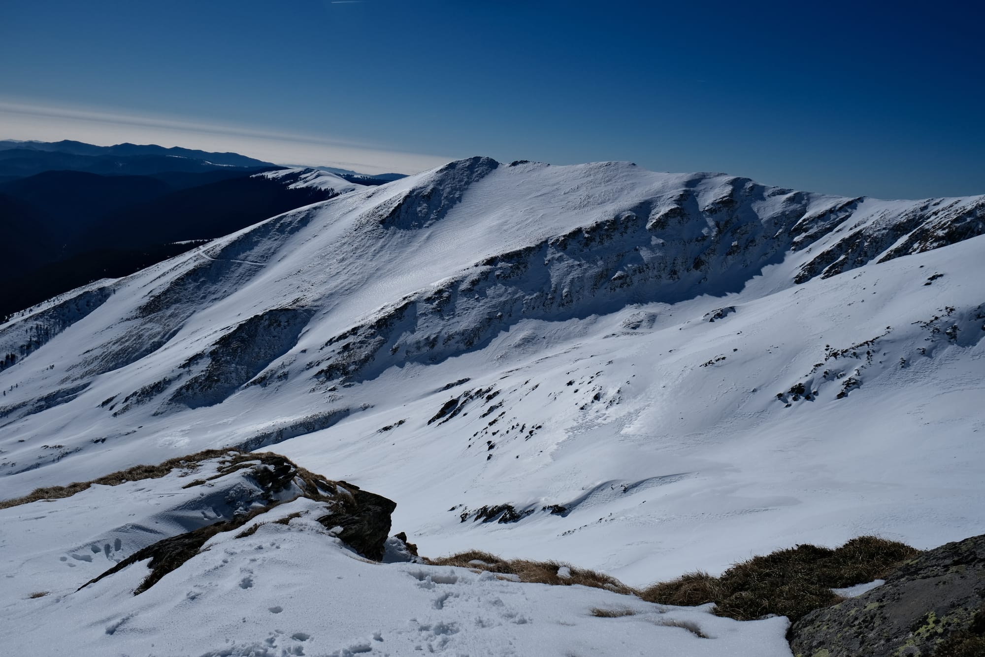
The first part of the hike was through a pine forest. This was the easiest part with the least snow cover, but every step was still uphill. There were a couple of small snow covered clearings but it wasn't until we made it out of the treeline that I had a proper view of the mountains before us, that's where I took the above picture.
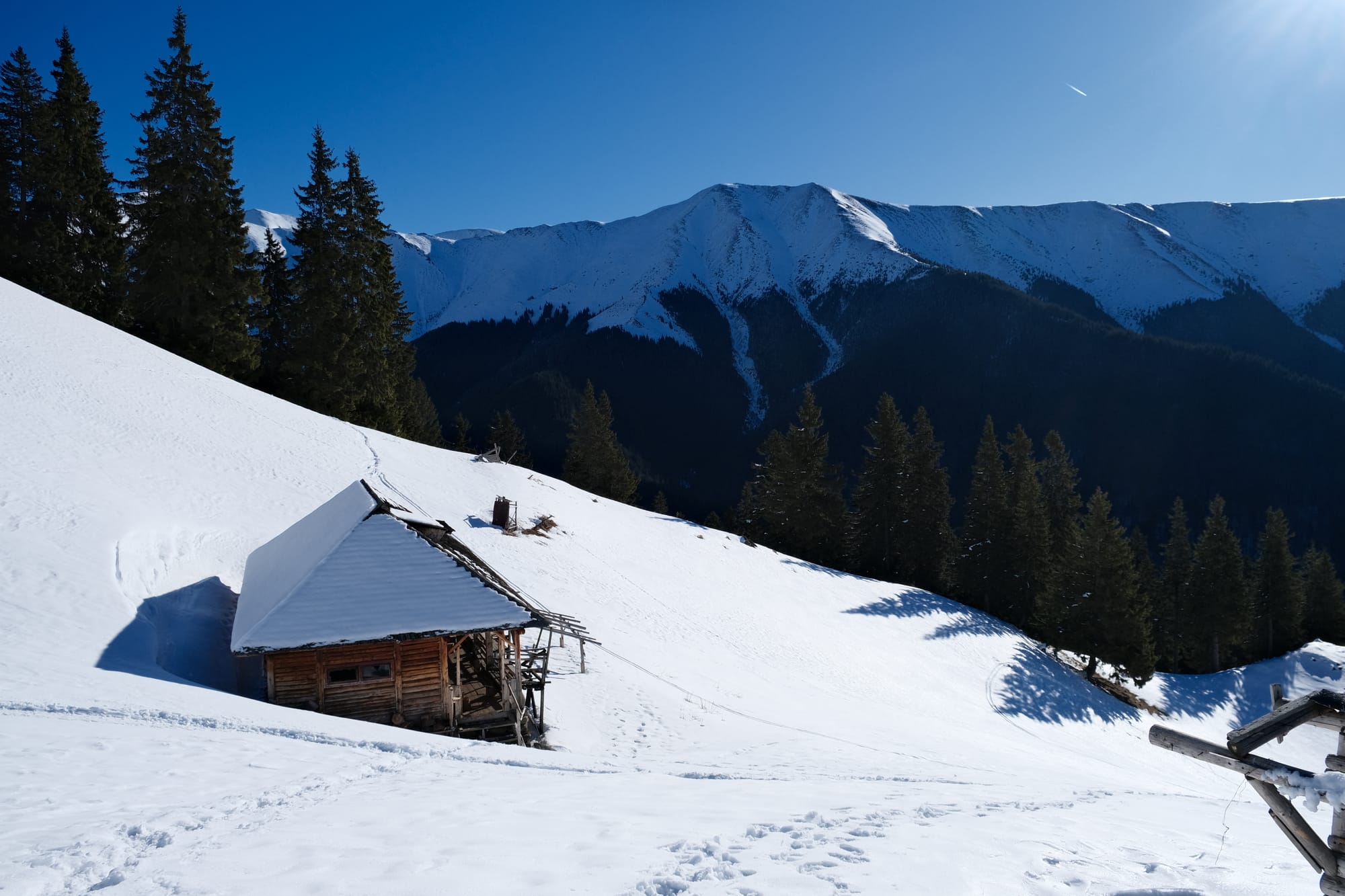
Just after the treeline was the shepherds' cabin, pictured above. This marked the end of the first stage. Here we put on our harnesses and crampons as the slope would get steeper and the snow thicker. By this point the day was getting warmer and while it probably was never higher than around zero degrees, I was never cold and actually had to remove layers so as not to overheat. With all the physical exertion, and the solar radiation amplified by the reflective snow, it easily felt like a 20 degree day.
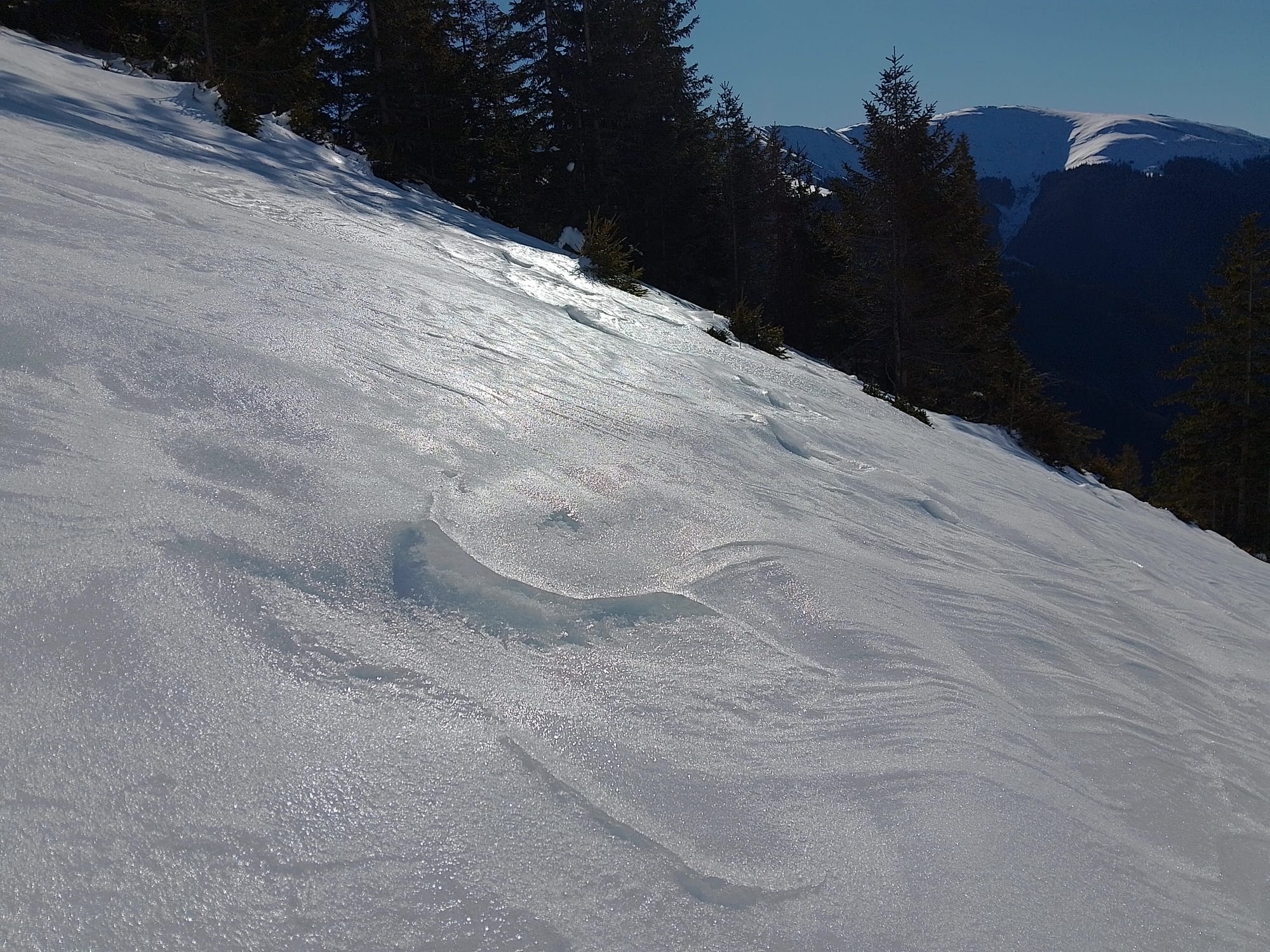
This image was taken shortly after the shepherds' cabin. With the sun shining the snow had a silvery sheen to it. The slope was getting much steeper, and I was very thankful for the crampons that helped my feet to grip into the snow.
As I was hiking up, I noticed a strange sound I had never heard before. It sounded almost like a waterfall, but not quite, and quickly fading, then regaining in strength. The best similarity I can think of is that of a rain stick. I quickly noticed the source of the sound as sliding flakes of snow and ice, falling down the slope, having been dislodged by walking hikers. The surface of the snow here had been melted and frozen into ice by the sun. With the slope being so steep, the dislodged snow particles could easily fall down quite a distance, and this sliding action caused the sound. I found it so beautiful and fascinating to experience something completely new.
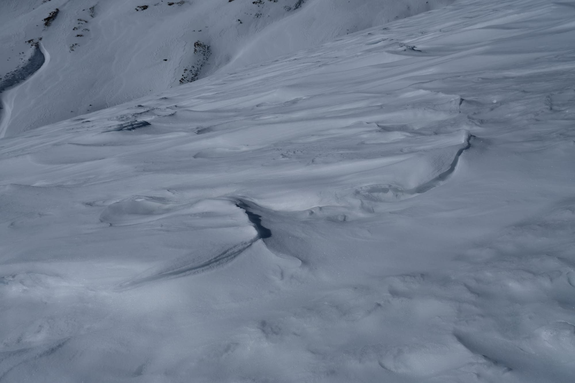
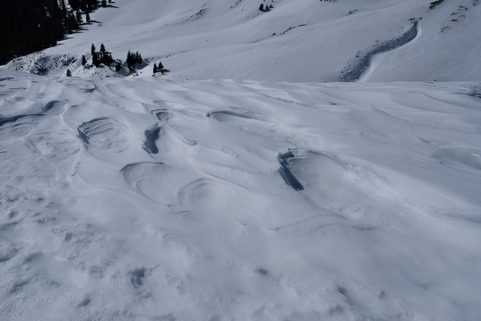
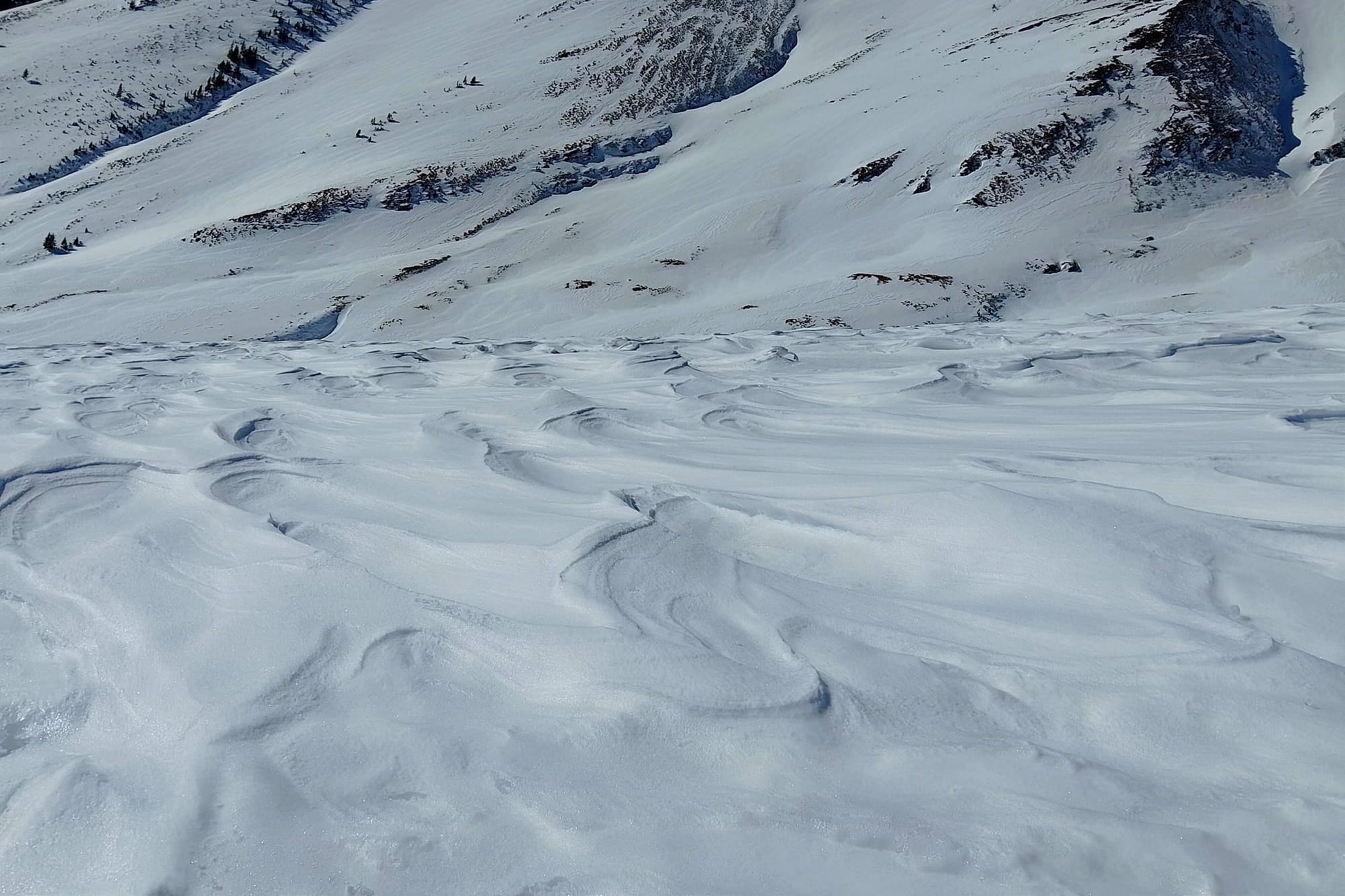
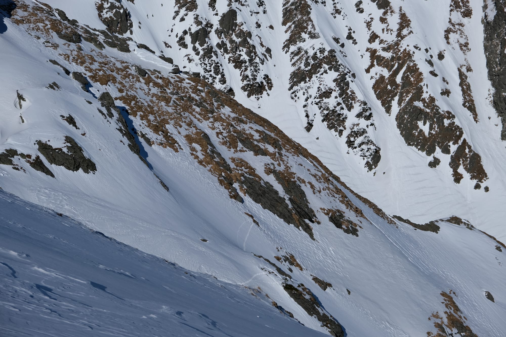
Further up we came across a section of snow that had been shaped by the wind. The wind sculpted these structures onto the snowy surface that was then frozen in place by a layer of ice, set there by the action of sunny days and freezing nights. I found it absolutely fascinating, hence the multiple images.
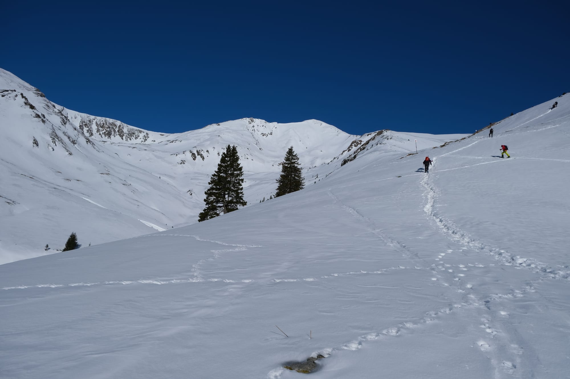
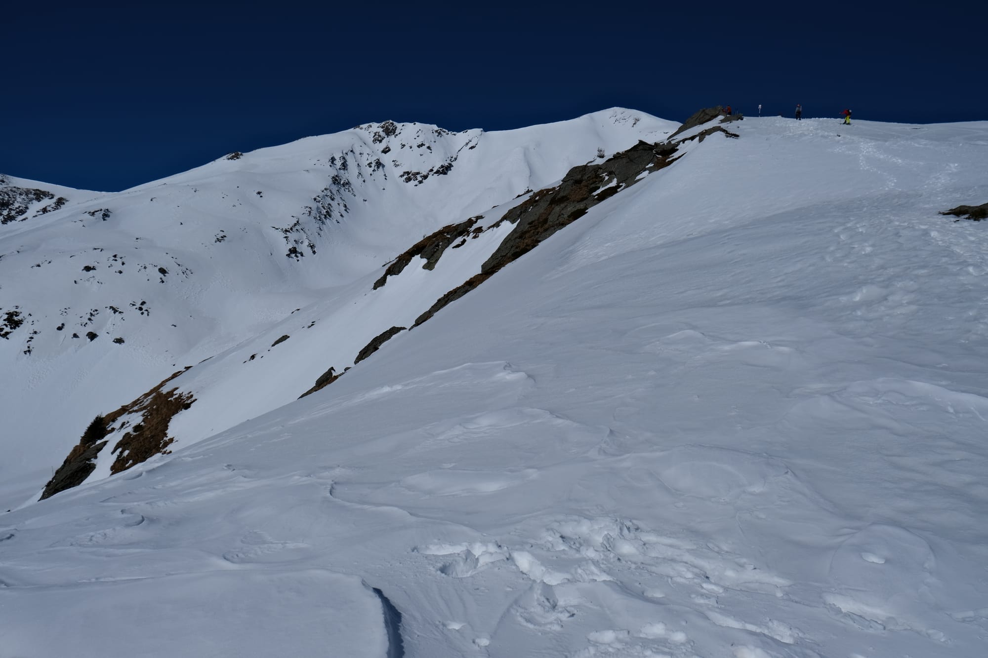
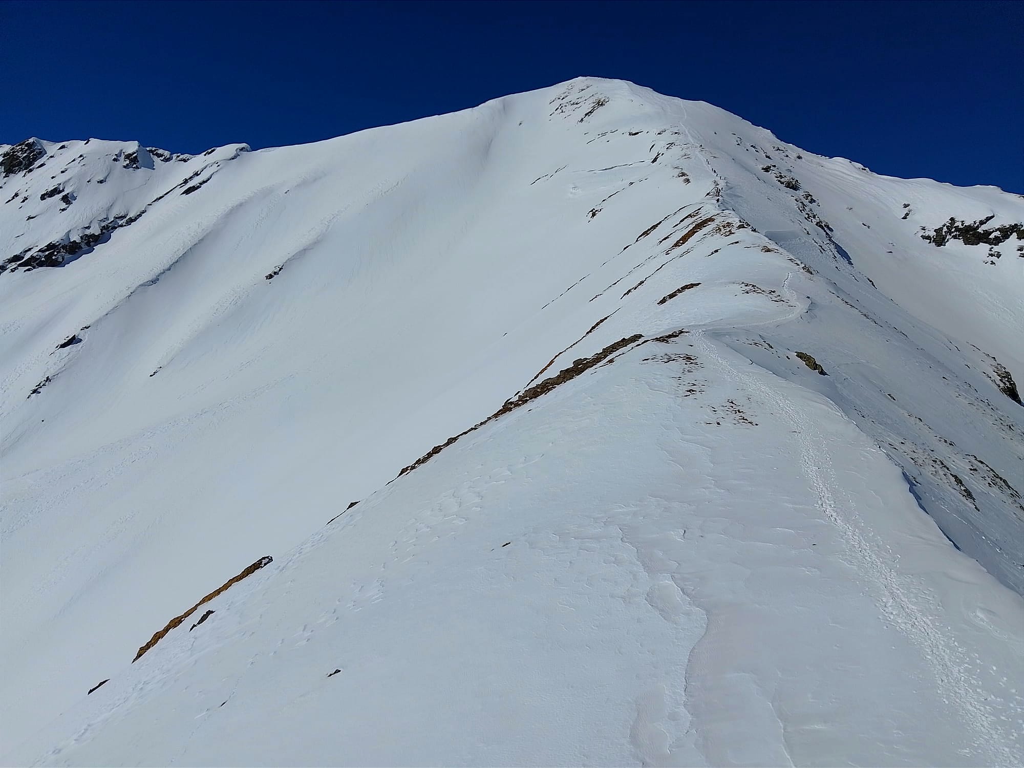
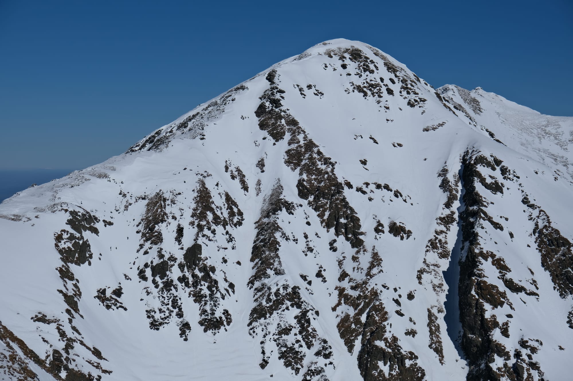
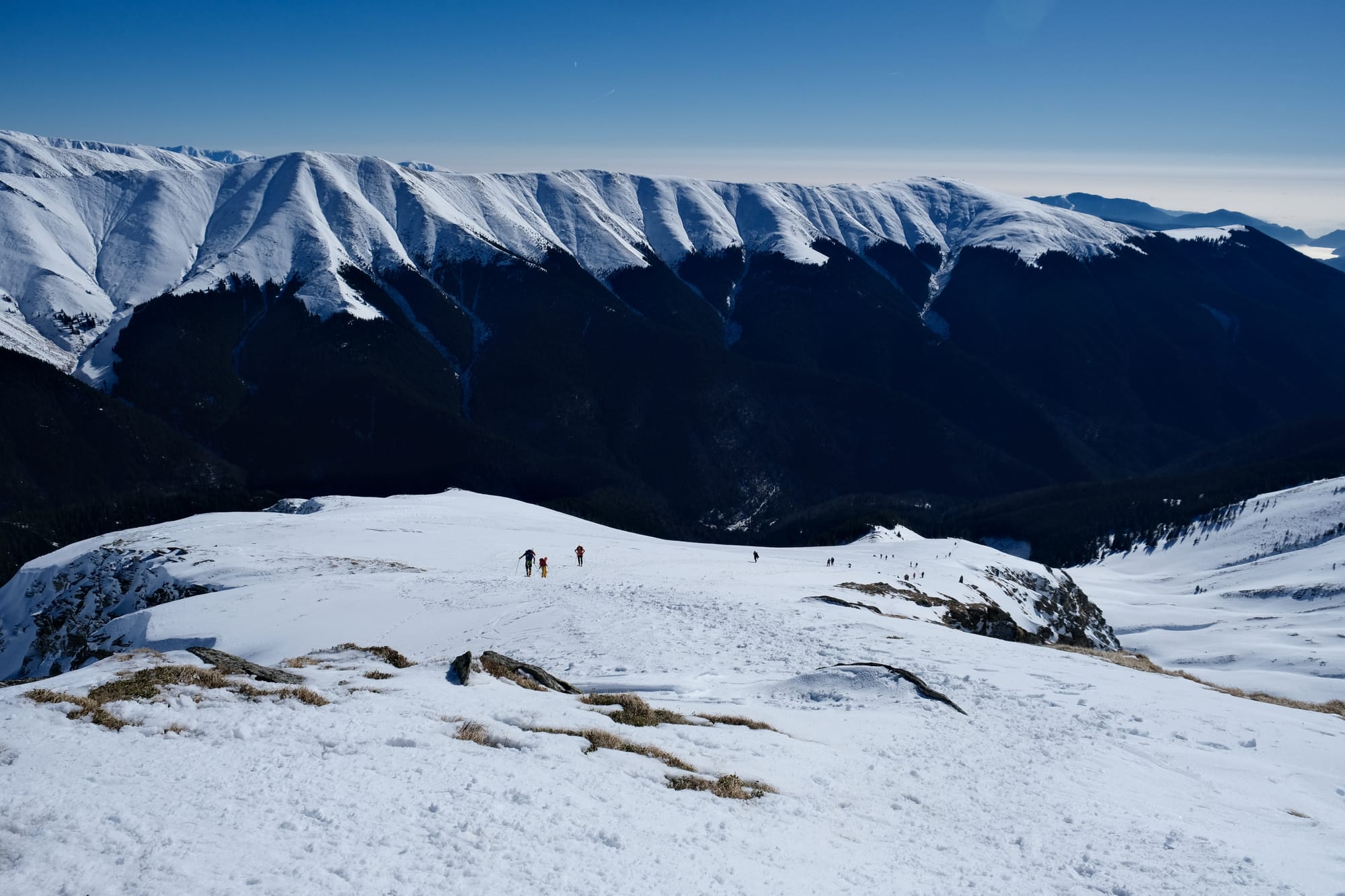
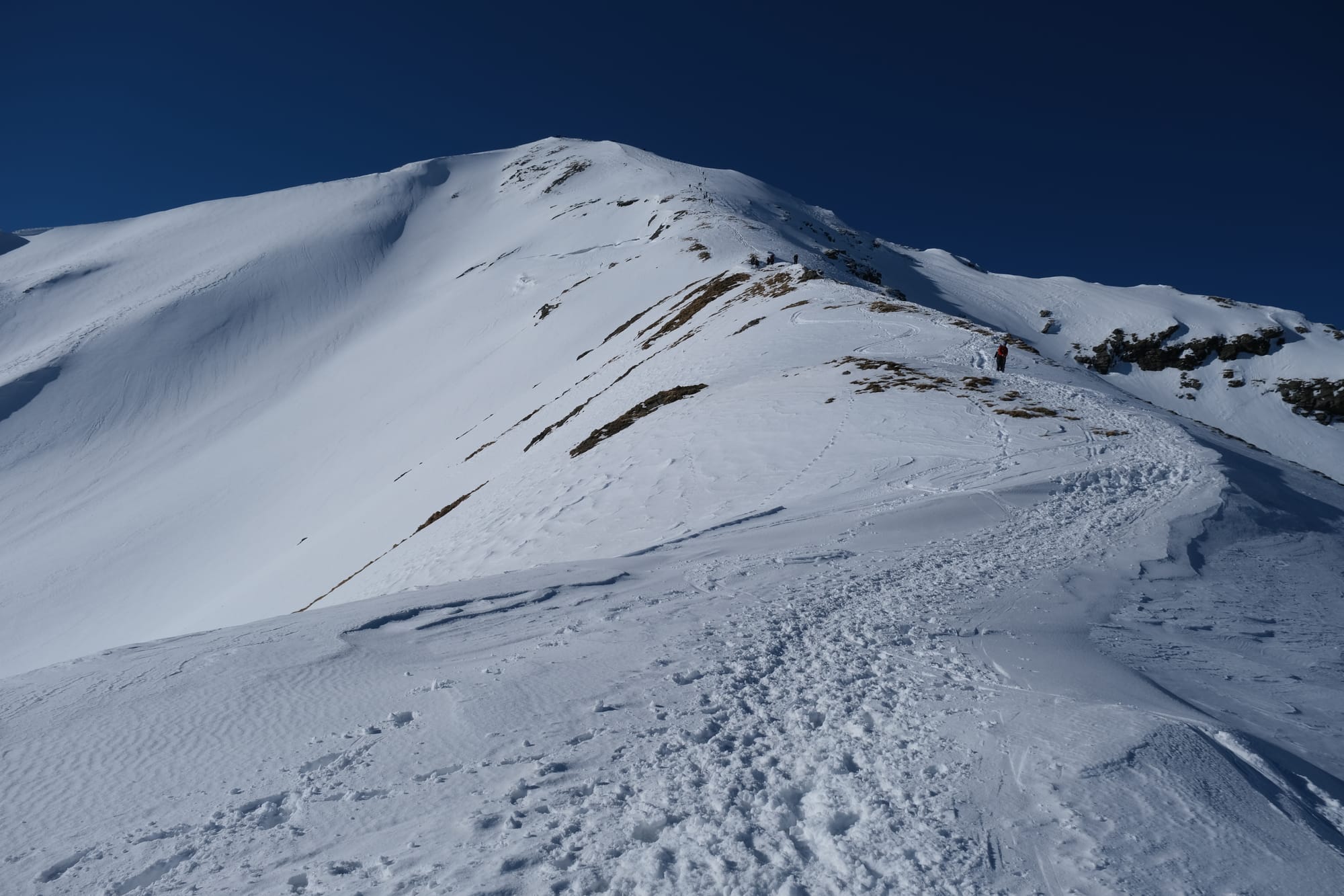
Each of these images were taken looking up the path towards the summit, at different points along the journey, getting closer with each picture. (note: the last picture was taken on my phone, hence the quality isn't as nice). The entire hike was going up this ridge line and, after the tree line, I almost always had a view of Lespezi summit on the horizon. Hiking up this trail, in the snow, requires much more energy and the overall pace is far slower than on normal terrain. My guide was telling me that an important mountaineering skill is to be able to look over the terrain and determine how long a group will take to make it to certain milestones. Looking down the hill, there was a group behind us that didn't look very far away yet it would take them half an hour to get up to the spot where we were standing. From where I took that first image, where you can already see the mountain peak, it would take us three and a half hours to make it all the way to the top.
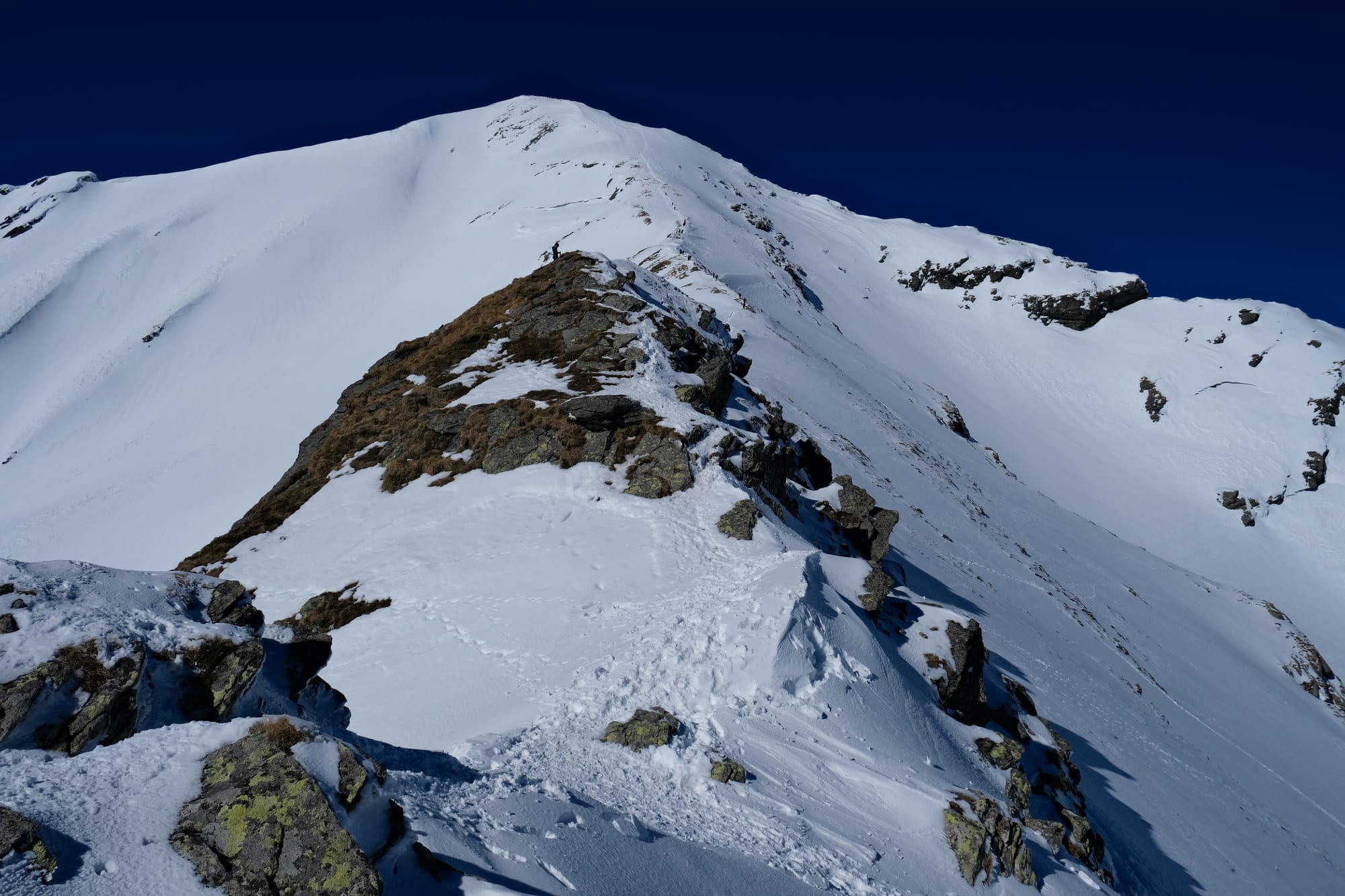
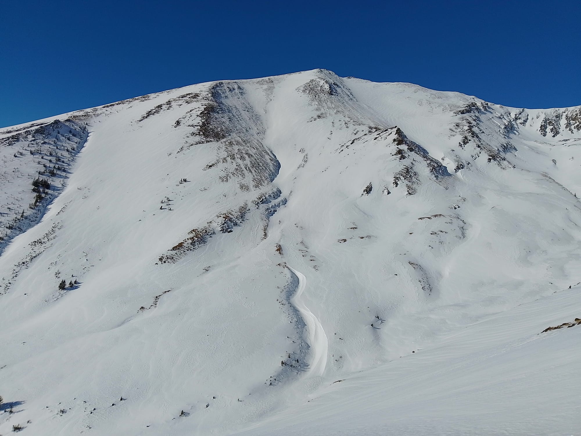
The third image shows where the technical section is. Where those rocks end, there is a short drop where I had to climb down, using the ice axe to provide stability. The guide set up a full rope system and let me down with a rope attached to my harness.
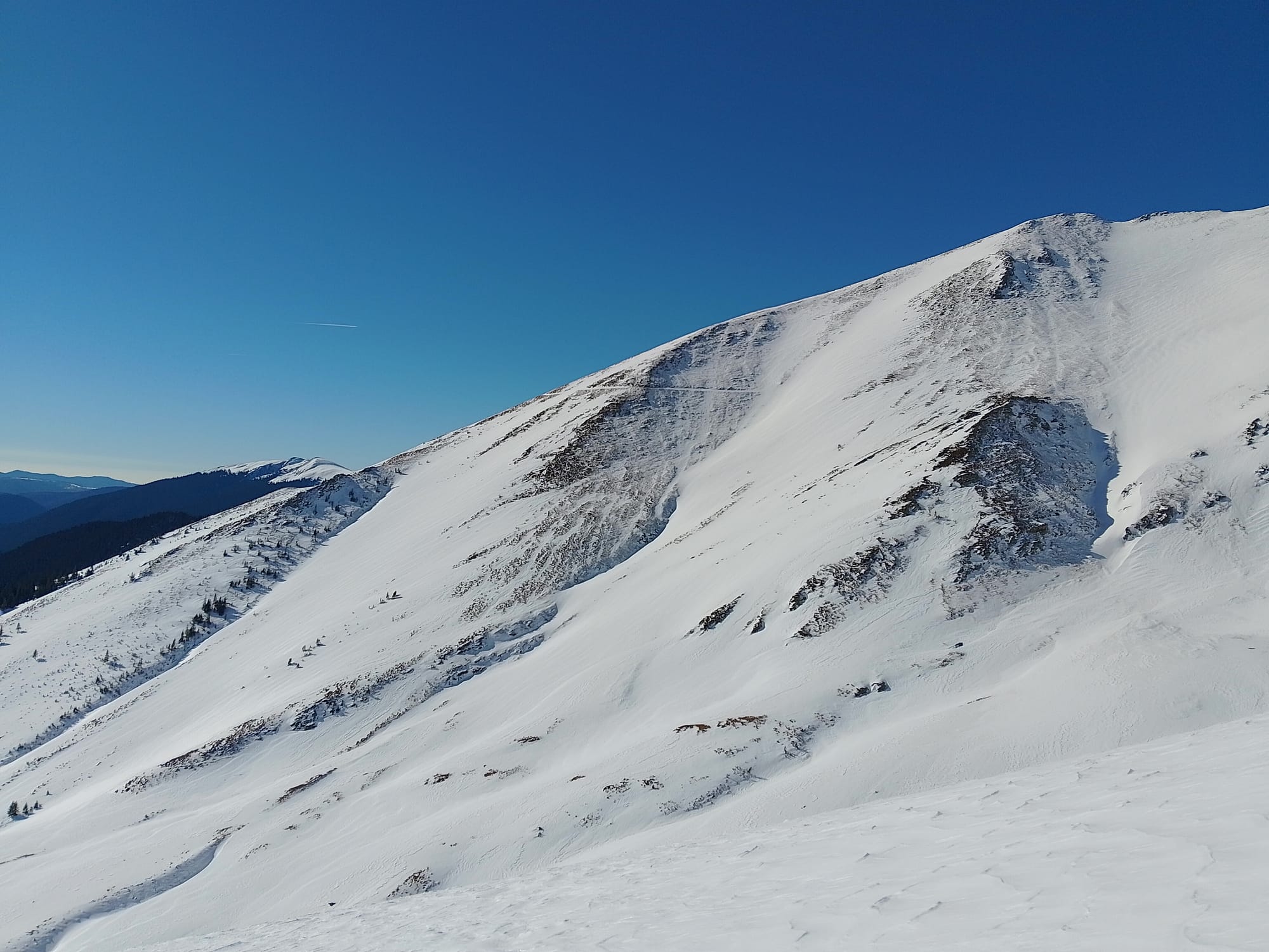
I took these images as we were waiting for the guide to set up the ropes at the technical section. This marked the end of the second stage of the hike. The third stage, from here up to the summit, was the steepest. At this point I needed to hold my ice axe in hand, to both use it for stability (like a walking pole) but also to use in an emergency, if I were to fall down the slope.
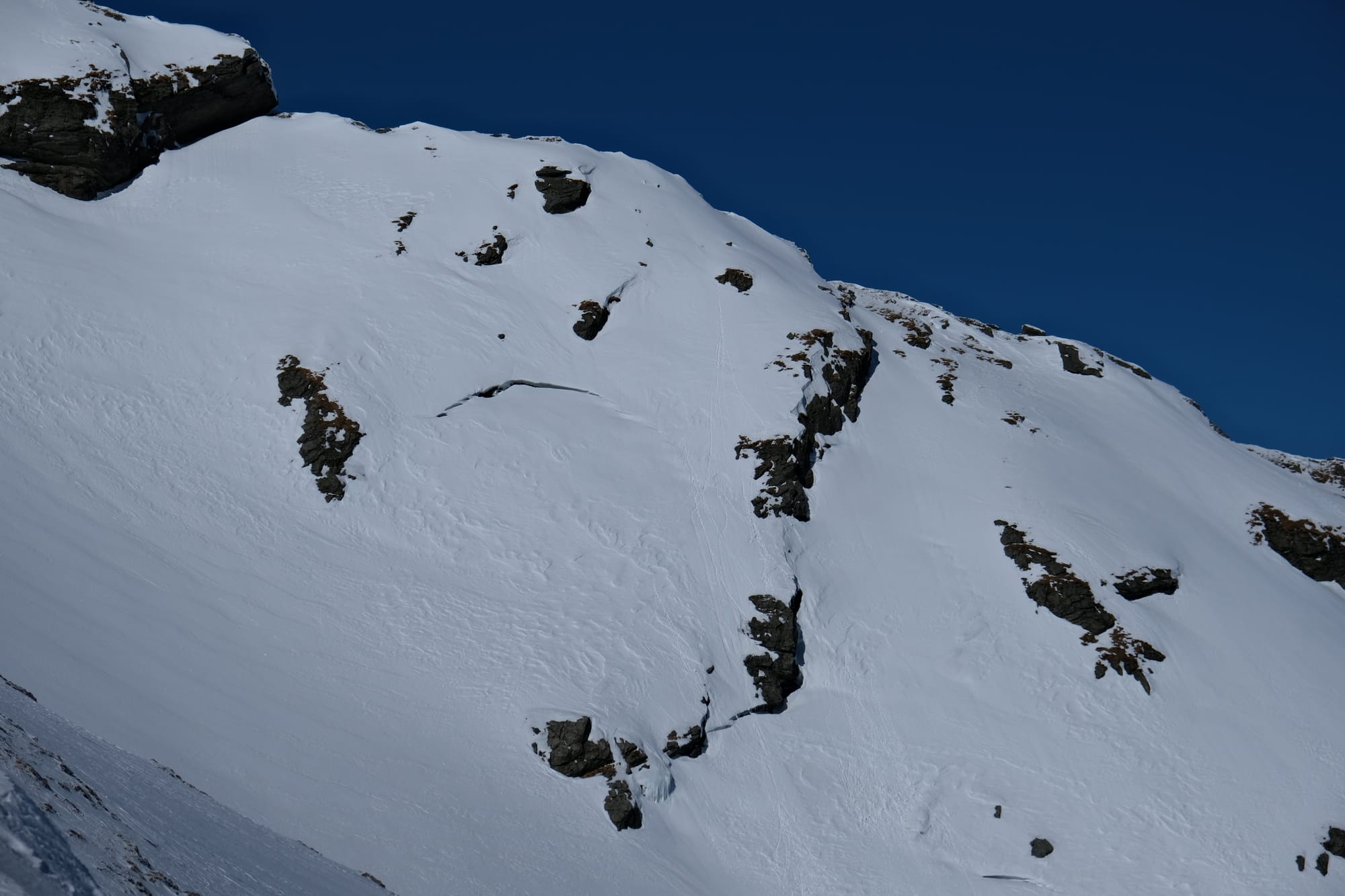
The guide pointed out this crack in the snow, saying this indicated that there would be an avalanche here within the next couple days. Thankfully, there were no avalanches on this day.

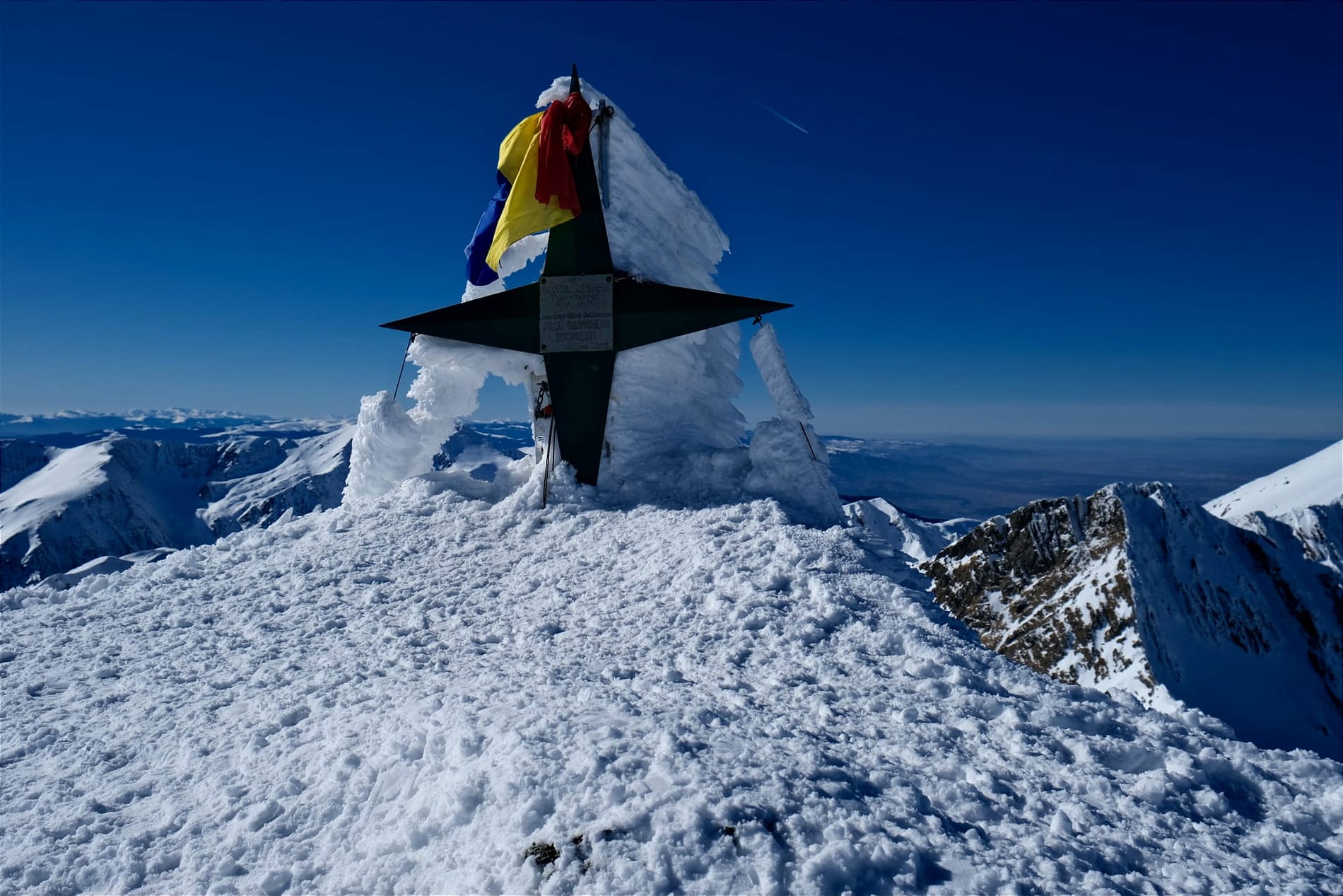
We finally made it to the summit at about 1:50 pm. As I approached I was initially disbelieving, thinking surely the mountain would continue, but we had made it. There were actually a number of people at the summit all taking turns getting pictures with the marker. The guide mentioned there were more people here than she had ever seen in winter. But I didn't mind, I was happy to have made it, and it was a beautiful day so I was glad they also could enjoy the mountains. We rested here for fifteen minutes or so, eating some food, and making sure to get a photo with the marker as well.
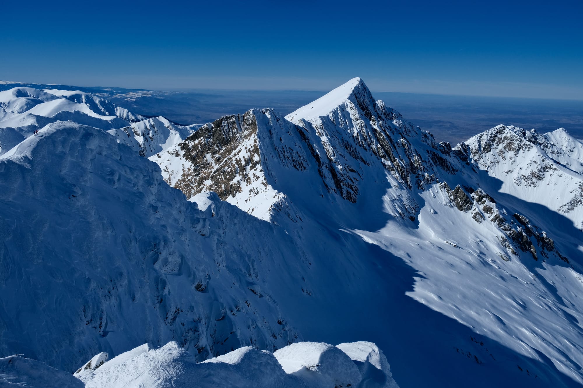
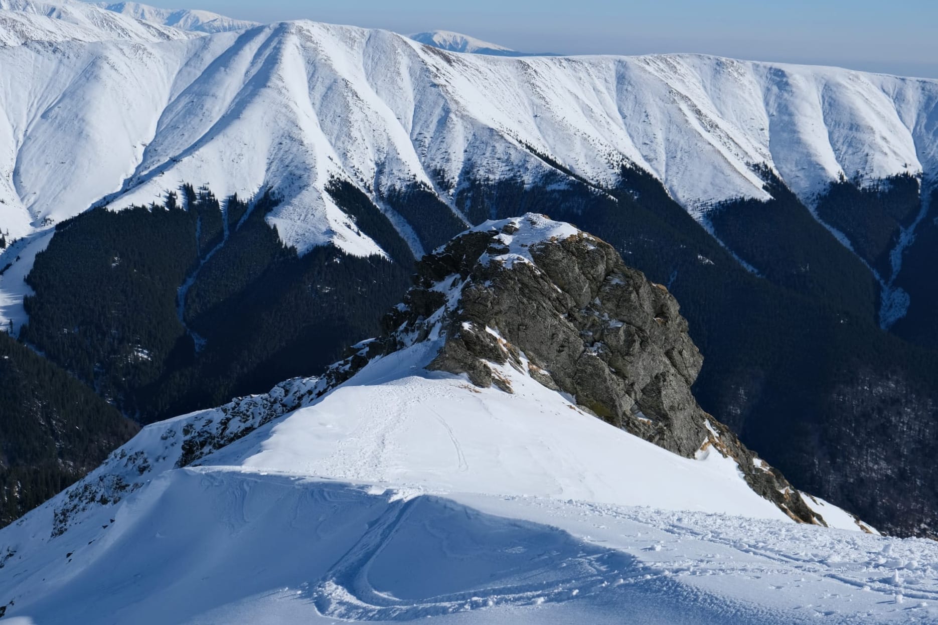
This is one of the first images I took from the summit. The entire hike I was looking up at Lespezi, the giant mountain dominated the view. Only at the top could I finally see what was beyond it. This image shows the start of the ridgeline that connects Lespezi peak to the main Făgăraș ridge, Lespezi peak itself is slightly to the south of the main ridge. The section on the left side of the image continues up to where I was standing, taking this picture. I was so fascinated by how these cliffs were completely covered in windswept snow, I found it absolutely beautiful.

The left (first) image shows a wider shot where you can see the ridge line extending to another mountain peak, focused in on in the right (second) image. This peak is the second highest peak in Romania and sits on the main Făgăraș ridge.
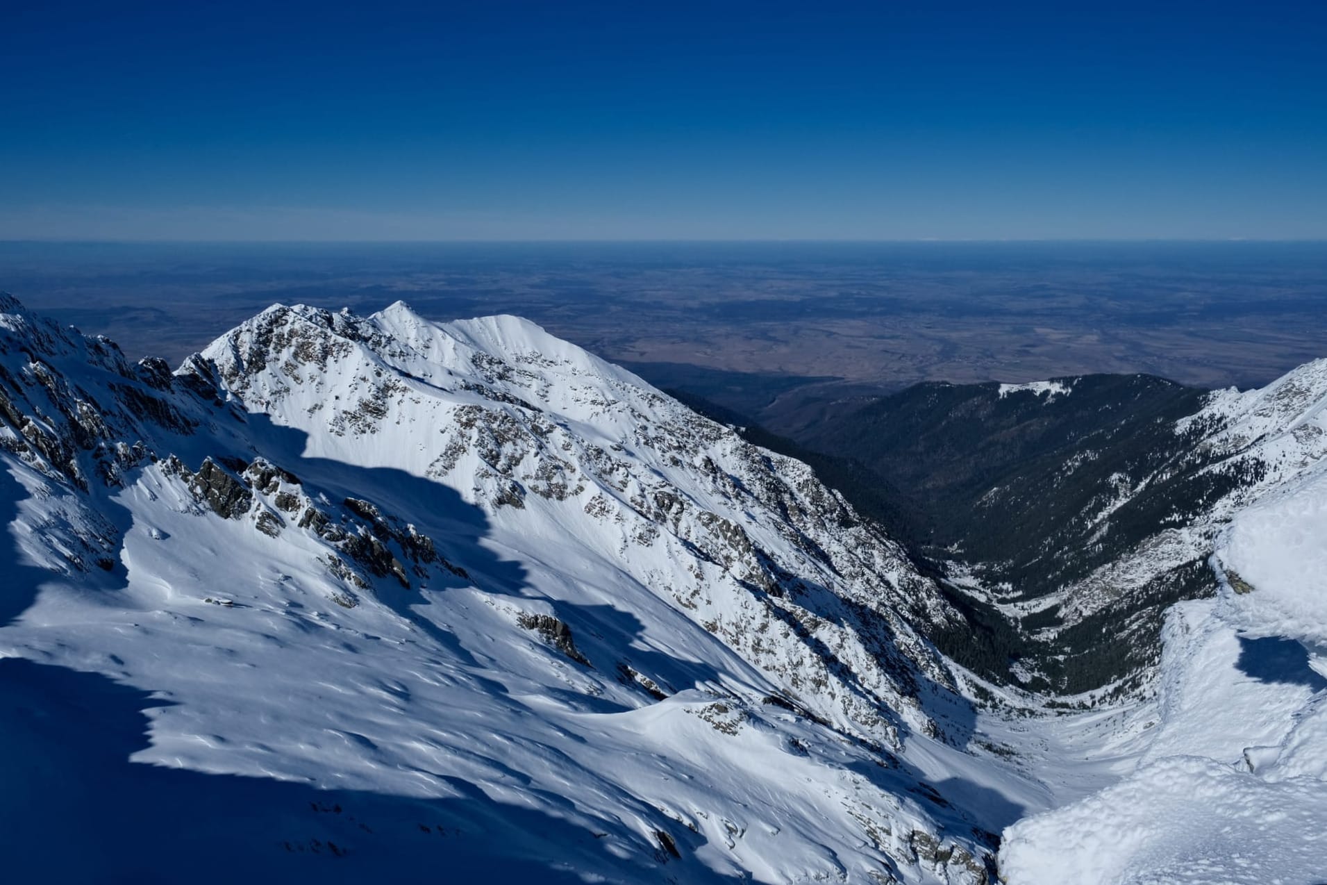
Looking out on this side of the mountains, towards the north, I could see far into the interior of Transylvania. The landscape was so far below where I was it almost seemed like a flat plain, but that part of Romania is still quite hilly. Somewhere in that landscape was Sighișoara, the city I had visited the previous weekend. The day was so clear that I could see patches of white on the horizon, that are just barely visible in the zoomed up image on the right, these were far away snow covered mountains.
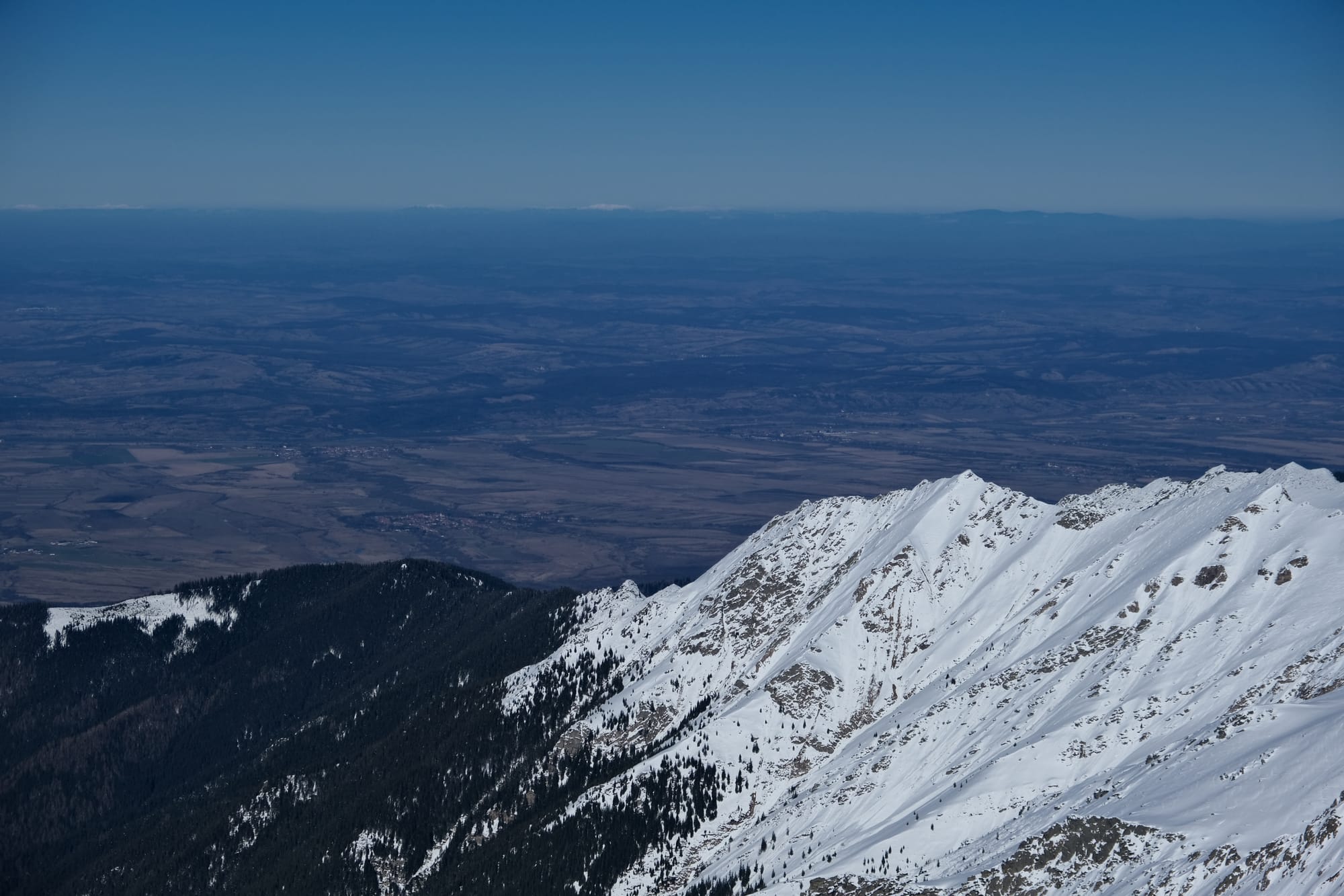
The highest peak in Romania is also visible from the top of Lespezi. You can see it in this image. It is the flat section of mountains on the horizon, in the centre right.
This picture is looking south east from the summit. The spur seen in the foreground, going down, is where we walked up.
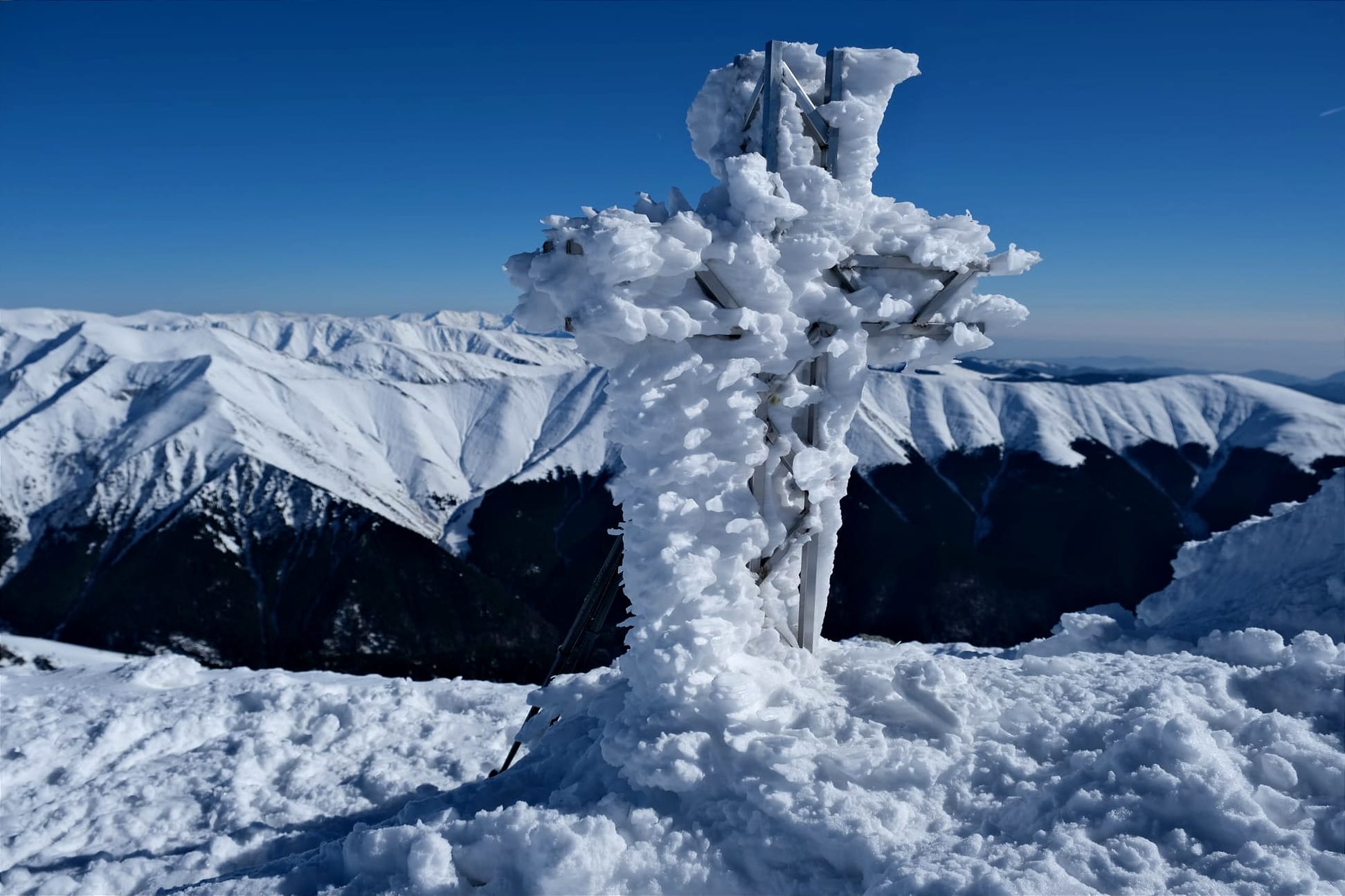
There was also this little metal cross near the summit. I loved how the snow and ice formed on it, like it was frozen in the middle of a storm.
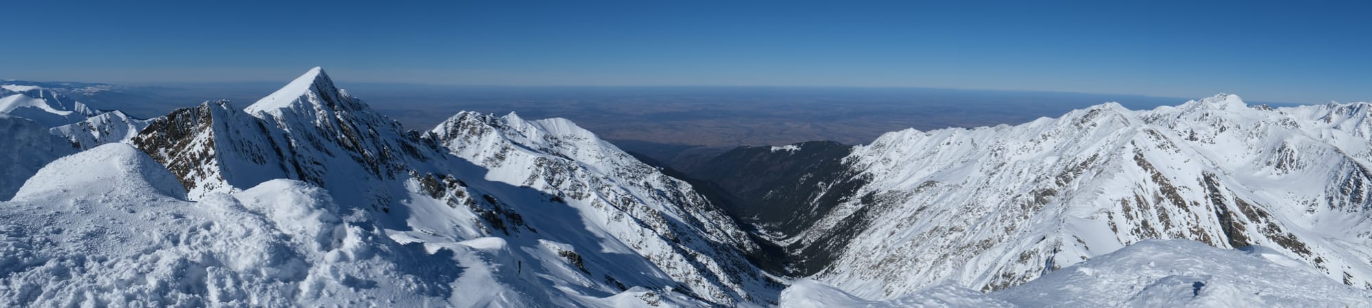
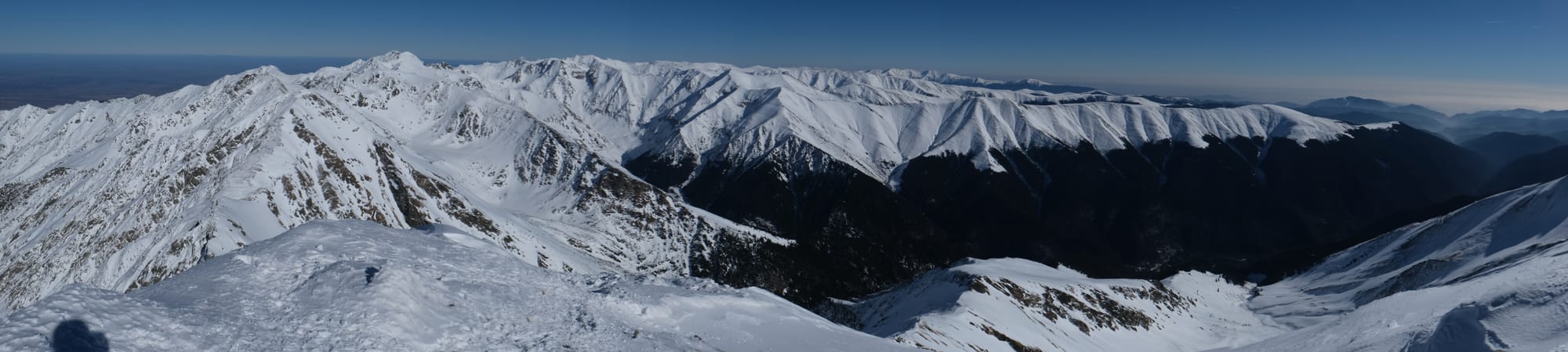
While not the best quality, I wanted to share these panoramas to give you a sense of the extent of the views from Lespezi. It really was a full 360 degree viewpoint and together these panoramas show nearly the full circle. The first panorama shows the view looking northward, the second shows the view to the east, extending southward. I missed the westward view in these panoramas but you can see that pictured in the first image I took at the summit.


While hiking up to Lespezi, I would often stop to look back at the valley behind us and the mountains on the other side. That valley has the Transfăgărășan road, that crosses the mountains, but it is only fully open in the summer time. That's where the car park for the trail is and where we started the hike.
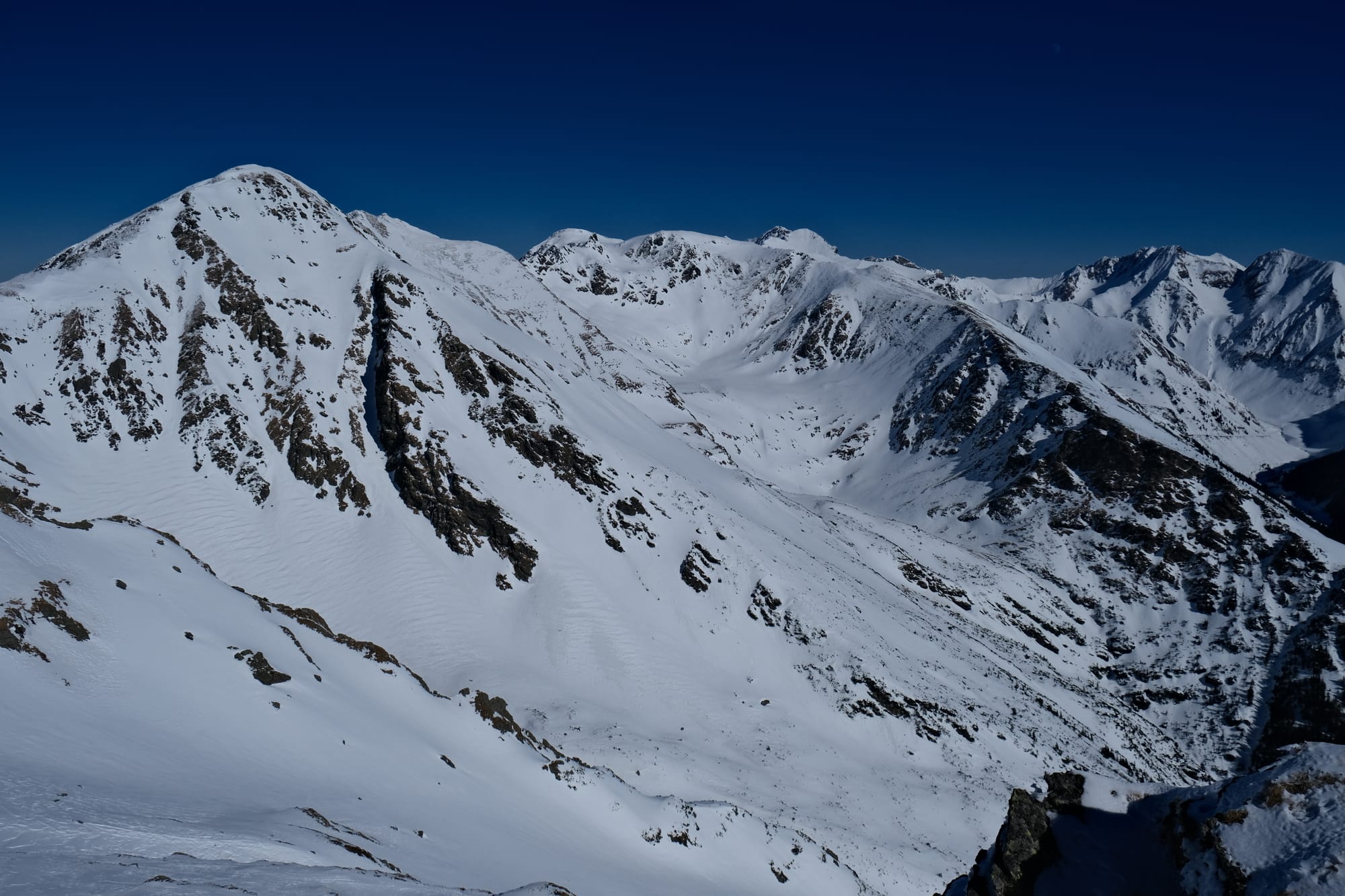
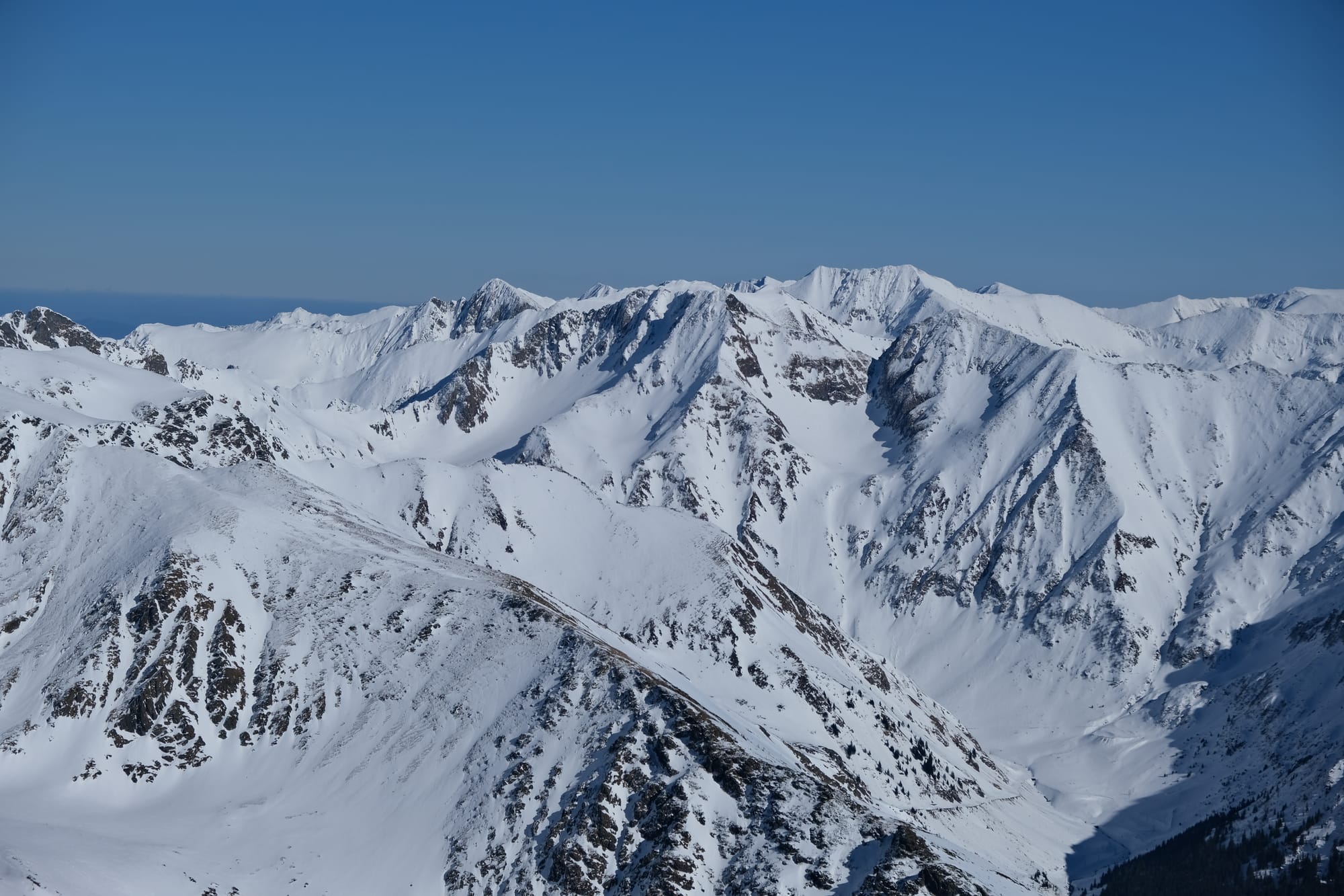
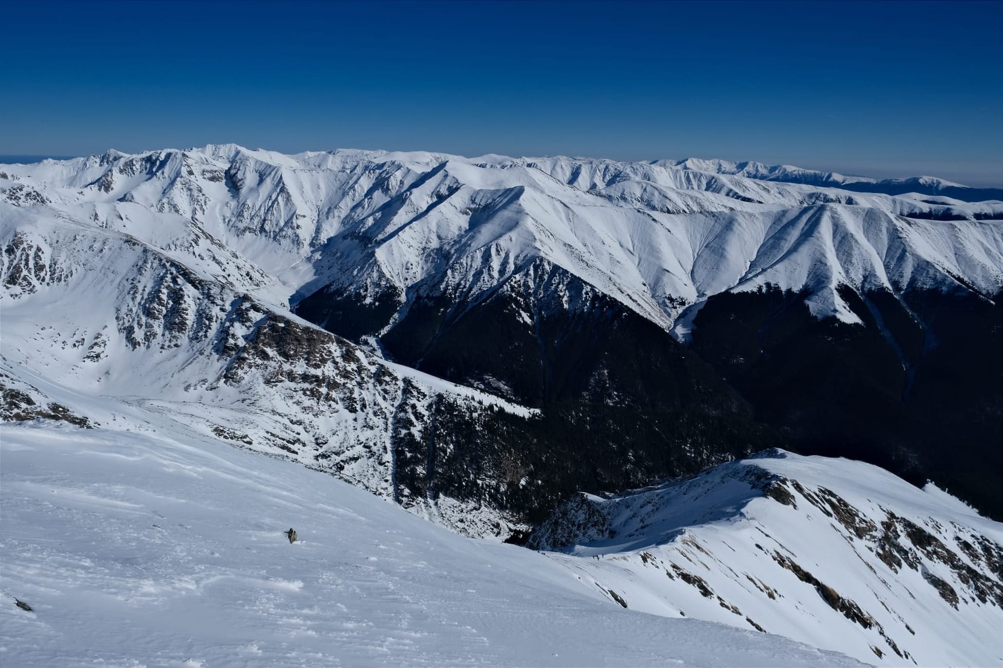
Each of the above images was taken at a different point on the hike. With the last one taken from the summit. I wanted to share these images together as you can see the elevation gain between the perspectives of each photograph. For most of the hike, those mountains were so tall I couldn't see anything beyond them. At the summit, I was high enough that now I could see mountains upon mountains extending beyond the first line all the way to the horizon. This closest ridge is basically perpendicular to the the main Făgărăș ridge, essentially an offshoot. These images are looking eastward, so from the summit, I was looking along the main ridge (that runs from east to west) and seeing all the offshoot ridge-lines layered on top of each other.

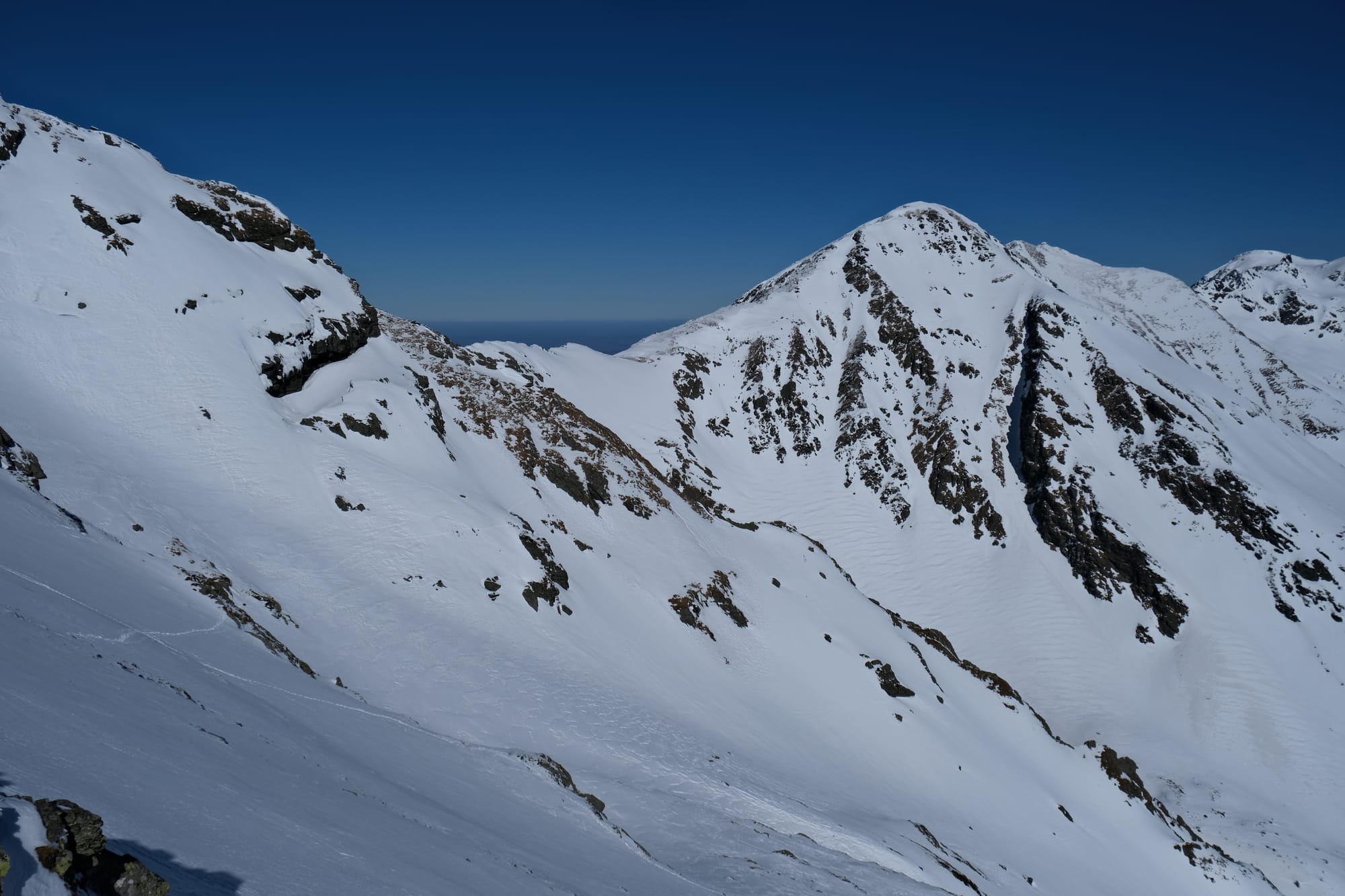
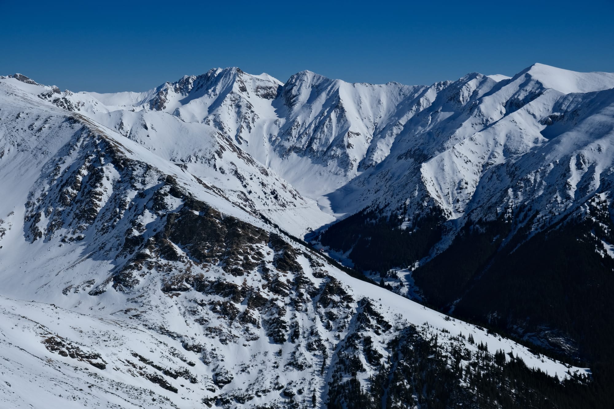
Another elevation study where each of these images were taken at different points on the hike, going from the lowest elevation to the highest. Two of these images are taken with my phone, hence the white balancing looks different. This side of the slope was a common view I had on my left while hiking up to the peak. In these images you can see a faint line on the mountain that was the construction site for a planned road that was canceled. You can see the road high up the mountain in the first images, then coming level, then below as I kept gaining elevation. I was often using this old road as a way-marker for me to see how much progress we had made.
After finishing up at the summit of Lespezi we returned back down the same way. Going down hill was faster, but required different muscles and skills. While uphill was more physically exerting, going downhill involved more technique and balance. The key was to always land with the heal first, and to keep the knees slightly bent.
We saw some mountain goats on the way down. Well my guide saw them, and I struggled to spot them but they were these tiny black dots on the patch of grass in the centre bottom right of the image.
On the way back I took this picture of the rocky outcrop where we had to climb down when going up. Because the snow wasn't too thick, we were able to return by going around, but this was the most dangerous part of the hike. I walked with my ice axe handy, the rock wall on the right and an incredibly steep drop to my left.
I took this picture looking back up to Lespezi. I loved how perfect the snow looked at this time of day.
We stopped for a break back at the shepherds' hut before continuing on the final stretch to the car park. There was a hotel and restaurant there and we had dinner there. I had a traditional Romaninan dish called Bulz. It was a ball of roasted polenta, with cheese in the middle and served with an egg on top.
This was an absolutely fantastic day and an amazing hike. I am hugely thankful to my guide from Alpine Challenge and I would highly recommend them if you ever want to hike in Romania. I would not have been able to experience this kind of hike, in the mountains, in winter, without them.
Thanks for reading – Edward
Written 29th of February 2024
Please comment below if you have any questions or thoughts on any pictures.